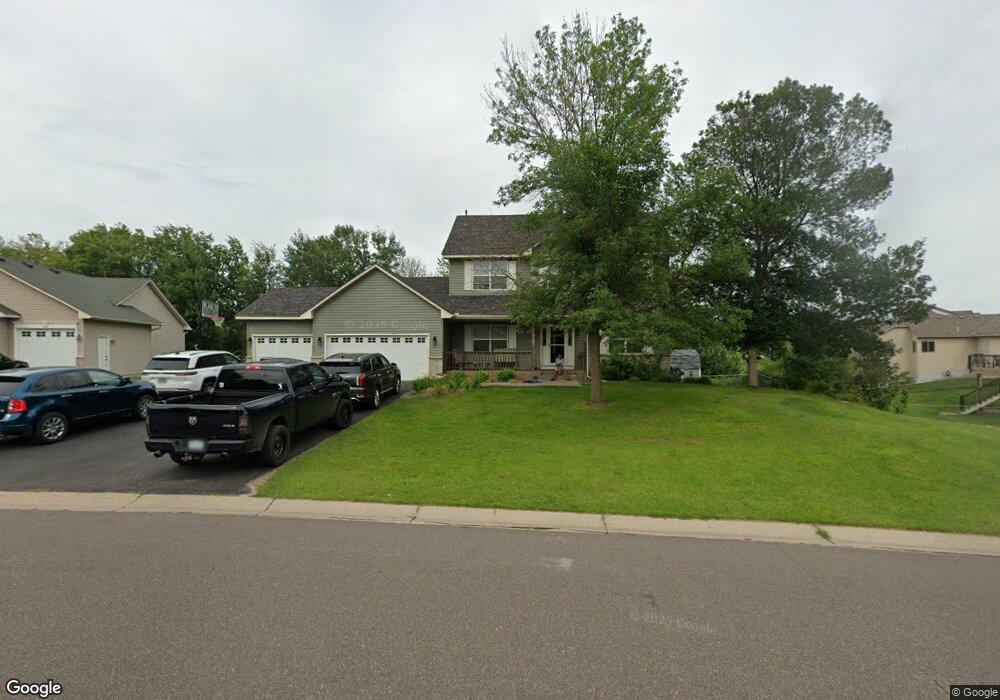
15705 Vale St NW Andover, MN 55304
Estimated Value: $439,000 - $562,000
4
Beds
3
Baths
2,208
Sq Ft
$231/Sq Ft
Est. Value
About This Home
This home is located at 15705 Vale St NW, Andover, MN 55304 and is currently estimated at $509,871, approximately $230 per square foot. 15705 Vale St NW is a home located in Anoka County with nearby schools including Rum River Elementary School, Oak View Middle School, and Andover Senior High School.
Ownership History
Date
Name
Owned For
Owner Type
Purchase Details
Closed on
Sep 23, 2013
Sold by
Mcadams Darren Keith
Bought by
Mangini Denise Diane and Mcadams Denise Diane Mangini
Current Estimated Value
Purchase Details
Closed on
Jun 26, 2002
Sold by
Swift Construction Inc
Bought by
Mcadams Darren K and Mangini Mcadams Denise D
Purchase Details
Closed on
Jan 11, 2002
Sold by
Gold Nugget Development Inc
Bought by
Swift Construction Inc
Create a Home Valuation Report for This Property
The Home Valuation Report is an in-depth analysis detailing your home's value as well as a comparison with similar homes in the area
Home Values in the Area
Average Home Value in this Area
Purchase History
| Date | Buyer | Sale Price | Title Company |
|---|---|---|---|
| Mangini Denise Diane | -- | None Available | |
| Mcadams Darren K | $292,595 | -- | |
| Swift Construction Inc | $58,900 | -- |
Source: Public Records
Tax History Compared to Growth
Tax History
| Year | Tax Paid | Tax Assessment Tax Assessment Total Assessment is a certain percentage of the fair market value that is determined by local assessors to be the total taxable value of land and additions on the property. | Land | Improvement |
|---|---|---|---|---|
| 2025 | $4,937 | $500,100 | $117,000 | $383,100 |
| 2024 | $4,937 | $469,600 | $98,100 | $371,500 |
| 2023 | $4,470 | $470,000 | $95,400 | $374,600 |
| 2022 | $4,158 | $467,400 | $84,200 | $383,200 |
| 2021 | $3,979 | $386,700 | $67,300 | $319,400 |
| 2020 | $3,795 | $362,900 | $61,200 | $301,700 |
| 2019 | $3,564 | $337,000 | $61,200 | $275,800 |
| 2018 | $3,720 | $311,800 | $0 | $0 |
| 2017 | $3,348 | $311,300 | $0 | $0 |
| 2016 | $3,546 | $280,000 | $0 | $0 |
| 2015 | $3,408 | $280,000 | $63,100 | $216,900 |
| 2014 | -- | $232,600 | $44,600 | $188,000 |
Source: Public Records
Map
Nearby Homes
- 1024 159th Ln NW
- 00000 153rd Ln NW
- 15453 Yellow Pine St NW
- 15620 Eagle St NW
- 15801 Drake St NW
- 1253 152nd Ave NW
- 16191 Unity St NW
- 930 151st Ave NW
- 15357 Prairie Rd NW
- 809 152nd Ave NW
- 1684 155th Ave NW
- 1722 157th Ln NW
- 15607 Kumquat St NW
- 15199 Palm St NW
- Foster Plan at Fields of Winslow Cove - Heritage Collection
- Courtland ii Plan at Fields of Winslow Cove - Heritage Collection
- Courtland Plan at Fields of Winslow Cove - Heritage Collection
- Donovan Plan at Fields of Winslow Cove - Heritage Collection
- 1475 162nd Ave NW
- 15188 Palm St NW
- 15717 Vale St NW
- 15655 Vale St NW
- 15710 Vale St NW
- 15647 Vale St NW
- 15729 Vale St NW
- 15660 Vale St NW
- 15654 Vale St NW
- 1162 157th Ln NW
- 15635 Vale St NW
- 15648 Vale St NW
- 15741 Vale St NW
- 1172 157th Ln NW
- 15642 Vale St NW
- 15759 Vale St NW
- 15623 Vale St NW
- 15620 Vale St NW
- 1182 157th Ln NW
- 15611 Vale St NW
- 15769 Vale St NW
- 15606 Vale St NW