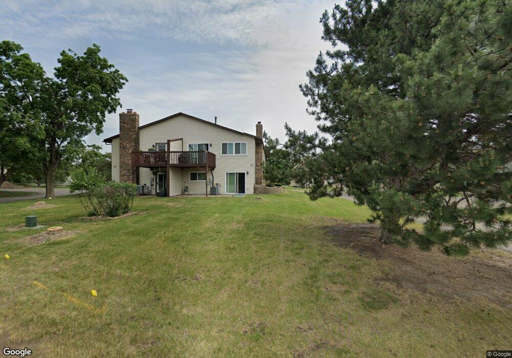
15736 Griffon Ct Saint Paul, MN 55124
Old Town NeighborhoodEstimated Value: $270,000 - $273,000
3
Beds
2
Baths
1,132
Sq Ft
$240/Sq Ft
Est. Value
About This Home
This home is located at 15736 Griffon Ct, Saint Paul, MN 55124 and is currently estimated at $271,611, approximately $239 per square foot. 15736 Griffon Ct is a home located in Dakota County with nearby schools including Cedar Park Elementary STEM School, Valley Middle School, and Apple Valley Senior High School.
Ownership History
Date
Name
Owned For
Owner Type
Purchase Details
Closed on
Jun 30, 2017
Sold by
Travers Linda J and Travers Kenneth J
Bought by
Keeler Sean and Keeler Carrie
Current Estimated Value
Home Financials for this Owner
Home Financials are based on the most recent Mortgage that was taken out on this home.
Original Mortgage
$185,576
Interest Rate
4.4%
Mortgage Type
FHA
Purchase Details
Closed on
Oct 23, 2000
Sold by
Steinke David J
Bought by
Hedges Linda J
Purchase Details
Closed on
Aug 18, 2000
Sold by
Helgren Jolynn M
Bought by
Steinke David J
Purchase Details
Closed on
Nov 4, 1997
Sold by
Waarvik Daniel A and Waarvik Diane J
Bought by
Helgren Jolynn M and Roush Robert R
Create a Home Valuation Report for This Property
The Home Valuation Report is an in-depth analysis detailing your home's value as well as a comparison with similar homes in the area
Home Values in the Area
Average Home Value in this Area
Purchase History
| Date | Buyer | Sale Price | Title Company |
|---|---|---|---|
| Keeler Sean | $189,000 | Burnet Title | |
| Hedges Linda J | $129,900 | -- | |
| Steinke David J | $129,500 | -- | |
| Helgren Jolynn M | $92,000 | -- |
Source: Public Records
Mortgage History
| Date | Status | Borrower | Loan Amount |
|---|---|---|---|
| Previous Owner | Keeler Sean | $185,576 |
Source: Public Records
Tax History Compared to Growth
Tax History
| Year | Tax Paid | Tax Assessment Tax Assessment Total Assessment is a certain percentage of the fair market value that is determined by local assessors to be the total taxable value of land and additions on the property. | Land | Improvement |
|---|---|---|---|---|
| 2024 | $2,910 | $261,100 | $49,100 | $212,000 |
| 2023 | $2,910 | $266,000 | $48,000 | $218,000 |
| 2022 | $2,308 | $249,800 | $47,900 | $201,900 |
| 2021 | $2,184 | $211,200 | $41,600 | $169,600 |
| 2020 | $2,124 | $197,300 | $39,700 | $157,600 |
| 2019 | $1,860 | $187,400 | $37,800 | $149,600 |
| 2018 | $1,728 | $174,400 | $35,000 | $139,400 |
| 2017 | $1,644 | $157,900 | $32,400 | $125,500 |
| 2016 | $1,569 | $145,100 | $30,800 | $114,300 |
| 2015 | $1,346 | $113,725 | $24,798 | $88,927 |
| 2014 | -- | $97,484 | $22,005 | $75,479 |
| 2013 | -- | $84,731 | $19,006 | $65,725 |
Source: Public Records
Map
Nearby Homes
- 15722 Griffon Ct
- 7765 157th St W
- 7616 157th St W Unit D
- 7600 157th St W Unit 105
- 15887 Griffon Path
- 8090 159th St W
- 889 Whitney Dr
- 841 Cortland Dr
- 16096 Harmony Path
- 834 Fireside Dr
- 921 Cortland Dr S
- 16246 Godson Cir
- 15511 Gateway Path Unit 132
- 15503 Gateway Path Unit 128
- 15979 Harwell Ave
- 892 Redwell Ln
- 16276 Greenbriar Ct
- 15554 Garnet Way Unit 5
- 15567 Garnet Way Unit 63
- 16377 Greenbriar Ct
- 15707 Griffon Path
- 15742 Griffon Ct
- 15732 Griffon Ct
- 15728 Griffon Ct
- 7770 157th St W
- 15716 Griffon Ct
- 15744 Griffon Ct
- 15711 Griffon Path
- 15735 Griffon Path
- 7760 157th St W
- 15712 Griffon Ct
- 15739 Griffon Path
- 15708 Griffon Ct
- 15700 Griffon Ct
- 15741 Griffon Ct
- 7775 157th St W
- 15701 Griffon Ct
- 7783 157th St W
- 15710 Griffon Path
- 15720 Griffon Path