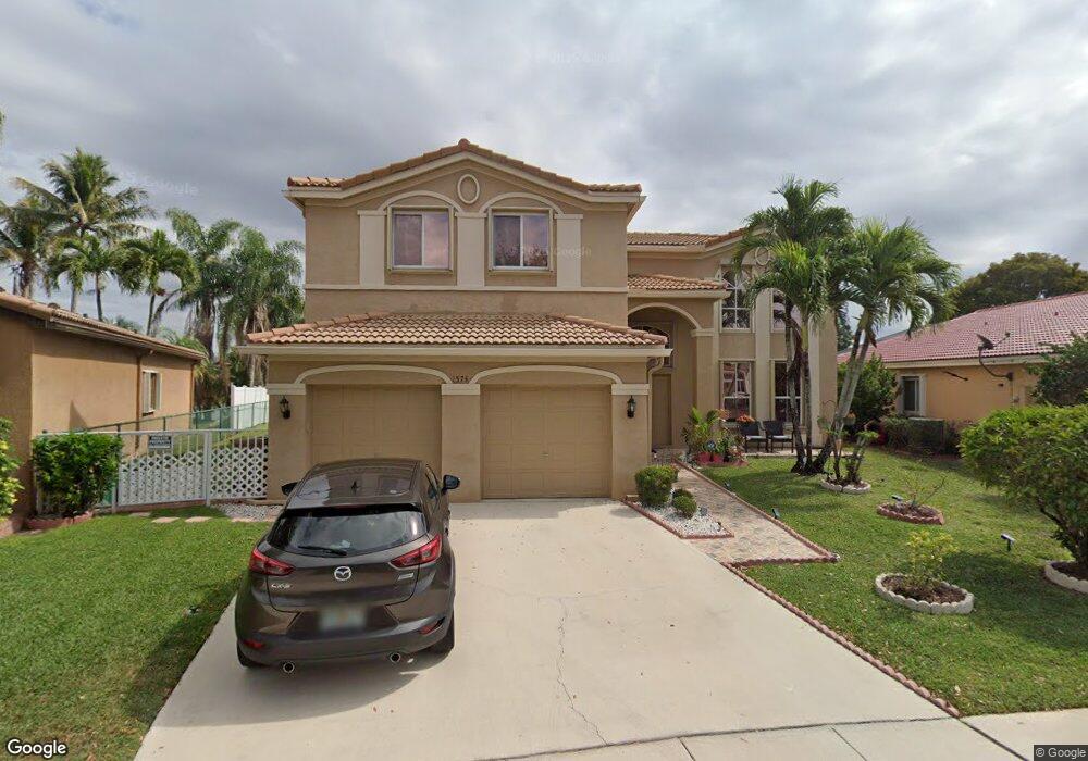
1574 E Harmony Lake Cir Davie, FL 33324
The Village At Harmony Lake NeighborhoodEstimated Value: $666,000 - $889,000
4
Beds
3
Baths
2,364
Sq Ft
$323/Sq Ft
Est. Value
About This Home
This home is located at 1574 E Harmony Lake Cir, Davie, FL 33324 and is currently estimated at $764,553, approximately $323 per square foot. 1574 E Harmony Lake Cir is a home located in Broward County with nearby schools including Fox Trail Elementary School, Indian Ridge Middle School, and Western High School.
Ownership History
Date
Name
Owned For
Owner Type
Purchase Details
Closed on
Nov 28, 2001
Sold by
Mays Gordon and Mays Carol Ann
Bought by
Flint Kenneth G and Flint Indra P
Current Estimated Value
Home Financials for this Owner
Home Financials are based on the most recent Mortgage that was taken out on this home.
Original Mortgage
$72,949
Interest Rate
6.09%
Purchase Details
Closed on
Feb 1, 1999
Sold by
Weitzer At Harmony Lakes Inc
Bought by
Mays Gordon and Mays Carol A
Home Financials for this Owner
Home Financials are based on the most recent Mortgage that was taken out on this home.
Original Mortgage
$151,200
Interest Rate
6.72%
Mortgage Type
New Conventional
Create a Home Valuation Report for This Property
The Home Valuation Report is an in-depth analysis detailing your home's value as well as a comparison with similar homes in the area
Home Values in the Area
Average Home Value in this Area
Purchase History
| Date | Buyer | Sale Price | Title Company |
|---|---|---|---|
| Flint Kenneth G | $275,000 | Home Title & Escrow | |
| Mays Gordon | $190,600 | -- |
Source: Public Records
Mortgage History
| Date | Status | Borrower | Loan Amount |
|---|---|---|---|
| Previous Owner | Flint Kenneth G | $72,949 | |
| Previous Owner | Mays Gordon | $151,200 | |
| Closed | Flint Kenneth G | $106,253 |
Source: Public Records
Tax History Compared to Growth
Tax History
| Year | Tax Paid | Tax Assessment Tax Assessment Total Assessment is a certain percentage of the fair market value that is determined by local assessors to be the total taxable value of land and additions on the property. | Land | Improvement |
|---|---|---|---|---|
| 2025 | $5,078 | $273,740 | -- | -- |
| 2024 | $4,959 | $266,030 | -- | -- |
| 2023 | $4,959 | $258,290 | $0 | $0 |
| 2022 | $4,691 | $250,770 | $0 | $0 |
| 2021 | $4,534 | $243,470 | $0 | $0 |
| 2020 | $4,513 | $240,110 | $0 | $0 |
| 2019 | $4,340 | $234,720 | $0 | $0 |
| 2018 | $4,197 | $230,350 | $0 | $0 |
| 2017 | $4,114 | $225,620 | $0 | $0 |
| 2016 | $4,075 | $220,980 | $0 | $0 |
| 2015 | $4,164 | $219,450 | $0 | $0 |
| 2014 | $4,203 | $217,710 | $0 | $0 |
| 2013 | -- | $214,500 | $63,060 | $151,440 |
Source: Public Records
Map
Nearby Homes
- 1636 SW 108th Terrace
- 10772 SW 14th Place
- 1683 SW 109th Terrace
- 1736 SW 109th Terrace
- 1413 SW 109th Way
- 1784 SW 110th Terrace Unit 256
- 11101 SW 15th Manor
- 11100 SW 17th Manor Unit 190
- 10550 W State Road 84 Unit 228
- 10550 W State Road 84
- 10550 W State Road 84 Unit 339
- 10550 W State Road 84 Unit 173
- 10550 W State Road 84 Unit 248
- 10550 W State Road 84 Unit 355
- 10550 W State Road 84 Unit 161
- 10550 W State Road 84 Unit 186
- 10550 W State Road 84 Unit 86
- 1541 SW 102nd Terrace
- 2001 Meadows Dr
- 1765 Back Lot SW 112th Ave
- 1604 E Harmony Lake Cir
- 1564 E Harmony Lake Cir
- 1614 E Harmony Lake Cir
- 1554 E Harmony Lake Cir
- 1573 E Harmony Lake Cir
- 1603 E Harmony Lake Cir
- 1624 E Harmony Lake Cir
- 1544 E Harmony Lake Cir
- 10765 SW 15th Place
- 1613 E Harmony Lake Cir
- 1576 SW 108th Terrace
- 1634 E Harmony Lake Cir
- 1606 SW 108th Terrace
- 10775 SW 15th Place
- 1623 E Harmony Lake Cir
- 1616 SW 108th Terrace
- 1534 E Harmony Lake Cir
- 1644 E Harmony Lake Cir
- 10805 SW 15th Place
- 1524 E Harmony Lake Cir