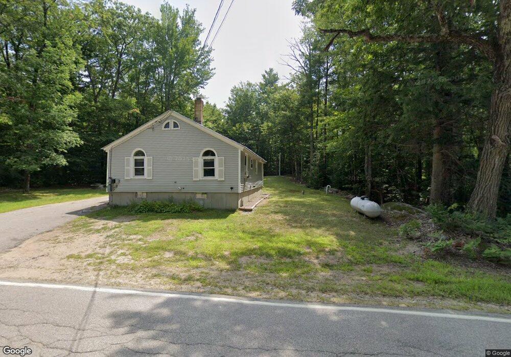
1575 Stark Rd Center Conway, NH 03813
Estimated Value: $289,309 - $319,000
2
Beds
1
Bath
860
Sq Ft
$353/Sq Ft
Est. Value
About This Home
This home is located at 1575 Stark Rd, Center Conway, NH 03813 and is currently estimated at $303,827, approximately $353 per square foot. 1575 Stark Rd is a home with nearby schools including A. Crosby Kennett Middle School, Kennett High School, and Robert Frost Charter School.
Ownership History
Date
Name
Owned For
Owner Type
Purchase Details
Closed on
May 28, 2010
Sold by
Mckay Thomas A and Day Amber Lynn
Bought by
Day Amber Lynn
Current Estimated Value
Home Financials for this Owner
Home Financials are based on the most recent Mortgage that was taken out on this home.
Original Mortgage
$121,500
Outstanding Balance
$82,066
Interest Rate
5.13%
Mortgage Type
Purchase Money Mortgage
Estimated Equity
$221,761
Create a Home Valuation Report for This Property
The Home Valuation Report is an in-depth analysis detailing your home's value as well as a comparison with similar homes in the area
Home Values in the Area
Average Home Value in this Area
Purchase History
| Date | Buyer | Sale Price | Title Company |
|---|---|---|---|
| Day Amber Lynn | $117,000 | -- |
Source: Public Records
Mortgage History
| Date | Status | Borrower | Loan Amount |
|---|---|---|---|
| Open | Day Amber Lynn | $121,500 |
Source: Public Records
Tax History Compared to Growth
Tax History
| Year | Tax Paid | Tax Assessment Tax Assessment Total Assessment is a certain percentage of the fair market value that is determined by local assessors to be the total taxable value of land and additions on the property. | Land | Improvement |
|---|---|---|---|---|
| 2024 | $2,533 | $209,300 | $52,000 | $157,300 |
| 2023 | $2,283 | $209,300 | $52,000 | $157,300 |
| 2022 | $2,465 | $136,500 | $63,200 | $73,300 |
| 2021 | $2,230 | $136,500 | $63,200 | $73,300 |
| 2020 | $2,367 | $136,500 | $63,200 | $73,300 |
| 2019 | $0 | $136,500 | $63,200 | $73,300 |
| 2018 | $0 | $114,400 | $53,200 | $61,200 |
| 2017 | $2,286 | $114,400 | $53,200 | $61,200 |
| 2016 | $0 | $114,400 | $53,200 | $61,200 |
| 2015 | $2,184 | $114,400 | $53,200 | $61,200 |
| 2014 | $2,158 | $114,400 | $53,200 | $61,200 |
| 2013 | $2,075 | $116,200 | $53,200 | $63,000 |
Source: Public Records
Map
Nearby Homes
- 1111 Stark Rd
- 137 Modock Hill Rd
- 15 Acadia Way
- -- Landsdown Ln
- 108 Maple Manor Rd
- 74 Garmish Rd
- 108 Brenner Dr
- 148 Brenner Dr
- 24 Amars Place
- 48 Maple Manor Rd
- 17 Skyline Way
- 44 Regent Hill Rd
- 26 Island Dr
- 592 Eaton Rd
- 149 Allard Hill Rd
- 00 Brenner Dr
- 369 Tasker Hill Rd
- 52 Appenvel Way
- 68 Eidelweiss Dr
- 237 Eaton Rd