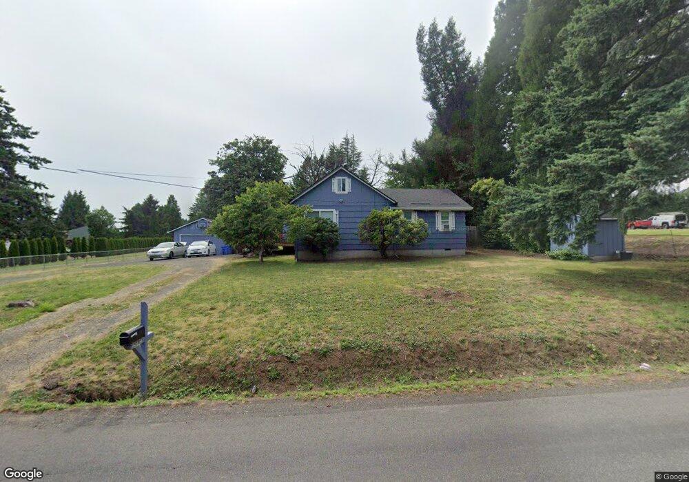
15781 SE Tong Rd Damascus, OR 97089
Estimated Value: $457,458 - $628,000
2
Beds
1
Bath
1,534
Sq Ft
$371/Sq Ft
Est. Value
About This Home
This home is located at 15781 SE Tong Rd, Damascus, OR 97089 and is currently estimated at $569,865, approximately $371 per square foot. 15781 SE Tong Rd is a home located in Clackamas County with nearby schools including Verne A Duncan Elementary School, Happy Valley Middle School, and Damascus Christian School.
Ownership History
Date
Name
Owned For
Owner Type
Purchase Details
Closed on
Jul 10, 1995
Sold by
Brunner Richard V and Brunner Sharon K
Bought by
Story Mark W and Story Darlene N
Current Estimated Value
Home Financials for this Owner
Home Financials are based on the most recent Mortgage that was taken out on this home.
Original Mortgage
$122,400
Interest Rate
7.74%
Mortgage Type
Purchase Money Mortgage
Create a Home Valuation Report for This Property
The Home Valuation Report is an in-depth analysis detailing your home's value as well as a comparison with similar homes in the area
Home Values in the Area
Average Home Value in this Area
Purchase History
| Date | Buyer | Sale Price | Title Company |
|---|---|---|---|
| Story Mark W | $144,000 | Ticor Title Insurance Compan |
Source: Public Records
Mortgage History
| Date | Status | Borrower | Loan Amount |
|---|---|---|---|
| Closed | Story Mark W | $122,400 |
Source: Public Records
Tax History Compared to Growth
Tax History
| Year | Tax Paid | Tax Assessment Tax Assessment Total Assessment is a certain percentage of the fair market value that is determined by local assessors to be the total taxable value of land and additions on the property. | Land | Improvement |
|---|---|---|---|---|
| 2025 | $3,552 | $201,852 | -- | -- |
| 2024 | $3,423 | $195,973 | -- | -- |
| 2023 | $3,423 | $190,266 | $0 | $0 |
| 2022 | $3,140 | $184,725 | $0 | $0 |
| 2021 | $3,023 | $179,345 | $0 | $0 |
| 2020 | $2,925 | $174,122 | $0 | $0 |
| 2019 | $2,885 | $169,051 | $0 | $0 |
| 2018 | $2,501 | $164,127 | $0 | $0 |
| 2017 | $2,419 | $159,347 | $0 | $0 |
| 2016 | $2,330 | $154,706 | $0 | $0 |
| 2015 | $2,597 | $150,200 | $0 | $0 |
| 2014 | $2,458 | $145,825 | $0 | $0 |
Source: Public Records
Map
Nearby Homes
- 18680 SE Highway 212
- 0 SE Armstrong Cir
- 18027 SE Emi St
- 17156 SE Macanudo St
- 17063 SE Macanudo St
- 14543 SE West Park Ct
- 14548 SE 172nd Ave
- 14790 SE 172nd Ave
- 15566 SE Melinda Ct
- 15556 SE Gladys Rose Way
- 16911 SE Siri Ct
- 14120 SE Brent Ave
- 16381 SE Deer Meadow Loop
- 16566 SE Deer Meadow Loop
- 13633 SE 178th Ave
- 20320 SE Walgren Rd
- 15786 SE Jansik Ct
- 16400 SE Highway 224
- 16300 SE Highway 224 Unit 8
- 16265 SE Highway 224
- 15743 SE Tong Rd
- 15711 SE Tong Rd
- 15861 SE Tong Rd
- 15851 SE Tong Rd
- 15805 SE Tong Rd
- 15860 SE Tong Rd
- 15840 SE Tong Rd
- 15919 SE Tong Rd
- 15610 SE Tong Rd
- 15985 SE Tong Rd
- 15920 SE Keller Rd
- 15841 SE Tong Rd
- 15672 SE Tong Rd
- 17988 SE Highway 212
- 15820 SE Tong Rd
- 15491 SE Tong Rd
- 15630 SE Tong Rd
- 18050 SE Highway 212
- 15528 SE Tong Rd
- 17920 SE Highway 212