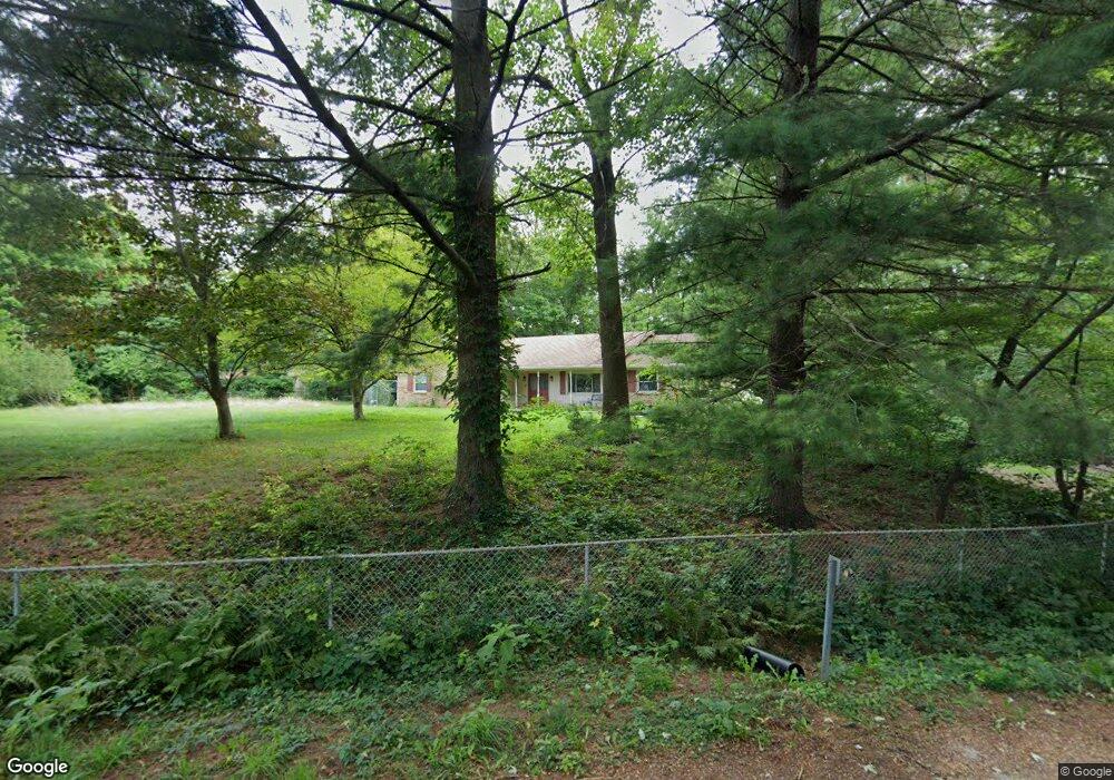
15794 Lin Rd Fortville, IN 46040
Brooks-Luxhaven NeighborhoodEstimated Value: $387,000 - $413,000
3
Beds
2
Baths
2,085
Sq Ft
$190/Sq Ft
Est. Value
About This Home
This home is located at 15794 Lin Rd, Fortville, IN 46040 and is currently estimated at $396,760, approximately $190 per square foot. 15794 Lin Rd is a home located in Hamilton County with nearby schools including Southeastern Elementary School, Hamilton Southeastern Intermediate / Junior High, and Hamilton Southeastern High School.
Ownership History
Date
Name
Owned For
Owner Type
Purchase Details
Closed on
Oct 3, 2022
Sold by
Singer Dixie D
Bought by
Fewell Cameron and Good Madison
Current Estimated Value
Home Financials for this Owner
Home Financials are based on the most recent Mortgage that was taken out on this home.
Original Mortgage
$0
Interest Rate
5.13%
Mortgage Type
Seller Take Back
Create a Home Valuation Report for This Property
The Home Valuation Report is an in-depth analysis detailing your home's value as well as a comparison with similar homes in the area
Home Values in the Area
Average Home Value in this Area
Purchase History
| Date | Buyer | Sale Price | Title Company |
|---|---|---|---|
| Fewell Cameron | -- | Ata National Title Group |
Source: Public Records
Mortgage History
| Date | Status | Borrower | Loan Amount |
|---|---|---|---|
| Closed | Fewell Cameron | $0 | |
| Open | Fewell Cameron | $130,000 |
Source: Public Records
Tax History Compared to Growth
Tax History
| Year | Tax Paid | Tax Assessment Tax Assessment Total Assessment is a certain percentage of the fair market value that is determined by local assessors to be the total taxable value of land and additions on the property. | Land | Improvement |
|---|---|---|---|---|
| 2024 | $2,079 | $243,000 | $37,500 | $205,500 |
| 2023 | $2,079 | $252,500 | $37,500 | $215,000 |
| 2022 | $1,758 | $214,700 | $37,500 | $177,200 |
| 2021 | $1,548 | $187,500 | $37,500 | $150,000 |
| 2020 | $1,260 | $161,200 | $37,500 | $123,700 |
| 2019 | $1,206 | $156,000 | $40,400 | $115,600 |
| 2018 | $1,393 | $164,900 | $40,400 | $124,500 |
| 2017 | $1,313 | $163,300 | $40,400 | $122,900 |
| 2016 | $1,307 | $163,400 | $40,400 | $123,000 |
| 2014 | $1,215 | $161,400 | $40,400 | $121,000 |
| 2013 | $1,215 | $164,800 | $40,300 | $124,500 |
Source: Public Records
Map
Nearby Homes
- 10504 Ruxton Ct
- 15628 Provincial Ln
- 10473 Ranford Blvd
- The Spiceland Plan at The Lakes at Grantham
- The Wildcat Plan at The Lakes at Grantham
- The Hayward Plan at The Lakes at Grantham
- The Fairbanks Plan at The Lakes at Grantham
- The Paddock Plan at The Lakes at Grantham
- The Carrington Plan at The Lakes at Grantham
- 16324 Portage Trail Ln
- 16338 Portage Trail Ln
- 15926 Bellows Ave
- 11338 Briargate Dr
- 15914 Bellows Ave
- 10389 Blue Ribbon Blvd
- 11362 Briargate Dr
- 10440 Vermillion Dr
- 10198 Ranford Blvd
- 10994 Edgewood Dr
- 10628 Kensington Ln
- 10765 Cyntheanne Rd
- 15766 Lin Rd
- 15785 Lin Rd
- 10900 Cyntheanne Rd
- 15763 Lin Rd
- 15740 Lin Rd
- 10714 Cyntheanne Rd
- 10762 Brenda Ct
- 10801 Cyntheanne Rd
- 15741 Lin Rd
- Lot 14 Lin Rd
- 10790 Brenda Ct
- 15719 Lin Rd
- 10643 Cyntheanne Rd
- 10804 Brenda Ct
- 0000 Brenda Ct
- 15710 Bodrum Dr
- 15698 Lin Rd
- 0 Brenda Ct Unit 2807610
- 0 Brenda Ct Unit 21024429