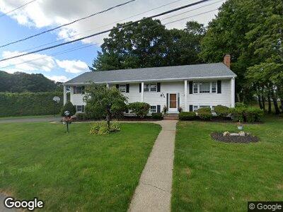
158 Candy Ln Brockton, MA 02301
Winters Corner NeighborhoodEstimated Value: $628,381 - $709,000
4
Beds
4
Baths
2,500
Sq Ft
$266/Sq Ft
Est. Value
About This Home
This home is located at 158 Candy Ln, Brockton, MA 02301 and is currently estimated at $665,095, approximately $266 per square foot. 158 Candy Ln is a home located in Plymouth County with nearby schools including Hancock Elementary School, Manthala George Jr. School, and Louis F Angelo Elementary School.
Ownership History
Date
Name
Owned For
Owner Type
Purchase Details
Closed on
May 5, 2023
Sold by
Wint Alfonso J and Wint Prendee Y
Bought by
Wint Prendee Y
Current Estimated Value
Home Financials for this Owner
Home Financials are based on the most recent Mortgage that was taken out on this home.
Original Mortgage
$383,000
Outstanding Balance
$375,002
Interest Rate
6.28%
Mortgage Type
Stand Alone Refi Refinance Of Original Loan
Estimated Equity
$310,692
Purchase Details
Closed on
Jul 15, 2005
Sold by
Orloff Carol A
Bought by
Wint Alfonso J and Wint Prendee J
Create a Home Valuation Report for This Property
The Home Valuation Report is an in-depth analysis detailing your home's value as well as a comparison with similar homes in the area
Home Values in the Area
Average Home Value in this Area
Purchase History
| Date | Buyer | Sale Price | Title Company |
|---|---|---|---|
| Wint Prendee Y | -- | None Available | |
| Wint Prendee Y | -- | None Available | |
| Wint Alfonso J | $479,000 | -- | |
| Wint Alfonso J | $479,000 | -- |
Source: Public Records
Mortgage History
| Date | Status | Borrower | Loan Amount |
|---|---|---|---|
| Open | Wint Prendee Y | $383,000 | |
| Closed | Wint Prendee Y | $383,000 | |
| Previous Owner | Wint Prendee Y | $362,000 | |
| Previous Owner | Orloff David S | $364,000 | |
| Previous Owner | Orloff David S | $45,500 | |
| Previous Owner | Orloff David S | $383,200 |
Source: Public Records
Tax History Compared to Growth
Tax History
| Year | Tax Paid | Tax Assessment Tax Assessment Total Assessment is a certain percentage of the fair market value that is determined by local assessors to be the total taxable value of land and additions on the property. | Land | Improvement |
|---|---|---|---|---|
| 2025 | $6,888 | $568,800 | $148,600 | $420,200 |
| 2024 | $6,587 | $548,000 | $148,600 | $399,400 |
| 2023 | $6,469 | $498,400 | $113,800 | $384,600 |
| 2022 | $6,208 | $444,400 | $103,600 | $340,800 |
| 2021 | $5,936 | $409,400 | $97,300 | $312,100 |
| 2020 | $5,681 | $375,000 | $93,200 | $281,800 |
| 2019 | $5,666 | $364,600 | $87,400 | $277,200 |
| 2018 | $5,512 | $343,200 | $87,400 | $255,800 |
| 2017 | $5,146 | $319,600 | $87,400 | $232,200 |
| 2016 | $5,229 | $301,200 | $83,500 | $217,700 |
| 2015 | $5,323 | $293,300 | $83,500 | $209,800 |
| 2014 | $4,815 | $265,600 | $83,500 | $182,100 |
Source: Public Records
Map
Nearby Homes
- 76 Sunset Dr
- 24 Santee Rd
- 154 Fairview Ave
- 1161 Pleasant St
- 1033 Pleasant St
- 688 Torrey St
- 48 Coweeset Dr
- 46 Loidie Ln
- Lot 2 Winterberry Ln
- LOT 4 Winterberry Ln
- Lot 1 Winterberry Ln
- 14 Westfield Dr
- 27 Carrlyn Rd
- 16 Chilton Rd
- 8 Chilton Rd
- 47 Grantview Terrace
- 15 Cathy Ln
- 19 Digby Ave
- 23 Angelo St
- 82 Brian Dr