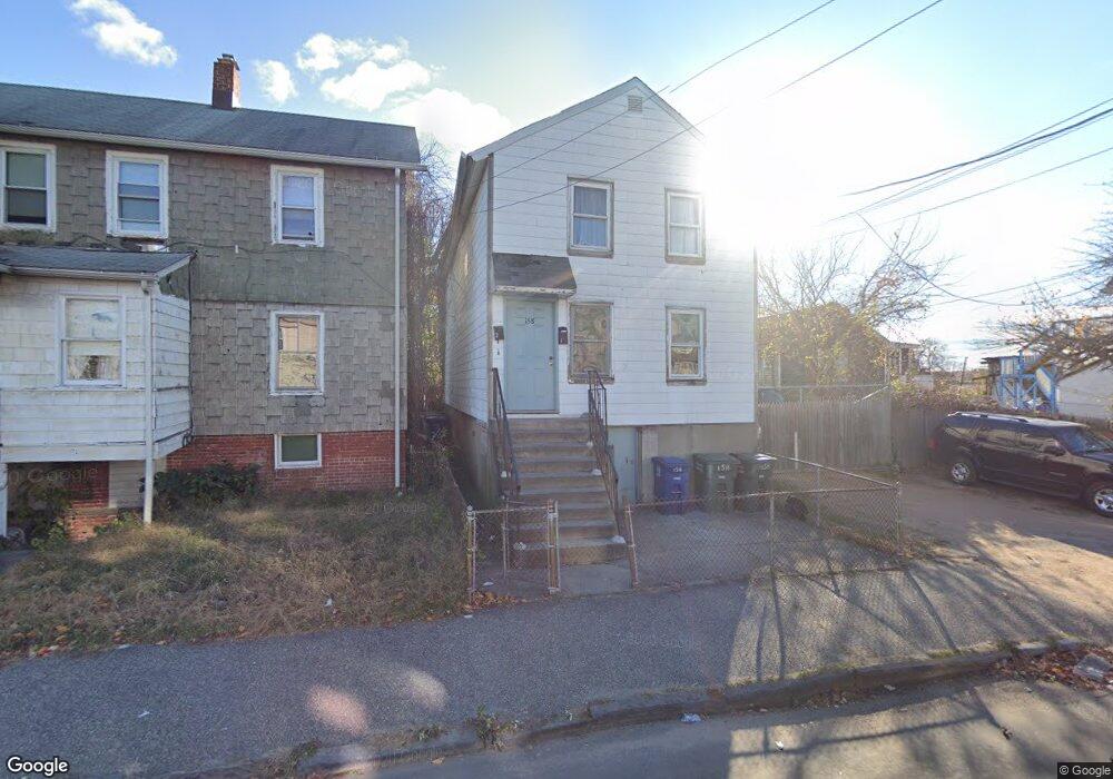
158 Jones Ave Bridgeport, CT 06604
The Hollow NeighborhoodEstimated Value: $261,714 - $340,000
4
Beds
2
Baths
1,304
Sq Ft
$226/Sq Ft
Est. Value
About This Home
This home is located at 158 Jones Ave, Bridgeport, CT 06604 and is currently estimated at $294,429, approximately $225 per square foot. 158 Jones Ave is a home located in Fairfield County with nearby schools including Geraldine Johnson School, Bassick High School, and Catholic Academy of Bridgeport-St. Raphael Academy.
Ownership History
Date
Name
Owned For
Owner Type
Purchase Details
Closed on
Jul 7, 2022
Sold by
Royal Realty Hldg Llc
Bought by
Jean Holdings Llc
Current Estimated Value
Purchase Details
Closed on
Dec 9, 1994
Sold by
Price Stephan H
Bought by
Lazzaro Joseph C
Home Financials for this Owner
Home Financials are based on the most recent Mortgage that was taken out on this home.
Original Mortgage
$40,000
Interest Rate
9%
Create a Home Valuation Report for This Property
The Home Valuation Report is an in-depth analysis detailing your home's value as well as a comparison with similar homes in the area
Home Values in the Area
Average Home Value in this Area
Purchase History
| Date | Buyer | Sale Price | Title Company |
|---|---|---|---|
| Jean Holdings Llc | $185,110 | None Available | |
| Jean Holdings Llc | $185,110 | None Available | |
| Royal Realty Hldg Llc | $150,100 | None Available | |
| Royal Realty Hldg Llc | $150,100 | None Available | |
| Lazzaro Joseph C | $40,000 | -- |
Source: Public Records
Mortgage History
| Date | Status | Borrower | Loan Amount |
|---|---|---|---|
| Previous Owner | Lazzaro Joseph C | $40,000 |
Source: Public Records
Tax History Compared to Growth
Tax History
| Year | Tax Paid | Tax Assessment Tax Assessment Total Assessment is a certain percentage of the fair market value that is determined by local assessors to be the total taxable value of land and additions on the property. | Land | Improvement |
|---|---|---|---|---|
| 2025 | $3,847 | $88,542 | $42,010 | $46,532 |
| 2024 | $3,847 | $88,542 | $42,010 | $46,532 |
| 2023 | $3,847 | $88,542 | $42,010 | $46,532 |
| 2022 | $3,847 | $88,542 | $42,010 | $46,532 |
| 2021 | $5,569 | $128,180 | $42,010 | $86,170 |
| 2020 | $5,079 | $94,070 | $19,890 | $74,180 |
| 2019 | $5,079 | $94,070 | $19,890 | $74,180 |
| 2018 | $5,115 | $94,070 | $19,890 | $74,180 |
| 2017 | $5,115 | $94,070 | $19,890 | $74,180 |
| 2016 | $5,115 | $94,070 | $19,890 | $74,180 |
| 2015 | $5,554 | $131,600 | $41,390 | $90,210 |
| 2014 | $5,554 | $131,600 | $41,390 | $90,210 |
Source: Public Records
Map
Nearby Homes
- 183 Calhoun Ave
- 139 Highland Ave Unit 143
- 309 Pequonnock St
- 318 Center St
- 120 Milne St Unit 122
- 75 Sanford Ave
- 113 Milne St Unit 115
- 191 Oak St
- 213 Harral Ave Unit 215
- 200 Harral Ave
- 100 Lorraine St
- 1373 Iranistan Ave
- 826 Norman St
- 1872 North Ave Unit 1874
- 1199 Iranistan Ave Unit 1201
- 592 Norman St Unit 594
- 78 Fairmount Ave
- 414 Wood Ave
- 90 Tom Thumb St
- 566 Wood Ave