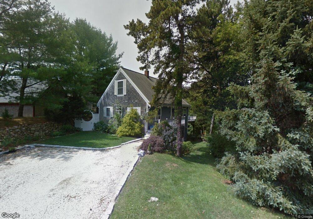
158 Trout Brook Rd Cotuit, MA 02635
Cotuit NeighborhoodEstimated Value: $655,644 - $830,000
3
Beds
2
Baths
1,061
Sq Ft
$689/Sq Ft
Est. Value
About This Home
This home is located at 158 Trout Brook Rd, Cotuit, MA 02635 and is currently estimated at $731,411, approximately $689 per square foot. 158 Trout Brook Rd is a home located in Barnstable County with nearby schools including West Villages Elementary School, Barnstable United Elementary School, and Barnstable Intermediate School.
Ownership History
Date
Name
Owned For
Owner Type
Purchase Details
Closed on
Feb 26, 2016
Sold by
Stpierre Daniel and Stpierre Lucia
Bought by
Saintpierre Daniel
Current Estimated Value
Home Financials for this Owner
Home Financials are based on the most recent Mortgage that was taken out on this home.
Original Mortgage
$26,000
Outstanding Balance
$20,762
Interest Rate
3.92%
Mortgage Type
New Conventional
Estimated Equity
$710,649
Purchase Details
Closed on
May 29, 2009
Sold by
Boger Dean M and Boger Patricia M
Bought by
Stpierre Daniel
Home Financials for this Owner
Home Financials are based on the most recent Mortgage that was taken out on this home.
Original Mortgage
$272,690
Interest Rate
4.87%
Mortgage Type
Purchase Money Mortgage
Purchase Details
Closed on
Jun 25, 1999
Sold by
Gagnon Mark D and Bouget Cynthia M
Bought by
Boger Dean M
Purchase Details
Closed on
Apr 24, 1989
Sold by
Aronson Tina G
Bought by
Bourget Cynthia M
Create a Home Valuation Report for This Property
The Home Valuation Report is an in-depth analysis detailing your home's value as well as a comparison with similar homes in the area
Home Values in the Area
Average Home Value in this Area
Purchase History
| Date | Buyer | Sale Price | Title Company |
|---|---|---|---|
| Saintpierre Daniel | -- | -- | |
| Stpierre Daniel | $294,000 | -- | |
| Boger Dean M | $136,000 | -- | |
| Bourget Cynthia M | $125,000 | -- |
Source: Public Records
Mortgage History
| Date | Status | Borrower | Loan Amount |
|---|---|---|---|
| Open | Saintpierre Daniel | $26,000 | |
| Previous Owner | Stpierre Daniel | $272,690 | |
| Previous Owner | Bourget Cynthia M | $172,000 | |
| Previous Owner | Bourget Cynthia M | $50,000 |
Source: Public Records
Tax History
| Year | Tax Paid | Tax Assessment Tax Assessment Total Assessment is a certain percentage of the fair market value that is determined by local assessors to be the total taxable value of land and additions on the property. | Land | Improvement |
|---|---|---|---|---|
| 2025 | $4,555 | $545,500 | $218,700 | $326,800 |
| 2024 | $4,173 | $529,600 | $218,700 | $310,900 |
| 2023 | $3,987 | $476,400 | $198,800 | $277,600 |
| 2022 | $3,850 | $372,300 | $136,700 | $235,600 |
| 2021 | $3,786 | $342,900 | $138,800 | $204,100 |
| 2020 | $3,889 | $332,100 | $138,800 | $193,300 |
| 2019 | $3,832 | $322,600 | $147,200 | $175,400 |
| 2018 | $2,607 | $324,700 | $171,600 | $153,100 |
| 2017 | $3,754 | $318,100 | $171,600 | $146,500 |
| 2016 | $3,675 | $319,300 | $172,800 | $146,500 |
| 2015 | $3,656 | $317,400 | $168,900 | $148,500 |
Source: Public Records
Map
Nearby Homes
- 226 Dunrobin Rd
- 70 Cape Dr Unit 14D
- 70 Cape Dr Unit 11D
- 70 Cape Dr Unit 11D
- 70 Simons Rd Unit E
- 70 Simons Rd
- 239 Oxford Dr
- 16 Spring Brook Ln
- 75 Bob White Run
- 1597 Santuit-Newtown Rd
- 4 Bishops Park
- 16 Cedar St
- 195 Falmouth Rd Unit 10E
- 195 Falmouth Rd Unit 19F
- 195 Falmouth Rd Unit 10E
- 195 Falmouth Rd Unit 9D
- 195 Falmouth Rd Unit 19F
- 1456 Santuit-Newtown Rd
- 6 Willow Cir
- 114 Orchard Rd
- 170 Trout Brook Rd
- 144 Trout Brook Rd
- 159 Trout Brook Rd
- 182 Trout Brook Rd
- 171 Trout Brook Rd
- 143 Trout Brook Rd
- 75 Furlong Way
- 123 Trout Brook Rd
- 95 Furlong Way
- 126 Trout Brook Rd
- 59 Furlong Way
- 101 Trout Brook Rd
- 41 Furlong Way
- 113 Furlong Way
- 25 Furlong Way
- 89 Trout Brook Rd
- 116 Trout Brook Rd
- 82 Furlong Way
- 94 Furlong Way
- 68 Furlong Way
Your Personal Tour Guide
Ask me questions while you tour the home.