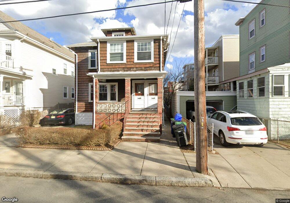
158 W Adams St Unit 2 Somerville, MA 02144
West Somerville NeighborhoodEstimated Value: $951,000 - $1,260,000
3
Beds
1
Bath
1,200
Sq Ft
$949/Sq Ft
Est. Value
About This Home
This home is located at 158 W Adams St Unit 2, Somerville, MA 02144 and is currently estimated at $1,138,582, approximately $948 per square foot. 158 W Adams St Unit 2 is a home located in Middlesex County with nearby schools including Somerville High School, International School of Boston, and Lesley Ellis School.
Ownership History
Date
Name
Owned For
Owner Type
Purchase Details
Closed on
Sep 18, 2015
Sold by
Reidy John and Mcneil Nancy B
Bought by
Radochia Leonard E and Radochia Melissa
Current Estimated Value
Home Financials for this Owner
Home Financials are based on the most recent Mortgage that was taken out on this home.
Original Mortgage
$450,000
Outstanding Balance
$353,807
Interest Rate
3.94%
Mortgage Type
New Conventional
Estimated Equity
$784,775
Purchase Details
Closed on
Nov 5, 2012
Sold by
Reidy Eleanor M
Bought by
Reidy John D and Mcneil Nancy B
Create a Home Valuation Report for This Property
The Home Valuation Report is an in-depth analysis detailing your home's value as well as a comparison with similar homes in the area
Home Values in the Area
Average Home Value in this Area
Purchase History
| Date | Buyer | Sale Price | Title Company |
|---|---|---|---|
| Radochia Leonard E | $600,000 | -- | |
| Reidy John D | -- | -- |
Source: Public Records
Mortgage History
| Date | Status | Borrower | Loan Amount |
|---|---|---|---|
| Open | Radochia Leonard E | $450,000 |
Source: Public Records
Tax History Compared to Growth
Tax History
| Year | Tax Paid | Tax Assessment Tax Assessment Total Assessment is a certain percentage of the fair market value that is determined by local assessors to be the total taxable value of land and additions on the property. | Land | Improvement |
|---|---|---|---|---|
| 2025 | $10,147 | $930,100 | $578,900 | $351,200 |
| 2024 | $9,590 | $911,600 | $578,900 | $332,700 |
| 2023 | $9,368 | $906,000 | $578,900 | $327,100 |
| 2022 | $8,660 | $850,700 | $551,300 | $299,400 |
| 2021 | $8,459 | $830,100 | $547,300 | $282,800 |
| 2020 | $8,322 | $824,800 | $547,600 | $277,200 |
| 2019 | $7,850 | $729,600 | $498,600 | $231,000 |
| 2018 | $7,644 | $675,900 | $453,300 | $222,600 |
| 2017 | $7,366 | $631,200 | $427,600 | $203,600 |
| 2016 | $7,294 | $582,100 | $381,900 | $200,200 |
| 2015 | $6,928 | $549,400 | $352,700 | $196,700 |
Source: Public Records
Map
Nearby Homes
- 33 Conwell Ave
- 233 Powder House Blvd
- 16 High St Unit 2
- 21 High St
- 8 Hamilton Rd Unit 2
- 34 Belknap St
- 9 Woods Ave
- 31 Fairfax St
- 327 Alewife Brook Pkwy Unit A
- 11 Watson St Unit 2
- 69 Sterling St
- 16 Hamilton Rd
- 33 Hamilton St
- 55 Packard Ave Unit 1
- 57 Packard Ave Unit B
- 57 Garrison Ave
- 22 Ossipee Rd Unit 2
- 14 Moore St
- 395 Alewife Brook Pkwy Unit 2C
- 395 Alewife Brook Pkwy Unit PH E
- 156 W Adams St Unit 2
- 156 W Adams St
- 158 W Adams St
- 154 W Adams St
- 152 W Adams St
- 154 W Adams St Unit 154
- 152 W Adams St Unit 2
- 69 Conwell Ave Unit 3
- 69 Conwell Ave Unit 1
- 65 Conwell Ave Unit A
- 65 Conwell Ave
- 65 Conwell Ave Unit 65
- 65 Conwell Ave
- 65 Conwell Ave Unit 1
- 65 Conwell Ave Unit 3
- 65 Conwell Ave Unit 1-1
- 65 Conwell Ave Unit 2
- 150 W Adams St
- 63 Conwell Ave
- 63 Conwell Ave Unit 3