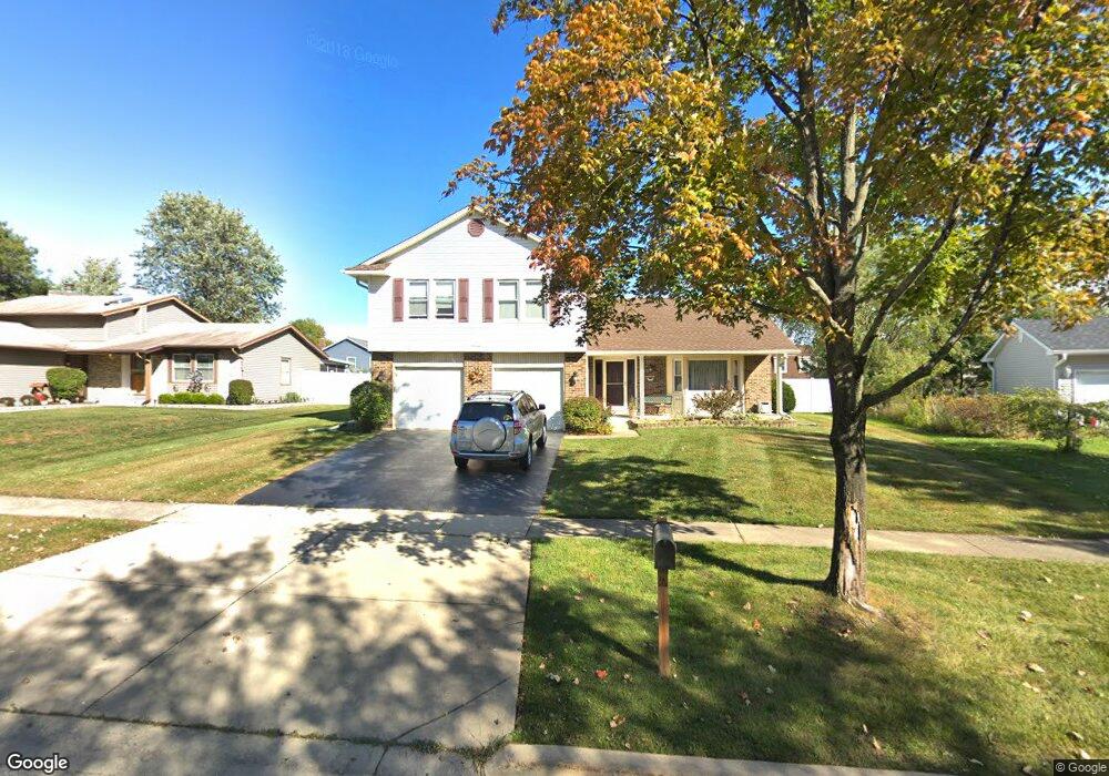
1580 Burning Bush Ln Hoffman Estates, IL 60192
South Ridge NeighborhoodEstimated Value: $550,000 - $558,000
4
Beds
3
Baths
2,372
Sq Ft
$233/Sq Ft
Est. Value
About This Home
This home is located at 1580 Burning Bush Ln, Hoffman Estates, IL 60192 and is currently estimated at $553,254, approximately $233 per square foot. 1580 Burning Bush Ln is a home located in Cook County with nearby schools including Frank C. Whiteley Elementary School, Plum Grove Jr High School, and William Fremd High School.
Ownership History
Date
Name
Owned For
Owner Type
Purchase Details
Closed on
Mar 31, 2016
Sold by
Kennedy Daniel T and Kennedy Brenda D
Bought by
Kennedy Daniel T and Kennedy Brenda D
Current Estimated Value
Purchase Details
Closed on
Oct 24, 2001
Sold by
Connor Stephen W and Connor Jill E
Bought by
Kennedy Daniel T and Kennedy Brenda D
Home Financials for this Owner
Home Financials are based on the most recent Mortgage that was taken out on this home.
Original Mortgage
$225,100
Outstanding Balance
$87,533
Interest Rate
6.8%
Estimated Equity
$465,721
Create a Home Valuation Report for This Property
The Home Valuation Report is an in-depth analysis detailing your home's value as well as a comparison with similar homes in the area
Home Values in the Area
Average Home Value in this Area
Purchase History
| Date | Buyer | Sale Price | Title Company |
|---|---|---|---|
| Kennedy Daniel T | -- | None Available | |
| Kennedy Daniel T | $310,000 | Lawyers Title Insurance Co |
Source: Public Records
Mortgage History
| Date | Status | Borrower | Loan Amount |
|---|---|---|---|
| Open | Kennedy Daniel T | $225,100 |
Source: Public Records
Tax History Compared to Growth
Tax History
| Year | Tax Paid | Tax Assessment Tax Assessment Total Assessment is a certain percentage of the fair market value that is determined by local assessors to be the total taxable value of land and additions on the property. | Land | Improvement |
|---|---|---|---|---|
| 2024 | $10,614 | $37,936 | $8,998 | $28,938 |
| 2023 | $10,543 | $37,936 | $8,998 | $28,938 |
| 2022 | $10,543 | $39,000 | $8,998 | $30,002 |
| 2021 | $9,520 | $31,759 | $6,248 | $25,511 |
| 2020 | $9,385 | $31,759 | $6,248 | $25,511 |
| 2019 | $9,289 | $35,210 | $6,248 | $28,962 |
| 2018 | $8,744 | $31,034 | $5,748 | $25,286 |
| 2017 | $9,123 | $32,718 | $5,748 | $26,970 |
| 2016 | $9,542 | $35,564 | $5,748 | $29,816 |
| 2015 | $8,689 | $30,581 | $5,248 | $25,333 |
| 2014 | $8,542 | $30,581 | $5,248 | $25,333 |
| 2013 | $8,308 | $30,581 | $5,248 | $25,333 |
Source: Public Records
Map
Nearby Homes
- 4320 Lombardy Ln
- 3925 Charlemagne Dr
- 3991 Whispering Trails Dr
- 4090 N Parkside Dr
- 3835 Huntington Blvd
- 26 Forest Ln
- 1404 W Sapphire Dr
- 16 Forest Ln
- 4658 Burnham Dr
- 13 Chipping Campden Dr
- 1980 Dogwood Dr
- 39 Forest Ln
- 3666 Whispering Trails Dr
- 3960 Colony Ct
- 4797 Amber Cir
- 4760 Amber Cir
- 1860 Burr Ridge Dr
- 4827 Turnberry Dr
- 1195 Old Timber Ct
- 1208 Old Timber Ln
- 1582 Burning Bush Ln
- 1578 Burning Bush Ln
- 4170 Crimson Dr
- 4160 Crimson Dr
- 4180 Crimson Dr
- 1584 Burning Bush Ln
- 4150 Crimson Dr
- 1576 Burning Bush Ln
- 1581 Burning Bush Ln
- 4136 Crimson Dr
- 1583 Burning Bush Ln
- 1586 Burning Bush Ln
- 4200 Crimson Dr
- 1585 Burning Bush Ln
- 4124 Crimson Dr Unit 4
- 4175 Crimson Dr
- 4165 Crimson Dr
- 1588 Burning Bush Ln
- 4122 Crimson Dr
- 4185 Crimson Dr