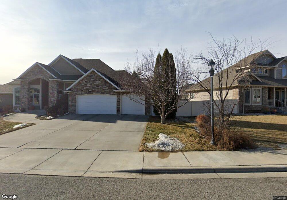
1580 Westridge Cir Billings, MT 59102
North Central Billings NeighborhoodEstimated Value: $683,665 - $881,000
4
Beds
3
Baths
4,471
Sq Ft
$168/Sq Ft
Est. Value
About This Home
This home is located at 1580 Westridge Cir, Billings, MT 59102 and is currently estimated at $749,416, approximately $167 per square foot. 1580 Westridge Cir is a home located in Yellowstone County with nearby schools including Poly Drive School, Will James Junior High School, and Billings Senior High School.
Ownership History
Date
Name
Owned For
Owner Type
Purchase Details
Closed on
May 24, 2013
Sold by
Macdonald Hugh and Macdonald Brandi
Bought by
Shin Tanya B
Current Estimated Value
Home Financials for this Owner
Home Financials are based on the most recent Mortgage that was taken out on this home.
Original Mortgage
$403,750
Outstanding Balance
$285,199
Interest Rate
3.41%
Mortgage Type
New Conventional
Estimated Equity
$464,217
Create a Home Valuation Report for This Property
The Home Valuation Report is an in-depth analysis detailing your home's value as well as a comparison with similar homes in the area
Home Values in the Area
Average Home Value in this Area
Purchase History
| Date | Buyer | Sale Price | Title Company |
|---|---|---|---|
| Shin Tanya B | -- | None Available |
Source: Public Records
Mortgage History
| Date | Status | Borrower | Loan Amount |
|---|---|---|---|
| Open | Shin Tanya B | $403,750 |
Source: Public Records
Tax History Compared to Growth
Tax History
| Year | Tax Paid | Tax Assessment Tax Assessment Total Assessment is a certain percentage of the fair market value that is determined by local assessors to be the total taxable value of land and additions on the property. | Land | Improvement |
|---|---|---|---|---|
| 2025 | $6,052 | $694,700 | $120,037 | $574,663 |
| 2024 | $6,052 | $606,800 | $107,950 | $498,850 |
| 2023 | $6,029 | $606,800 | $107,950 | $498,850 |
| 2022 | $4,867 | $515,500 | $0 | $0 |
| 2021 | $5,490 | $515,500 | $0 | $0 |
| 2020 | $5,196 | $464,200 | $0 | $0 |
| 2019 | $4,975 | $464,200 | $0 | $0 |
| 2018 | $5,188 | $477,700 | $0 | $0 |
| 2017 | $5,048 | $477,700 | $0 | $0 |
| 2016 | $4,567 | $433,200 | $0 | $0 |
| 2015 | $4,471 | $433,200 | $0 | $0 |
| 2014 | $4,424 | $229,172 | $0 | $0 |
Source: Public Records
Map
Nearby Homes
- 1605 Forest Park Dr
- 1803 Forest Park Dr
- 2624 Southridge Dr
- 5915 Southridge Dr
- 2550 Forest Meadow Ln
- 2641 Forest Meadow Ln
- 1815 28th St W
- 2060 Edgewood Dr
- 2403 Avenue B
- 1716 Patricia Ln
- 1820 Patricia Ln
- 1824 Patricia Ln
- 2826 Oakland Dr Unit 10
- 0 Julianne Dr Unit 354976
- 0 Julianne Dr Unit 354975
- 2820 Boulder Ave
- 2260 Avenue C
- 2219 Avenue B
- 2332 Alderson Ave
- 2230 Avenue C
- 1570 Westridge Cir
- 1640 Westridge Cir
- 1585 Westridge Cir
- 1565 Forest Park Dr
- 1575 Westridge Cir
- 1595 Westridge Cir
- 1565 Westridge Cir
- 1605 Westridge Cir
- 1645 Westridge Cir
- 1635 Westridge Cir
- 1615 Westridge Cir
- 1810 Arcadia Dr
- 1555 Westridge Cir
- 1655 Westridge Cir
- 1826 Arcadia Dr
- 1804 Arcadia Dr
- 1580 Forest Park Dr
- 1527 Westridge Dr
- 1625 Westridge Cir
- 1545 Westridge Cir