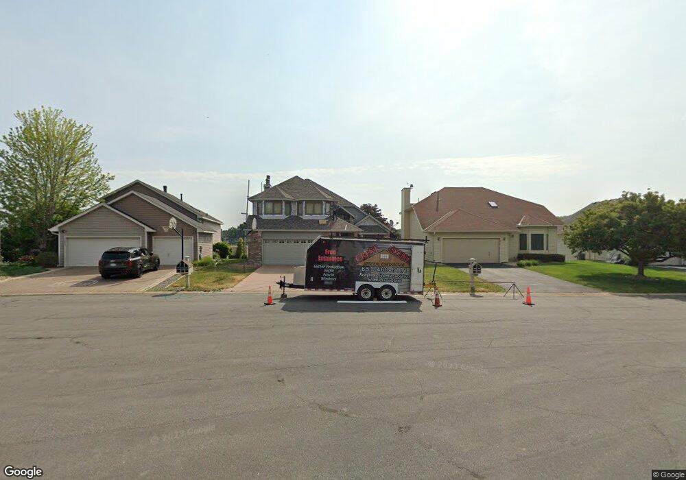
15828 Hyland Pointe Ct Saint Paul, MN 55124
Old Town NeighborhoodEstimated Value: $640,891 - $699,000
4
Beds
4
Baths
2,202
Sq Ft
$309/Sq Ft
Est. Value
About This Home
This home is located at 15828 Hyland Pointe Ct, Saint Paul, MN 55124 and is currently estimated at $679,473, approximately $308 per square foot. 15828 Hyland Pointe Ct is a home located in Dakota County with nearby schools including Southview Elementary School, Valley Middle School, and Apple Valley Senior High School.
Ownership History
Date
Name
Owned For
Owner Type
Purchase Details
Closed on
Sep 5, 2007
Sold by
Kadue Diane and Kadue Richard
Bought by
Rodmanesh Kaikhushroo E and Farestani Azormidokht
Current Estimated Value
Purchase Details
Closed on
Aug 29, 2002
Sold by
Carlson Wesley G and Carlson Susan F
Bought by
Sweeney Thomas P and Sweeney Diane E
Create a Home Valuation Report for This Property
The Home Valuation Report is an in-depth analysis detailing your home's value as well as a comparison with similar homes in the area
Home Values in the Area
Average Home Value in this Area
Purchase History
| Date | Buyer | Sale Price | Title Company |
|---|---|---|---|
| Rodmanesh Kaikhushroo E | $446,500 | -- | |
| Sweeney Thomas P | $400,000 | -- |
Source: Public Records
Tax History Compared to Growth
Tax History
| Year | Tax Paid | Tax Assessment Tax Assessment Total Assessment is a certain percentage of the fair market value that is determined by local assessors to be the total taxable value of land and additions on the property. | Land | Improvement |
|---|---|---|---|---|
| 2024 | $6,512 | $592,200 | $231,000 | $361,200 |
| 2023 | $6,512 | $563,700 | $231,500 | $332,200 |
| 2022 | $5,436 | $555,800 | $230,800 | $325,000 |
| 2021 | $5,276 | $468,200 | $200,700 | $267,500 |
| 2020 | $5,442 | $444,400 | $191,100 | $253,300 |
| 2019 | $5,017 | $444,600 | $182,000 | $262,600 |
| 2018 | $4,838 | $427,700 | $173,300 | $254,400 |
| 2017 | $4,936 | $395,300 | $165,100 | $230,200 |
| 2016 | $5,006 | $383,000 | $157,200 | $225,800 |
| 2015 | $4,848 | $380,884 | $153,009 | $227,875 |
| 2014 | -- | $371,401 | $147,114 | $224,287 |
| 2013 | -- | $344,369 | $135,052 | $209,317 |
Source: Public Records
Map
Nearby Homes
- 15931 Hyland Pointe Ct
- 15964 Hyland Dr
- 15813 Garden View Dr
- 16125 Crystal Hills Dr
- 16187 Hawthorn Path
- 16407 Hutchinson Dr
- 15979 Harwell Ave
- 15505 Logarto Ln
- 1010 E 157th St
- 1629 Keller Lake Dr
- 892 Redwell Ln
- 16421 Gunflint Trail
- 1516 Rushmore Dr
- 8090 159th St W
- 938 Cortland Dr S
- 16096 Harmony Path
- 16824 Interlachen Blvd
- 921 Cortland Dr S
- 889 Whitney Dr
- 16551 Irwinton Cir
- 15834 Hyland Pointe Ct
- 15820 Hyland Pointe Ct
- 15836 Hyland Pointe Ct
- 15804 Hyland Pointe Ct
- 15838 Hyland Pointe Ct
- 15796 Hyland Pointe Ct
- 15835 Hyland Pointe Ct
- 15844 Hyland Pointe Ct
- 15831 Hyland Pointe Ct
- 15821 Hyland Pointe Ct
- 15805 Hyland Pointe Ct
- 15856 Hyland Pointe Ct
- 15845 Hyland Pointe Ct
- 15799 Hyland Pointe Ct
- 15870 Hyland Pointe Ct
- 15859 Hyland Pointe Ct
- 15865 Hyland Pointe Ct
- 15888 Hyland Pointe Ct
- 15879 Hyland Pointe Ct
- 15894 Hyland Pointe Ct
