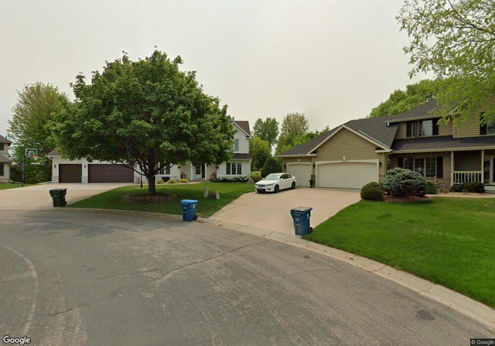
1585 Wexford Cir Saint Paul, MN 55122
Estimated Value: $743,000 - $809,000
4
Beds
3
Baths
3,156
Sq Ft
$243/Sq Ft
Est. Value
About This Home
This home is located at 1585 Wexford Cir, Saint Paul, MN 55122 and is currently estimated at $766,366, approximately $242 per square foot. 1585 Wexford Cir is a home located in Dakota County with nearby schools including Thomas Lake Elementary School, Black Hawk Middle School, and Eastview Senior High School.
Ownership History
Date
Name
Owned For
Owner Type
Purchase Details
Closed on
Feb 21, 2019
Sold by
Bitzan Mullaney John W and Bitzan Mullaney Joan
Bought by
Junge Gregory and Freeborg Junge Stacy
Current Estimated Value
Home Financials for this Owner
Home Financials are based on the most recent Mortgage that was taken out on this home.
Original Mortgage
$421,200
Outstanding Balance
$369,555
Interest Rate
4.4%
Mortgage Type
VA
Estimated Equity
$396,811
Create a Home Valuation Report for This Property
The Home Valuation Report is an in-depth analysis detailing your home's value as well as a comparison with similar homes in the area
Home Values in the Area
Average Home Value in this Area
Purchase History
| Date | Buyer | Sale Price | Title Company |
|---|---|---|---|
| Junge Gregory | $490,000 | Titlesmart Inc |
Source: Public Records
Mortgage History
| Date | Status | Borrower | Loan Amount |
|---|---|---|---|
| Open | Junge Gregory | $421,200 |
Source: Public Records
Tax History Compared to Growth
Tax History
| Year | Tax Paid | Tax Assessment Tax Assessment Total Assessment is a certain percentage of the fair market value that is determined by local assessors to be the total taxable value of land and additions on the property. | Land | Improvement |
|---|---|---|---|---|
| 2024 | $7,498 | $703,800 | $139,400 | $564,400 |
| 2023 | $7,498 | $661,300 | $139,800 | $521,500 |
| 2022 | $6,300 | $625,700 | $149,000 | $476,700 |
| 2021 | $6,496 | $551,000 | $129,600 | $421,400 |
| 2020 | $6,216 | $554,000 | $123,400 | $430,600 |
| 2019 | $5,931 | $521,200 | $117,600 | $403,600 |
| 2018 | $5,448 | $523,100 | $112,000 | $411,100 |
| 2017 | $5,596 | $468,600 | $106,700 | $361,900 |
| 2016 | $5,716 | $458,600 | $101,500 | $357,100 |
| 2015 | $5,845 | $464,400 | $101,500 | $362,900 |
| 2014 | -- | $482,900 | $98,800 | $384,100 |
| 2013 | -- | $420,400 | $89,700 | $330,700 |
Source: Public Records
Map
Nearby Homes
- 1617 Clemson Dr Unit B
- 1605 Clemson Dr Unit A
- 4234 Boulder Ridge Point
- 1656 Oakbrooke Way
- 4168 Arbor Ln
- 1645 Hickory Hill Dr
- 4199 Knob Cir Unit 102
- 1650 Hickory Hill Dr
- 4143 Meadowlark Point
- 4100 Meadowlark Ln
- 1780 Talon Trail
- 1669 Walnut Ln
- 4290 Blackhawk Rd
- 4241 Blackhawk Rd
- 1569 Lancaster Ln
- 1536 Stonewood Ln
- 4613 1/2 Penkwe Way
- 1630 Murphy Pkwy
- 1511 Deerwood Bend
- 1866 Bear Path Trail
- 1589 Wexford Cir
- 1588 Wexford Cir
- 4303 Clemson Cir Unit A
- 4303 Clemson Cir Unit B
- 4303 Clemson Cir
- 4305 Clemson Cir Unit B
- 4305 Clemson Cir Unit A
- 1593 Wexford Cir
- 1592 Wexford Cir
- 4301 Clemson Cir Unit B
- 4301 Clemson Cir Unit A
- 4301 Clemson Cir
- 1613 Summit Hill
- 1615 Summit Hill
- 1611 Summit Hill
- 4300 Clemson Cir Unit A
- 4300 Clemson Cir Unit B
- 1611 Summit Ave
- 1596 Wexford Cir
- 1617 Summit Hill