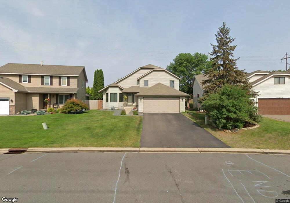
15865 Hyland Pointe Ct Saint Paul, MN 55124
Old Town NeighborhoodEstimated Value: $326,000 - $497,000
3
Beds
2
Baths
2,050
Sq Ft
$204/Sq Ft
Est. Value
About This Home
This home is located at 15865 Hyland Pointe Ct, Saint Paul, MN 55124 and is currently estimated at $418,971, approximately $204 per square foot. 15865 Hyland Pointe Ct is a home located in Dakota County with nearby schools including Southview Elementary School, Valley Middle School, and Apple Valley Senior High School.
Ownership History
Date
Name
Owned For
Owner Type
Purchase Details
Closed on
Jun 22, 2006
Sold by
Johnson Brian R and Johnson Carolyn A
Bought by
Kewlcy Scott and Brunette Kimberly
Current Estimated Value
Purchase Details
Closed on
Nov 10, 2005
Sold by
Not Provided
Bought by
Kabot Jeffrey J and Kabot Melissa K
Purchase Details
Closed on
Mar 19, 2004
Sold by
Turner Clayton C and Turner Doris J
Bought by
Blankenship Mary L
Create a Home Valuation Report for This Property
The Home Valuation Report is an in-depth analysis detailing your home's value as well as a comparison with similar homes in the area
Home Values in the Area
Average Home Value in this Area
Purchase History
| Date | Buyer | Sale Price | Title Company |
|---|---|---|---|
| Kewlcy Scott | $305,000 | -- | |
| Kabot Jeffrey J | $272,000 | -- | |
| Blankenship Mary L | $265,000 | -- |
Source: Public Records
Tax History Compared to Growth
Tax History
| Year | Tax Paid | Tax Assessment Tax Assessment Total Assessment is a certain percentage of the fair market value that is determined by local assessors to be the total taxable value of land and additions on the property. | Land | Improvement |
|---|---|---|---|---|
| 2024 | $4,532 | $402,000 | $121,500 | $280,500 |
| 2023 | $4,532 | $401,200 | $121,800 | $279,400 |
| 2022 | $3,854 | $398,700 | $121,400 | $277,300 |
| 2021 | $3,808 | $337,000 | $105,500 | $231,500 |
| 2020 | $3,798 | $326,400 | $96,700 | $229,700 |
| 2019 | $3,370 | $316,500 | $92,000 | $224,500 |
| 2018 | $3,300 | $295,400 | $87,700 | $207,700 |
| 2017 | $3,256 | $278,100 | $83,500 | $194,600 |
| 2016 | $2,971 | $261,800 | $79,500 | $182,300 |
| 2015 | $2,857 | $222,943 | $72,758 | $150,185 |
| 2014 | -- | $215,858 | $69,815 | $146,043 |
| 2013 | -- | $197,437 | $63,642 | $133,795 |
Source: Public Records
Map
Nearby Homes
- 15931 Hyland Pointe Ct
- 15964 Hyland Dr
- 16125 Crystal Hills Dr
- 15813 Garden View Dr
- 16407 Hutchinson Dr
- 16187 Hawthorn Path
- 15505 Logarto Ln
- 1010 E 157th St
- 15979 Harwell Ave
- 1629 Keller Lake Dr
- 16421 Gunflint Trail
- 892 Redwell Ln
- 16824 Interlachen Blvd
- 1516 Rushmore Dr
- 8090 159th St W
- 16551 Irwinton Cir
- 16096 Harmony Path
- 938 Cortland Dr S
- 16557 Iredale Ct
- 333 Maple Island Rd
- 15859 Hyland Pointe Ct
- 15879 Hyland Pointe Ct
- 15845 Hyland Pointe Ct
- 15835 Hyland Pointe Ct
- 15895 Hyland Pointe Ct
- 15831 Hyland Pointe Ct
- 15870 Hyland Pointe Ct
- 15901 Hyland Pointe Ct
- 15888 Hyland Pointe Ct
- 15856 Hyland Pointe Ct
- 15821 Hyland Pointe Ct
- 15894 Hyland Pointe Ct
- 15844 Hyland Pointe Ct
- 15911 Hyland Pointe Ct
- 15904 Hyland Pointe Ct
- 15838 Hyland Pointe Ct
- 15805 Hyland Pointe Ct
- 15836 Hyland Pointe Ct
- 15920 Hyland Pointe Ct
- 15834 Hyland Pointe Ct