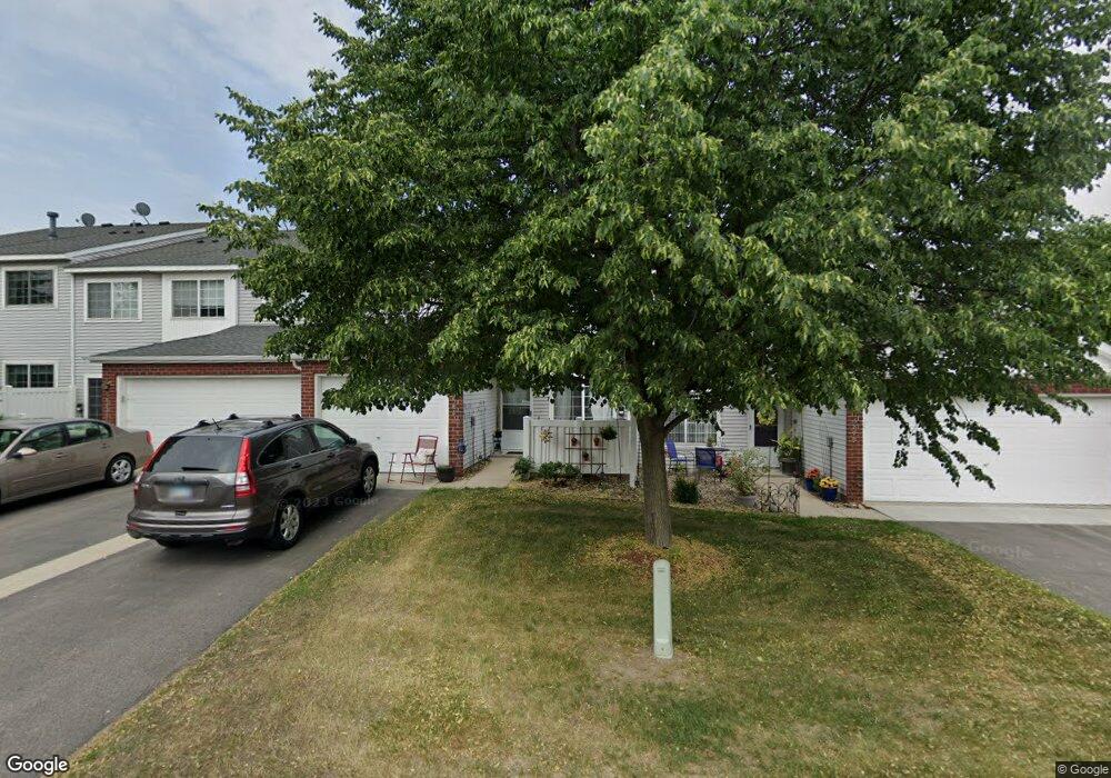
15883 Firtree Dr Saint Paul, MN 55124
Galaxie Commons NeighborhoodEstimated Value: $225,947 - $240,000
2
Beds
2
Baths
1,086
Sq Ft
$215/Sq Ft
Est. Value
About This Home
This home is located at 15883 Firtree Dr, Saint Paul, MN 55124 and is currently estimated at $233,487, approximately $214 per square foot. 15883 Firtree Dr is a home located in Dakota County with nearby schools including Highland Elementary School, Scott Highlands Middle School, and Rosemount Senior High School.
Ownership History
Date
Name
Owned For
Owner Type
Purchase Details
Closed on
Jun 21, 2006
Sold by
Cresap Jennifer Marie
Bought by
Not Provided
Current Estimated Value
Purchase Details
Closed on
Jan 25, 2002
Sold by
Toso Brian and Toso Tamara
Bought by
Cresap Jennifer M
Purchase Details
Closed on
Jan 29, 1999
Sold by
Pulte Homes Of Minnesota Corp
Bought by
Merrifield Tamra K
Create a Home Valuation Report for This Property
The Home Valuation Report is an in-depth analysis detailing your home's value as well as a comparison with similar homes in the area
Home Values in the Area
Average Home Value in this Area
Purchase History
| Date | Buyer | Sale Price | Title Company |
|---|---|---|---|
| Not Provided | $159,000 | -- | |
| Cresap Jennifer M | $129,000 | -- | |
| Merrifield Tamra K | $92,890 | -- |
Source: Public Records
Tax History Compared to Growth
Tax History
| Year | Tax Paid | Tax Assessment Tax Assessment Total Assessment is a certain percentage of the fair market value that is determined by local assessors to be the total taxable value of land and additions on the property. | Land | Improvement |
|---|---|---|---|---|
| 2024 | $2,046 | $206,200 | $48,000 | $158,200 |
| 2023 | $2,046 | $194,500 | $47,000 | $147,500 |
| 2022 | $1,788 | $195,200 | $46,800 | $148,400 |
| 2021 | $1,672 | $169,300 | $40,700 | $128,600 |
| 2020 | $1,588 | $156,900 | $38,800 | $118,100 |
| 2019 | $1,428 | $146,300 | $36,900 | $109,400 |
| 2018 | $1,341 | $140,100 | $35,000 | $105,100 |
| 2017 | $1,328 | $128,600 | $32,400 | $96,200 |
| 2016 | $1,317 | $122,400 | $30,800 | $91,600 |
| 2015 | $1,160 | $94,214 | $23,593 | $70,621 |
| 2014 | -- | $82,987 | $20,991 | $61,996 |
| 2013 | -- | $69,689 | $17,831 | $51,858 |
Source: Public Records
Map
Nearby Homes
- 15682 Fjord Ave
- 6414 158th St W Unit 201
- 6068 158th Ct W
- 15792 Flan Ct
- 16123 Flagstaff Ct N
- 15602 Fairbrook Ct
- 6456 157th St W
- 15645 Flight Ln
- 5875 156th Way
- 6744 Foliage Ct W
- 16294 Florida Way W
- 6634 162nd Ct Unit 421
- 15352 Floret Way Unit 91
- 15521 Foghorn Ln
- 6760 158th St W
- 6852 161st St W
- 6656 Gerdine Path W
- 6869 Folkestone Rd Unit 614
- 15823 Freedom Ln
- 15705 Fremont Way
- 15879 Firtree Dr Unit 73
- 15887 Firtree Dr Unit 75
- 15884 Fjord Ave Unit 79
- 15880 Fjord Ave Unit 80
- 15888 Fjord Ave
- 15888 Fjord Ave Unit 78
- 15891 Firtree Dr Unit 76
- 15892 Fjord Ave Unit 77
- 15902 Firtree Dr Unit 40
- 15913 Firtree Dr
- 15913 Firtree Dr Unit 25
- 15903 Finch Ln
- 15912 Fjord Ave Unit 32
- 15871 Firtree Ln
- 6300 158th St W
- 15919 Firtree Dr Unit 26
- 15918 Fjord Ave
- 15873 Firtree Ln
- 15873 Firtree Ln Unit 71
- 6292 158th St W Unit 66