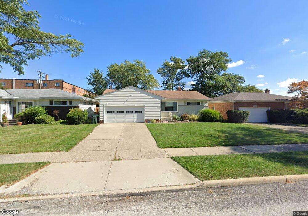
1597 Mallard Dr Cleveland, OH 44124
Estimated Value: $233,000 - $255,890
3
Beds
2
Baths
1,233
Sq Ft
$202/Sq Ft
Est. Value
About This Home
This home is located at 1597 Mallard Dr, Cleveland, OH 44124 and is currently estimated at $248,723, approximately $201 per square foot. 1597 Mallard Dr is a home located in Cuyahoga County with nearby schools including Mayfield High School, Corpus Christi Academy, and Hawken Lower-Middle School.
Ownership History
Date
Name
Owned For
Owner Type
Purchase Details
Closed on
Apr 9, 2009
Sold by
Calabrese Nicole Musarra and Calabrese Antonio
Bought by
Freeman Laura L
Current Estimated Value
Home Financials for this Owner
Home Financials are based on the most recent Mortgage that was taken out on this home.
Original Mortgage
$85,600
Outstanding Balance
$54,605
Interest Rate
5.11%
Mortgage Type
Purchase Money Mortgage
Estimated Equity
$194,118
Purchase Details
Closed on
Aug 23, 2006
Sold by
Calabrese Antonio
Bought by
Calabrese Nicole Musarra
Purchase Details
Closed on
Dec 8, 1997
Sold by
Reisman Anne
Bought by
Calabrese Antonio
Home Financials for this Owner
Home Financials are based on the most recent Mortgage that was taken out on this home.
Original Mortgage
$84,700
Interest Rate
7.46%
Mortgage Type
New Conventional
Purchase Details
Closed on
Jan 1, 1975
Bought by
Reisman Anne
Create a Home Valuation Report for This Property
The Home Valuation Report is an in-depth analysis detailing your home's value as well as a comparison with similar homes in the area
Home Values in the Area
Average Home Value in this Area
Purchase History
| Date | Buyer | Sale Price | Title Company |
|---|---|---|---|
| Freeman Laura L | $107,000 | Enterprise Title Agency | |
| Calabrese Nicole Musarra | -- | None Available | |
| Calabrese Antonio | $94,150 | -- | |
| Reisman Anne | -- | -- |
Source: Public Records
Mortgage History
| Date | Status | Borrower | Loan Amount |
|---|---|---|---|
| Open | Freeman Laura L | $85,600 | |
| Previous Owner | Calabrese Antonio | $84,700 |
Source: Public Records
Tax History Compared to Growth
Tax History
| Year | Tax Paid | Tax Assessment Tax Assessment Total Assessment is a certain percentage of the fair market value that is determined by local assessors to be the total taxable value of land and additions on the property. | Land | Improvement |
|---|---|---|---|---|
| 2024 | $5,521 | $84,595 | $14,420 | $70,175 |
| 2023 | $4,142 | $58,250 | $13,060 | $45,190 |
| 2022 | $4,266 | $58,240 | $13,060 | $45,190 |
| 2021 | $4,222 | $58,240 | $13,060 | $45,190 |
| 2020 | $3,939 | $49,770 | $11,170 | $38,610 |
| 2019 | $3,817 | $142,200 | $31,900 | $110,300 |
| 2018 | $3,540 | $49,770 | $11,170 | $38,610 |
| 2017 | $3,605 | $44,140 | $9,240 | $34,900 |
| 2016 | $3,578 | $44,140 | $9,240 | $34,900 |
| 2015 | $3,245 | $44,140 | $9,240 | $34,900 |
| 2014 | $3,245 | $43,270 | $9,070 | $34,200 |
Source: Public Records
Map
Nearby Homes
- 5931 Mayberry Ave
- 1574 Hawthorne Dr
- 1590 Longwood Dr
- 1575 Lander Rd
- 1430 Belrose Rd
- 1722 Hawthorne Dr
- 1363 Ranchland Dr
- 1737 Mayfair Blvd
- 1572 Crestwood Rd
- 1763 Temple Ave
- 5688 Shawnee Dr
- 1379 Lander Rd
- 1391 Iroquois Ave
- 1337 Elmwood Rd
- 1328 Elmwood Rd
- 5960 Cantwell Dr
- 1775 Brainard Rd
- 1839 Caronia Dr
- 6132 Westerham Rd
- 5831 Alberta Dr
- 1593 Mallard Dr
- 1601 Mallard Dr
- 1575 Mallard Dr
- 5911 Mayberry Ave
- 5915 Mayberry Ave
- 1609 Mallard Dr
- 1600 Mallard Dr
- 1596 Mallard Dr
- 1604 Mallard Dr
- 1592 Mallard Dr
- 1585 Mallard Dr
- 5919 Mayberry Ave
- 1608 Mallard Dr
- 1613 Mallard Dr
- 1588 Mallard Dr
- 5914 Mayberry Ave
- 1612 Mallard Dr
- 5923 Mayberry Ave
- 5918 Mayberry Ave
- 1617 Mallard Dr