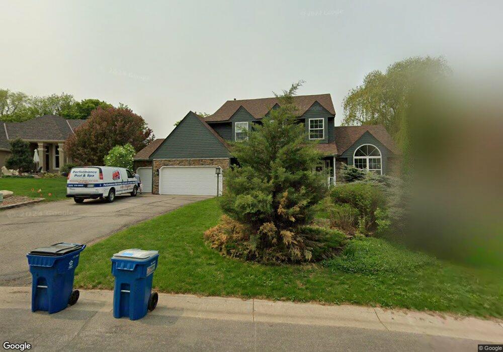
1597 Wexford Cir Saint Paul, MN 55122
Estimated Value: $647,596 - $725,000
4
Beds
4
Baths
2,683
Sq Ft
$254/Sq Ft
Est. Value
About This Home
This home is located at 1597 Wexford Cir, Saint Paul, MN 55122 and is currently estimated at $681,149, approximately $253 per square foot. 1597 Wexford Cir is a home located in Dakota County with nearby schools including Thomas Lake Elementary School, Black Hawk Middle School, and Eastview Senior High School.
Ownership History
Date
Name
Owned For
Owner Type
Purchase Details
Closed on
Aug 22, 2017
Sold by
Hoff Michael H and Hoff Kathrine T
Bought by
Groebner Andrew R and Groebner Rebecca A
Current Estimated Value
Home Financials for this Owner
Home Financials are based on the most recent Mortgage that was taken out on this home.
Original Mortgage
$364,000
Outstanding Balance
$303,730
Interest Rate
3.96%
Mortgage Type
New Conventional
Estimated Equity
$377,419
Purchase Details
Closed on
Aug 8, 2002
Sold by
Carlin Thomas J and Carlin Deborah G
Bought by
Hoff Michael H and Hoff Katherine T
Create a Home Valuation Report for This Property
The Home Valuation Report is an in-depth analysis detailing your home's value as well as a comparison with similar homes in the area
Home Values in the Area
Average Home Value in this Area
Purchase History
| Date | Buyer | Sale Price | Title Company |
|---|---|---|---|
| Groebner Andrew R | $455,000 | On-Site Title Llc | |
| Hoff Michael H | $354,900 | -- |
Source: Public Records
Mortgage History
| Date | Status | Borrower | Loan Amount |
|---|---|---|---|
| Open | Groebner Andrew R | $364,000 |
Source: Public Records
Tax History Compared to Growth
Tax History
| Year | Tax Paid | Tax Assessment Tax Assessment Total Assessment is a certain percentage of the fair market value that is determined by local assessors to be the total taxable value of land and additions on the property. | Land | Improvement |
|---|---|---|---|---|
| 2024 | $5,904 | $612,900 | $130,500 | $482,400 |
| 2023 | $5,904 | $536,900 | $130,900 | $406,000 |
| 2022 | $4,594 | $467,900 | $133,900 | $334,000 |
| 2021 | $4,700 | $408,900 | $113,000 | $295,900 |
| 2020 | $4,480 | $408,200 | $107,600 | $300,600 |
| 2019 | $4,240 | $380,400 | $102,500 | $277,900 |
| 2018 | $3,898 | $379,400 | $97,700 | $281,700 |
| 2017 | $4,026 | $340,300 | $93,000 | $247,300 |
| 2016 | $4,175 | $335,400 | $88,600 | $246,800 |
| 2015 | $4,187 | $337,720 | $86,983 | $250,737 |
| 2014 | -- | $344,587 | $84,794 | $259,793 |
| 2013 | -- | $300,987 | $75,853 | $225,134 |
Source: Public Records
Map
Nearby Homes
- 1612 Summit Hill
- 1610 Clemson Dr
- 4249 Boulder Ridge Point
- 4168 Arbor Ln
- 1680 Oakbrooke Ct
- 4163 Starbridge Ct
- 4199 Knob Cir Unit 102
- 4184 Knob Cir
- 4150 Knob Cir
- 4100 Meadowlark Ln
- 1676 Hickory Ln
- 4290 Blackhawk Rd
- 4411 Clover Ln Unit A
- 4418 Clover Ln Unit B
- 4401 Clover Ln Unit B
- 4049 Deerwood Trail
- 1778 Walnut Ln
- 1655 Walnut Ln
- 1536 Stonewood Ln
- 1630 Murphy Pkwy
- 1593 Wexford Cir
- 1601 Wexford Cir
- 1607 Summit Hill
- 1609 Summit Hill
- 1650 Marina Ln
- 1605 Wexford Cir
- 1611 Summit Hill
- 1611 Summit Ave
- 1654 Marina Ln
- 1589 Wexford Cir
- 1646 Marina Ln
- 1600 Wexford Cir
- 1614 Summit Hill
- 1613 Summit Hill
- 4270 Wexford Way
- 1585 Wexford Cir
- 1658 Marina Ln
- 1642 Marina Ln
- 1608 Summit Hill
- 1610 Summit Hill