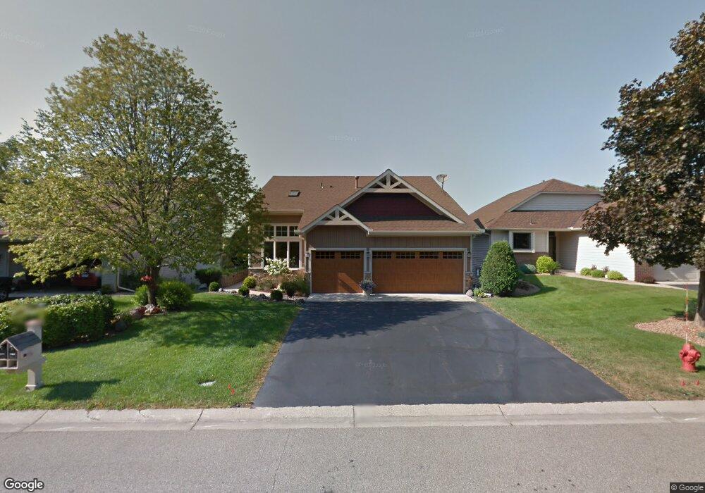
15982 Hyland Pointe Ct Saint Paul, MN 55124
Old Town NeighborhoodEstimated Value: $678,467 - $719,000
4
Beds
4
Baths
2,334
Sq Ft
$298/Sq Ft
Est. Value
About This Home
This home is located at 15982 Hyland Pointe Ct, Saint Paul, MN 55124 and is currently estimated at $695,367, approximately $297 per square foot. 15982 Hyland Pointe Ct is a home located in Dakota County with nearby schools including Southview Elementary School, Valley Middle School, and Apple Valley Senior High School.
Ownership History
Date
Name
Owned For
Owner Type
Purchase Details
Closed on
Jul 31, 2015
Sold by
Hamilton Andrew S and Hamilton Christine M
Bought by
Connors Jeffrey J and Connors Heidi M
Current Estimated Value
Home Financials for this Owner
Home Financials are based on the most recent Mortgage that was taken out on this home.
Original Mortgage
$369,325
Outstanding Balance
$290,373
Interest Rate
4.02%
Mortgage Type
New Conventional
Estimated Equity
$404,994
Purchase Details
Closed on
Feb 24, 2009
Sold by
Dorr Trevor M and Dorr Robin M
Bought by
Hamilton Andrew S and Hamilton Christine M
Purchase Details
Closed on
Oct 24, 2003
Sold by
Dorr Trevor M and Dorr Robin M
Bought by
Essevein Carol K
Create a Home Valuation Report for This Property
The Home Valuation Report is an in-depth analysis detailing your home's value as well as a comparison with similar homes in the area
Home Values in the Area
Average Home Value in this Area
Purchase History
| Date | Buyer | Sale Price | Title Company |
|---|---|---|---|
| Connors Jeffrey J | $4,345,106 | Burnet Title | |
| Hamilton Andrew S | $380,000 | -- | |
| Essevein Carol K | $410,000 | -- |
Source: Public Records
Mortgage History
| Date | Status | Borrower | Loan Amount |
|---|---|---|---|
| Open | Connors Jeffrey J | $369,325 |
Source: Public Records
Tax History Compared to Growth
Tax History
| Year | Tax Paid | Tax Assessment Tax Assessment Total Assessment is a certain percentage of the fair market value that is determined by local assessors to be the total taxable value of land and additions on the property. | Land | Improvement |
|---|---|---|---|---|
| 2024 | $6,914 | $627,100 | $231,000 | $396,100 |
| 2023 | $6,914 | $593,800 | $231,500 | $362,300 |
| 2022 | $5,658 | $593,100 | $230,800 | $362,300 |
| 2021 | $5,516 | $487,300 | $200,700 | $286,600 |
| 2020 | $5,702 | $464,700 | $191,100 | $273,600 |
| 2019 | $5,228 | $465,800 | $182,000 | $283,800 |
| 2018 | $5,041 | $445,700 | $173,300 | $272,400 |
| 2017 | $5,178 | $410,700 | $165,100 | $245,600 |
| 2016 | $4,770 | $400,400 | $157,200 | $243,200 |
| 2015 | $4,615 | $362,572 | $152,324 | $210,248 |
| 2014 | -- | $353,198 | $146,426 | $206,772 |
| 2013 | -- | $326,929 | $134,353 | $192,576 |
Source: Public Records
Map
Nearby Homes
- 15964 Hyland Dr
- 15931 Hyland Pointe Ct
- 15813 Garden View Dr
- 16187 Hawthorn Path
- 15979 Harwell Ave
- 16407 Hutchinson Dr
- 16125 Crystal Hills Dr
- 16421 Gunflint Trail
- 892 Redwell Ln
- 15505 Logarto Ln
- 1010 E 157th St
- 8090 159th St W
- 1629 Keller Lake Dr
- 16096 Harmony Path
- 938 Cortland Dr S
- 16824 Interlachen Blvd
- 921 Cortland Dr S
- 889 Whitney Dr
- 1516 Rushmore Dr
- 16371 Harmony Path
- 15984 Hyland Pointe Ct
- 15980 Hyland Pointe Ct
- 15986 Hyland Pointe Ct
- 15978 Hyland Pointe Ct
- 15988 Hyland Pointe Ct
- 15976 Hyland Pointe Ct
- 15969 Hyland Dr
- 15990 Hyland Pointe Ct
- 15977 Hyland Dr
- 15967 Hyland Dr
- 15974 Hyland Pointe Ct
- 15963 Hyland Dr
- 15973 Hyland Dr
- 15992 Hyland Pointe Ct
- 15989 Hyland Dr
- 15955 Hyland Dr
- 15972 Hyland Pointe Ct
- 15985 Hyland Dr
- 15994 Hyland Pointe Ct
- 15951 Hyland Dr