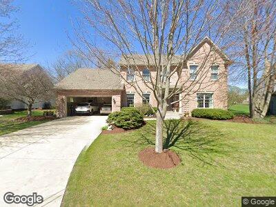
16 Ashwood Ct Unit 13 Sugar Grove, IL 60554
Prestbury NeighborhoodEstimated Value: $483,998 - $557,000
--
Bed
--
Bath
3,004
Sq Ft
$172/Sq Ft
Est. Value
About This Home
This home is located at 16 Ashwood Ct Unit 13, Sugar Grove, IL 60554 and is currently estimated at $515,750, approximately $171 per square foot. 16 Ashwood Ct Unit 13 is a home located in Kane County with nearby schools including Fearn Elementary School, Herget Middle School, and West Aurora High School.
Ownership History
Date
Name
Owned For
Owner Type
Purchase Details
Closed on
Dec 4, 2008
Sold by
Power Denise A
Bought by
Power James R and Power Denise A
Current Estimated Value
Home Financials for this Owner
Home Financials are based on the most recent Mortgage that was taken out on this home.
Original Mortgage
$165,000
Interest Rate
5.19%
Mortgage Type
Stand Alone Refi Refinance Of Original Loan
Purchase Details
Closed on
May 1, 2003
Sold by
Power Denise A
Bought by
Power Denise Ann and Power James Robert
Home Financials for this Owner
Home Financials are based on the most recent Mortgage that was taken out on this home.
Original Mortgage
$136,750
Interest Rate
4.25%
Mortgage Type
Credit Line Revolving
Purchase Details
Closed on
Mar 21, 2000
Sold by
Power James R and Power Denise A
Bought by
Power Denise A and Denise A Power Living Trust
Purchase Details
Closed on
Jul 17, 1995
Sold by
Thill Sweeney & Williams Partnership
Bought by
Power James R and Power Denise A
Home Financials for this Owner
Home Financials are based on the most recent Mortgage that was taken out on this home.
Original Mortgage
$203,000
Interest Rate
7.5%
Purchase Details
Closed on
May 13, 1994
Sold by
Merchants National Bank Of Aurora
Bought by
Thill Sweeney & Williams Partnership
Create a Home Valuation Report for This Property
The Home Valuation Report is an in-depth analysis detailing your home's value as well as a comparison with similar homes in the area
Home Values in the Area
Average Home Value in this Area
Purchase History
| Date | Buyer | Sale Price | Title Company |
|---|---|---|---|
| Power James R | -- | Nations Title Agency | |
| Power Denise Ann | -- | First American Title | |
| Power Denise A | -- | -- | |
| Power Denise A | -- | -- | |
| Power Denise A | -- | -- | |
| Power James R | $275,500 | First American Title Ins Co | |
| Thill Sweeney & Williams Partnership | $35,000 | First American Title Ins Co |
Source: Public Records
Mortgage History
| Date | Status | Borrower | Loan Amount |
|---|---|---|---|
| Open | Power James R | $181,000 | |
| Closed | Power James R | $184,000 | |
| Closed | Power James R | $197,000 | |
| Closed | Power James R | $200,000 | |
| Closed | Power James R | $205,000 | |
| Closed | Power James R | $165,000 | |
| Closed | Power Denise A | $178,000 | |
| Closed | Power James R | $136,750 | |
| Closed | Power Denise Ann | $182,000 | |
| Closed | Power James R | $203,000 |
Source: Public Records
Tax History Compared to Growth
Tax History
| Year | Tax Paid | Tax Assessment Tax Assessment Total Assessment is a certain percentage of the fair market value that is determined by local assessors to be the total taxable value of land and additions on the property. | Land | Improvement |
|---|---|---|---|---|
| 2023 | $8,575 | $134,235 | $32,593 | $101,642 |
| 2022 | $8,409 | $123,925 | $30,090 | $93,835 |
| 2021 | $8,163 | $117,601 | $28,635 | $88,966 |
| 2020 | $8,503 | $115,092 | $28,024 | $87,068 |
| 2019 | $8,557 | $111,329 | $27,108 | $84,221 |
| 2018 | $8,638 | $109,025 | $25,058 | $83,967 |
| 2017 | $8,446 | $104,121 | $23,931 | $80,190 |
| 2016 | $8,315 | $99,532 | $22,876 | $76,656 |
| 2015 | -- | $92,605 | $21,284 | $71,321 |
| 2014 | -- | $88,550 | $20,352 | $68,198 |
| 2013 | -- | $89,481 | $20,566 | $68,915 |
Source: Public Records
Map
Nearby Homes
- 35 Walnut Cir
- 144 N Buckingham Dr
- 11 Fernilee Ct
- 1165 Mcdole Dr Unit 1
- 792 Black Walnut Dr
- 1250 Hall St Unit 1
- 66 Winthrop New Rd
- 896 Black Walnut Dr
- 684 Greenfield Rd
- 868 Edgewood Dr
- 947 Lakeridge Ct
- 933 Lakeridge Ct
- 706 Brighton Dr
- 954 Black Walnut Dr
- 731 Queens Gate Cir Unit 1
- 985 Pinecrest Dr
- 750 Tudor Ct
- 12 Briargate Cir
- 1340 Slater St
- 6.63 Acres Denny Rd
- 16 Ashwood Ct Unit 13
- 15 Ashwood Ct
- 20 Walnut Cir
- 22 Walnut Cir
- 18 Walnut Cir
- 14 Ashwood Ct
- 18 Ashwood Ct Unit 13
- 13 Ashwood Ct
- 11 Ashwood Ct Unit 1
- 24 Walnut Cir
- 12 Ashwood Ct
- 19 Walnut Cir Unit 13
- 21 Walnut Cir
- 10 Ashwood Ct
- 28 Walnut Cir
- 1 Ashwood Ct Unit 13
- 2 Ashwood Ct Unit 13
- 17 Walnut Cir
- 3 Ashwood Ct
- 2 Yorkshire Ct