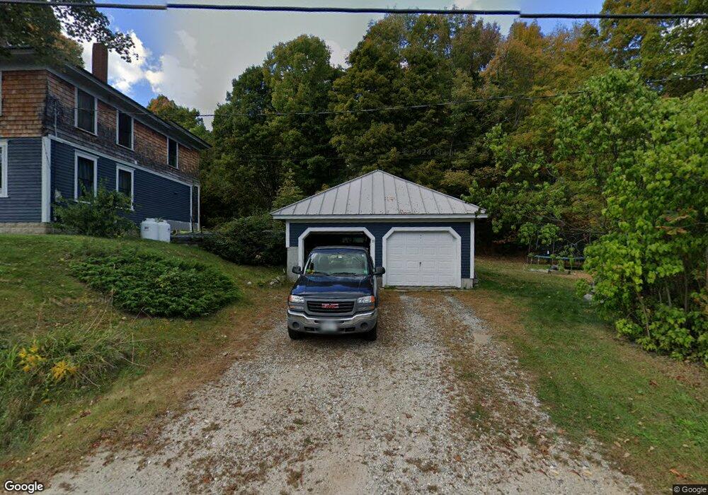
16 Cobbs Bridge Rd New Gloucester, ME 04260
Estimated Value: $380,000 - $474,000
4
Beds
2
Baths
1,926
Sq Ft
$223/Sq Ft
Est. Value
About This Home
This home is located at 16 Cobbs Bridge Rd, New Gloucester, ME 04260 and is currently estimated at $429,895, approximately $223 per square foot. 16 Cobbs Bridge Rd is a home located in Cumberland County with nearby schools including Gray-New Gloucester High School.
Ownership History
Date
Name
Owned For
Owner Type
Purchase Details
Closed on
Nov 28, 2017
Sold by
Rheault Christopher S
Bought by
Provencal Anthony R
Current Estimated Value
Home Financials for this Owner
Home Financials are based on the most recent Mortgage that was taken out on this home.
Original Mortgage
$201,479
Interest Rate
4.75%
Mortgage Type
FHA
Create a Home Valuation Report for This Property
The Home Valuation Report is an in-depth analysis detailing your home's value as well as a comparison with similar homes in the area
Home Values in the Area
Average Home Value in this Area
Purchase History
| Date | Buyer | Sale Price | Title Company |
|---|---|---|---|
| Provencal Anthony R | -- | -- |
Source: Public Records
Mortgage History
| Date | Status | Borrower | Loan Amount |
|---|---|---|---|
| Closed | Provencal Anthony R | $201,479 |
Source: Public Records
Tax History Compared to Growth
Tax History
| Year | Tax Paid | Tax Assessment Tax Assessment Total Assessment is a certain percentage of the fair market value that is determined by local assessors to be the total taxable value of land and additions on the property. | Land | Improvement |
|---|---|---|---|---|
| 2025 | $3,515 | $227,184 | $77,976 | $149,208 |
| 2024 | $3,383 | $227,184 | $77,976 | $149,208 |
| 2023 | $3,246 | $227,184 | $77,976 | $149,208 |
| 2022 | $3,135 | $227,184 | $77,976 | $149,208 |
| 2021 | $3,116 | $225,783 | $77,976 | $147,807 |
| 2020 | $3,082 | $225,783 | $77,976 | $147,807 |
| 2019 | $2,157 | $218,900 | $52,500 | $166,400 |
| 2018 | $3,394 | $214,800 | $52,500 | $162,300 |
| 2017 | $2,864 | $183,600 | $52,500 | $131,100 |
| 2016 | $2,699 | $183,600 | $52,500 | $131,100 |
| 2015 | $2,690 | $183,600 | $52,500 | $131,100 |
| 2014 | $2,662 | $183,600 | $52,500 | $131,100 |
| 2013 | $2,469 | $183,600 | $52,500 | $131,100 |
Source: Public Records
Map
Nearby Homes
- 10 Cobbs Bridge Rd
- 160 Gloucester Hill Rd
- 155 & 151 Gloucester Hill Rd
- 0018-C Gloucester Hill Rd
- 164 Intervale Rd
- 200 Woodman Rd
- 22 Shaw Rd
- 271 Bennett Rd
- 12 Country Charm Ln
- 29 Rockwood Dr
- 24 Swamp Rd
- TBD Targett Rd
- 10-56 C&E Bowdoin Way
- 65 Blueberry Ln
- 14 Golden Way
- 423 Sabbathday Rd
- 0 Mayall
- 161 Beaver Dam Dr
- 343 Shaker Rd
- 284 Allen Rd
- 14 Cobbs Bridge Rd
- 22 Cobbs Bridge Rd
- 17 Cobbs Bridge Rd
- 21 Cobbs Bridge Rd
- 388 Intervale Rd
- 384 Intervale Rd
- 9 Cobbs Bridge Rd
- 5 Cobbs Bridge Rd
- 5 Cobb's Bridge Rd
- 31 Cobbs Bridge Rd
- 376 Intervale Rd
- 8 Grange Hall Rd
- 0 Cobb's Bridge
- 0 Cobbs Bridge
- 30 Cobbs Bridge Rd
- 30 Cobbs Bridge Rd
- 400 Intervale Rd
- 391 Intervale Rd
- 372 Intervale Rd
- 12 Grange Hall Rd