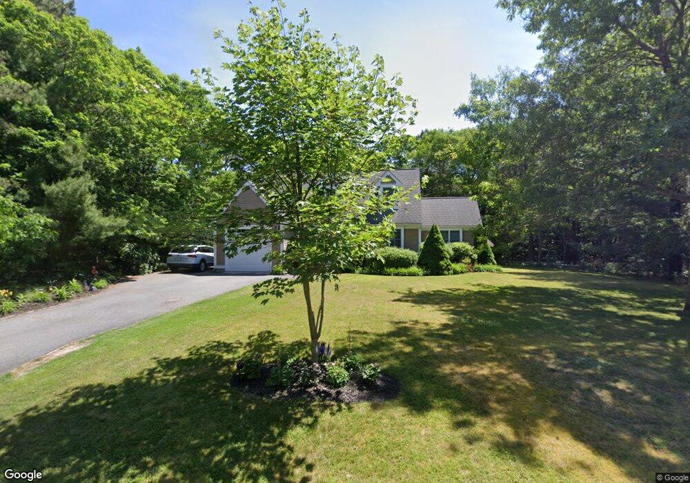
16 Cranberry Ridge Rd Mashpee, MA 02649
Estimated Value: $873,000 - $943,000
About This Home
This home is located at 16 Cranberry Ridge Rd, Mashpee, MA 02649 and is currently estimated at $892,774, approximately $495 per square foot. 16 Cranberry Ridge Rd is a home located in Barnstable County with nearby schools including Kenneth C. Coombs School, Quashnet School, and Mashpee Middle School.
Ownership History
We collect this data history from publicly available records. To have your information removed, we recommend requesting removal directly through your county’s website.
Purchase Details
Home Financials for this Owner
Home Financials are based on the most recent Mortgage that was taken out on this home.Purchase Details
Purchase Details
Home Financials for this Owner
Home Financials are based on the most recent Mortgage that was taken out on this home.Purchase Details
Home Financials for this Owner
Home Financials are based on the most recent Mortgage that was taken out on this home.Purchase Details
Purchase History
We collect this data history from publicly available records. To have your information removed, we recommend requesting removal directly through your county’s website.
| Date | Buyer | Sale Price | Title Company |
|---|---|---|---|
| $470,500 | -- | ||
| $470,500 | -- | ||
| $337,500 | -- | ||
| $337,500 | -- | ||
| $250,000 | -- | ||
| $250,000 | -- | ||
| $49,000 | -- | ||
| $49,000 | -- | ||
| $45,500 | -- | ||
| $45,500 | -- |
Mortgage History
We collect this data history from publicly available records. To have your information removed, we recommend requesting removal directly through your county’s website.
| Date | Status | Borrower | Loan Amount |
|---|---|---|---|
| Open | $265,000 | ||
| Closed | $265,000 | ||
| Previous Owner | $225,000 | ||
| Previous Owner | $160,000 |
Tax History
We collect this data history from publicly available records. To have your information removed, we recommend requesting removal directly through your county’s website.
| Year | Tax Paid | Tax Assessment Tax Assessment Total Assessment is a certain percentage of the fair market value that is determined by local assessors to be the total taxable value of land and additions on the property. | Land | Improvement |
|---|---|---|---|---|
| 2025 | $4,958 | $749,000 | $242,700 | $506,300 |
| 2024 | $4,640 | $721,600 | $239,100 | $482,500 |
| 2023 | $4,372 | $623,700 | $227,700 | $396,000 |
| 2022 | $4,192 | $513,100 | $185,100 | $328,000 |
| 2021 | $4,114 | $453,600 | $166,700 | $286,900 |
| 2020 | $4,001 | $440,100 | $160,400 | $279,700 |
| 2019 | $3,828 | $423,000 | $160,400 | $262,600 |
| 2018 | $2,049 | $407,300 | $160,400 | $246,900 |
| 2017 | $1,814 | $384,100 | $160,400 | $223,700 |
| 2016 | $3,427 | $370,900 | $160,400 | $210,500 |
| 2015 | $3,297 | $361,900 | $160,400 | $201,500 |
| 2014 | $3,348 | $356,600 | $155,700 | $200,900 |
Map
- 70 Simons Rd Unit E
- 70 Simons Rd
- 70 Cape Dr Unit 8B
- 70 Cape Dr Unit 8B
- 30 Pleasant Park Dr
- 114 Orchard Rd
- 107 Abbey Gate Rd
- 7 Oxford Dr
- 75 Trout Brook Rd
- 140 Pheasant Hill Cir
- 140 Pheasant Hill Cir
- 15 Hampton Ct Unit 15
- 11 Riverview Ave Unit A
- 11 Riverview Ave Unit 11A
- 4 Bishops Park
- 239 Oxford Dr
- 29 Carleton Dr
- 10 Village Green Cir Unit 10
- 10 Village Green Cir
- 11 Stratford Ridge Unit 11
- 28 Cranberry Ridge Rd
- 4 Cranberry Ridge Rd
- 15 Cranberry Ridge Rd
- 11 Cranberry Ridge Rd
- 117 Sampsons Mill Rd
- 21 Cranberry Ridge Rd
- 21 Cranberry Ridge Rd Unit .
- 5 Cranberry Ridge Rd
- 36 Cranberry Ridge Rd
- 27 Cranberry Ridge Rd
- 0 Cranberry Ridge Rd
- 123 Sampsons Mill Rd
- 33 Cranberry Ridge Rd
- 97 Sampsons Mill Rd
- 112 Sampsons Mill Rd
- 39 Cranberry Ridge Rd
- 118 Sampsons Mill Rd
- 104 Sampsons Mill Rd
- 42 Simons Rd
- 127 Sampsons Mill Rd
Ask me questions while you tour the home.