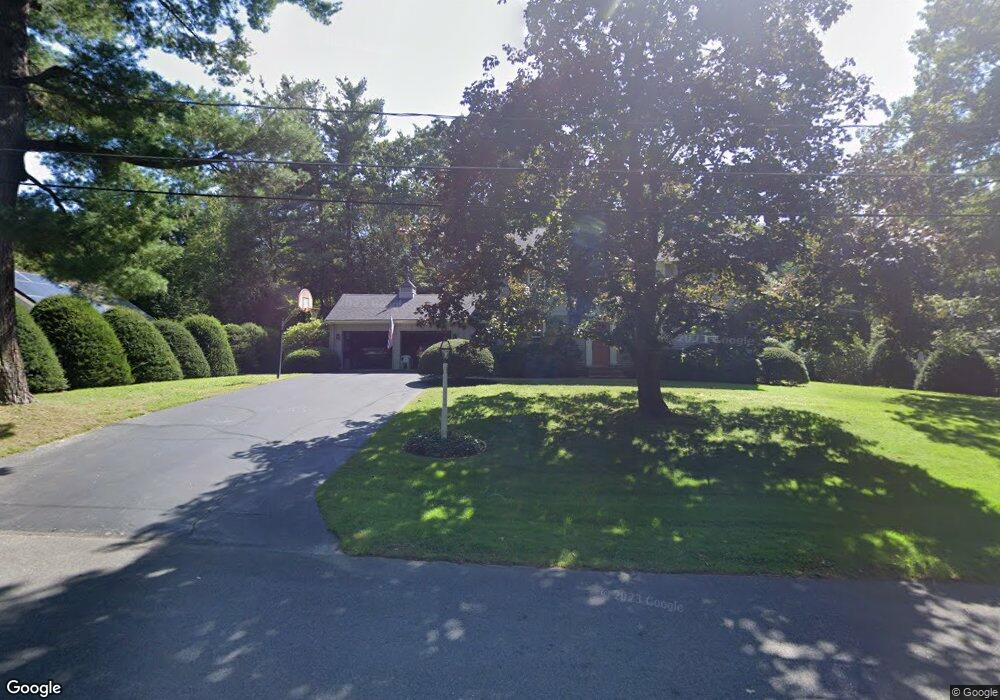
16 Hemlock Rd Andover, MA 01810
West Andover NeighborhoodEstimated Value: $1,001,932 - $1,660,000
4
Beds
3
Baths
2,692
Sq Ft
$473/Sq Ft
Est. Value
About This Home
This home is located at 16 Hemlock Rd, Andover, MA 01810 and is currently estimated at $1,273,483, approximately $473 per square foot. 16 Hemlock Rd is a home located in Essex County with nearby schools including Henry C. Sanborn Elementary School, Andover West Middle School, and Andover High School.
Ownership History
Date
Name
Owned For
Owner Type
Purchase Details
Closed on
Aug 13, 2021
Sold by
Desmond Gerard and Desmond Ellen A
Bought by
Desmond Nt and Desmond
Current Estimated Value
Purchase Details
Closed on
Jul 17, 1987
Sold by
Munroe Richard
Bought by
Desmond Gerard
Create a Home Valuation Report for This Property
The Home Valuation Report is an in-depth analysis detailing your home's value as well as a comparison with similar homes in the area
Home Values in the Area
Average Home Value in this Area
Purchase History
We collect this data history from publicly available records. To have your information removed, we recommend requesting removal directly through your county’s website.
| Date | Buyer | Sale Price | Title Company |
|---|---|---|---|
| Desmond Nt | -- | None Available | |
| Desmond Nt | -- | None Available | |
| Desmond Gerard | $323,000 | -- |
Source: Public Records
Mortgage History
We collect this data history from publicly available records. To have your information removed, we recommend requesting removal directly through your county’s website.
| Date | Status | Borrower | Loan Amount |
|---|---|---|---|
| Previous Owner | Desmond Gerard | $138,500 | |
| Previous Owner | Desmond Gerard | $40,000 | |
| Previous Owner | Desmond Gerard | $184,000 |
Source: Public Records
Tax History
| Year | Tax Paid | Tax Assessment Tax Assessment Total Assessment is a certain percentage of the fair market value that is determined by local assessors to be the total taxable value of land and additions on the property. | Land | Improvement |
|---|---|---|---|---|
| 2025 | $10,937 | $875,700 | $515,900 | $359,800 |
| 2024 | $10,379 | $805,800 | $463,100 | $342,700 |
| 2023 | $9,921 | $726,300 | $417,100 | $309,200 |
| 2022 | $9,313 | $637,900 | $362,700 | $275,200 |
| 2021 | $8,906 | $582,500 | $329,800 | $252,700 |
| 2020 | $8,544 | $569,200 | $321,900 | $247,300 |
| 2019 | $8,463 | $554,200 | $312,300 | $241,900 |
| 2018 | $8,177 | $522,800 | $300,400 | $222,400 |
| 2017 | $7,818 | $515,000 | $294,500 | $220,500 |
| 2016 | $7,660 | $516,900 | $294,500 | $222,400 |
| 2015 | $7,403 | $494,500 | $283,000 | $211,500 |
Source: Public Records
Map
Nearby Homes
- 102 Argilla Rd
- 4 Fairway Dr
- 24 W Parish Dr
- 1 Delisio Dr
- 25 Crenshaw Ln Unit 15-2
- 15 Geneva Rd
- 13 Leah Way
- 14 Geneva Rd
- 57 Juniper Rd
- 12 Robert Dr Unit 12
- 27 Lincoln St
- 4 Apple Blossom Rd
- 4 Andover Country Club Ln
- 11 Cuba St
- 2 Stouffer Cir
- 25 Clubview Dr Unit 25
- 2 Brechin Terrace
- 14 Samos Ln
- 18 Dale St Unit 9D
- 40 Lincoln Cir E
- 18 Hemlock Rd
- 14 Hemlock Rd
- 20 Hemlock Rd
- 53 Wild Rose Dr
- 55 Wild Rose Dr
- 12 Hemlock Rd
- 9 Sweetbriar Ln
- 17 Hemlock Rd
- 51 Wild Rose Dr
- 22 Hemlock Rd
- 57 Wild Rose Dr
- 19 Hemlock Rd
- 10 Sweetbriar Ln
- 10 Hemlock Rd
- 7 Sweetbriar Ln
- 24 Hemlock Rd
- 49 Wild Rose Dr
- 123 Mixed Use Property
- 9 Hemlock Rd
- 59 Wild Rose Dr
Your Personal Tour Guide
Ask me questions while you tour the home.