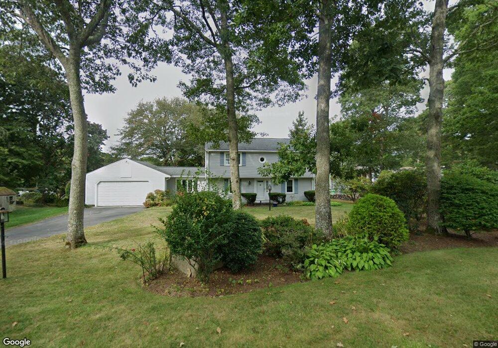
16 Sunset Cir Mashpee, MA 02649
Estimated Value: $766,911 - $1,084,000
4
Beds
2
Baths
1,801
Sq Ft
$500/Sq Ft
Est. Value
About This Home
This home is located at 16 Sunset Cir, Mashpee, MA 02649 and is currently estimated at $900,978, approximately $500 per square foot. 16 Sunset Cir is a home located in Barnstable County with nearby schools including Kenneth C. Coombs School, Quashnet School, and Mashpee Middle School.
Ownership History
Date
Name
Owned For
Owner Type
Purchase Details
Closed on
Jul 13, 2011
Sold by
Madden Frances G and Jameson Susan K
Bought by
Jameson Susan K and Madden Frances G
Current Estimated Value
Purchase Details
Closed on
Nov 5, 1999
Sold by
Shapiro Betty R and Rochelle Jan
Bought by
Madden Frances G and Jameson Susan K
Home Financials for this Owner
Home Financials are based on the most recent Mortgage that was taken out on this home.
Original Mortgage
$95,000
Interest Rate
7.73%
Mortgage Type
Purchase Money Mortgage
Purchase Details
Closed on
Apr 30, 1998
Sold by
Loewinger Nancy E
Bought by
Shapiro Betty R and Rochelle Jan
Home Financials for this Owner
Home Financials are based on the most recent Mortgage that was taken out on this home.
Original Mortgage
$85,000
Interest Rate
7.04%
Mortgage Type
Purchase Money Mortgage
Create a Home Valuation Report for This Property
The Home Valuation Report is an in-depth analysis detailing your home's value as well as a comparison with similar homes in the area
Purchase History
| Date | Buyer | Sale Price | Title Company |
|---|---|---|---|
| Jameson Susan K | -- | -- | |
| Madden Frances G | $241,500 | -- | |
| Shapiro Betty R | $163,500 | -- |
Source: Public Records
Mortgage History
| Date | Status | Borrower | Loan Amount |
|---|---|---|---|
| Previous Owner | Shapiro Betty R | $92,000 | |
| Previous Owner | Shapiro Betty R | $85,000 | |
| Previous Owner | Shapiro Betty R | $95,000 | |
| Previous Owner | Shapiro Betty R | $85,000 |
Source: Public Records
Tax History
| Year | Tax Paid | Tax Assessment Tax Assessment Total Assessment is a certain percentage of the fair market value that is determined by local assessors to be the total taxable value of land and additions on the property. | Land | Improvement |
|---|---|---|---|---|
| 2025 | $5,746 | $868,000 | $499,300 | $368,700 |
| 2024 | $5,336 | $829,800 | $454,000 | $375,800 |
| 2023 | $5,166 | $737,000 | $432,200 | $304,800 |
| 2022 | $5,221 | $639,100 | $386,600 | $252,500 |
| 2021 | $3,458 | $537,700 | $316,600 | $221,100 |
| 2020 | $4,702 | $517,300 | $304,400 | $212,900 |
| 2019 | $7,239 | $483,800 | $286,200 | $197,600 |
| 2018 | $2,906 | $472,200 | $286,200 | $186,000 |
| 2017 | $2,835 | $453,000 | $286,200 | $166,800 |
| 2016 | $4,077 | $441,200 | $286,200 | $155,000 |
| 2015 | $3,961 | $434,800 | $286,200 | $148,600 |
| 2014 | $3,890 | $414,300 | $280,600 | $133,700 |
Source: Public Records
Map
Nearby Homes
- 83 Pond Cir
- 211 James Cir
- 168 Ninigret Ave
- 163 Ninigret Ave
- 409 Currier Rd
- 54 Sassacus Rd
- 160 Algonquin Ave
- 44 Twin Oaks Dr Unit 44
- 44 Twin Oaks Dr
- 114 Doran Dr
- 15 Pebble Beach Ave Unit 2005-103
- 15 Pebble Beach Ave
- 17 Twin Oaks Dr Unit 17
- 6 Masters Ct
- 26 Highland St
- 4 N Ridge Rd
- 4 N Ridge Rd Unit 431
- 153 Leisure Green Dr
- 153 Leisure Green Dr Unit 749
- 171 Currier Rd
- 93 Sunset Cir
- 2 Sunset Cir
- 13 Sunset Cir
- 17 Sunset Cir
- 89 Sunset Cir
- 89 Sunset Cir Unit SI ID1386128P
- 89 Sunset Cir Unit ID1386128P
- 9 Sunset Cir
- 22 Sunset Cir
- 5 Sunset Cir
- 82 Sunset Cir
- 97 James Cir
- 83 Sunset Cir
- 1 Sunset Cir
- 27 Sunset Cir
- 92 James Cir
- 92 James Cir Unit 92
- 92 James Cir
- 103 James Cir
- 107 James Cir
Your Personal Tour Guide
Ask me questions while you tour the home.