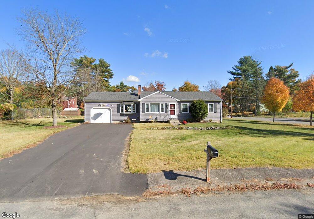
16 Tyson Rd Franklin, MA 02038
Estimated Value: $518,663 - $553,000
3
Beds
1
Bath
1,210
Sq Ft
$448/Sq Ft
Est. Value
About This Home
This home is located at 16 Tyson Rd, Franklin, MA 02038 and is currently estimated at $542,416, approximately $448 per square foot. 16 Tyson Rd is a home located in Norfolk County with nearby schools including Helen Keller Elementary School, Annie Sullivan Middle School, and Franklin High School.
Ownership History
Date
Name
Owned For
Owner Type
Purchase Details
Closed on
May 21, 2020
Sold by
Corrigan Marilyn K
Bought by
Marilyn K Corrigan Ret
Current Estimated Value
Purchase Details
Closed on
Feb 28, 2000
Sold by
Bisson Susette M
Bought by
Corrigan Marilyn K
Home Financials for this Owner
Home Financials are based on the most recent Mortgage that was taken out on this home.
Original Mortgage
$50,000
Interest Rate
8.15%
Mortgage Type
Purchase Money Mortgage
Purchase Details
Closed on
Jun 25, 1992
Sold by
Crivello Maria F
Bought by
Bisson Susette M and Bisson Mark E
Home Financials for this Owner
Home Financials are based on the most recent Mortgage that was taken out on this home.
Original Mortgage
$97,000
Interest Rate
8.57%
Mortgage Type
Purchase Money Mortgage
Create a Home Valuation Report for This Property
The Home Valuation Report is an in-depth analysis detailing your home's value as well as a comparison with similar homes in the area
Purchase History
| Date | Buyer | Sale Price | Title Company |
|---|---|---|---|
| Marilyn K Corrigan Ret | -- | None Available | |
| Corrigan Marilyn K | $185,000 | -- | |
| Bisson Susette M | $137,000 | -- |
Source: Public Records
Mortgage History
| Date | Status | Borrower | Loan Amount |
|---|---|---|---|
| Previous Owner | Bisson Susette M | $50,000 | |
| Previous Owner | Bisson Susette M | $98,200 | |
| Previous Owner | Bisson Susette M | $97,000 |
Source: Public Records
Tax History
| Year | Tax Paid | Tax Assessment Tax Assessment Total Assessment is a certain percentage of the fair market value that is determined by local assessors to be the total taxable value of land and additions on the property. | Land | Improvement |
|---|---|---|---|---|
| 2025 | $5,187 | $446,400 | $236,700 | $209,700 |
| 2024 | $5,013 | $425,200 | $236,700 | $188,500 |
| 2023 | $5,289 | $420,400 | $258,400 | $162,000 |
| 2022 | $4,753 | $338,300 | $197,300 | $141,000 |
| 2021 | $4,590 | $313,300 | $205,400 | $107,900 |
| 2020 | $4,494 | $309,700 | $207,300 | $102,400 |
| 2019 | $4,165 | $284,100 | $181,800 | $102,300 |
| 2018 | $4,054 | $276,700 | $185,400 | $91,300 |
| 2017 | $3,982 | $273,100 | $181,800 | $91,300 |
| 2016 | $3,864 | $266,500 | $188,800 | $77,700 |
| 2015 | $3,685 | $248,300 | $170,600 | $77,700 |
| 2014 | $3,516 | $243,300 | $165,600 | $77,700 |
Source: Public Records
Map
Nearby Homes
- 9 Elliot Mills Unit 5
- 8 Elliot Mills Unit 30
- 5 Elliot Mills Unit 3
- 7 Elliot Mills Unit 4
- 10 Elliot Mills Unit 29
- 14 Waites Crossing
- 75 Jordan Rd
- 3 Oak View Terrace Unit 3
- 19 Waites Crossing
- 13 Waites Crossing
- 30 Longobardi Dr Unit 30
- 50 Reed Fulton Ave Unit Lot 61
- 17 Longhill Rd
- 204 Lincoln St
- 62 Uncas Ave
- 64 Uncas Ave
- 0 Toils End Rd
- 45 Joshua Rd
- 66 Uncas Ave
- 68 Uncas Ave
Your Personal Tour Guide
Ask me questions while you tour the home.