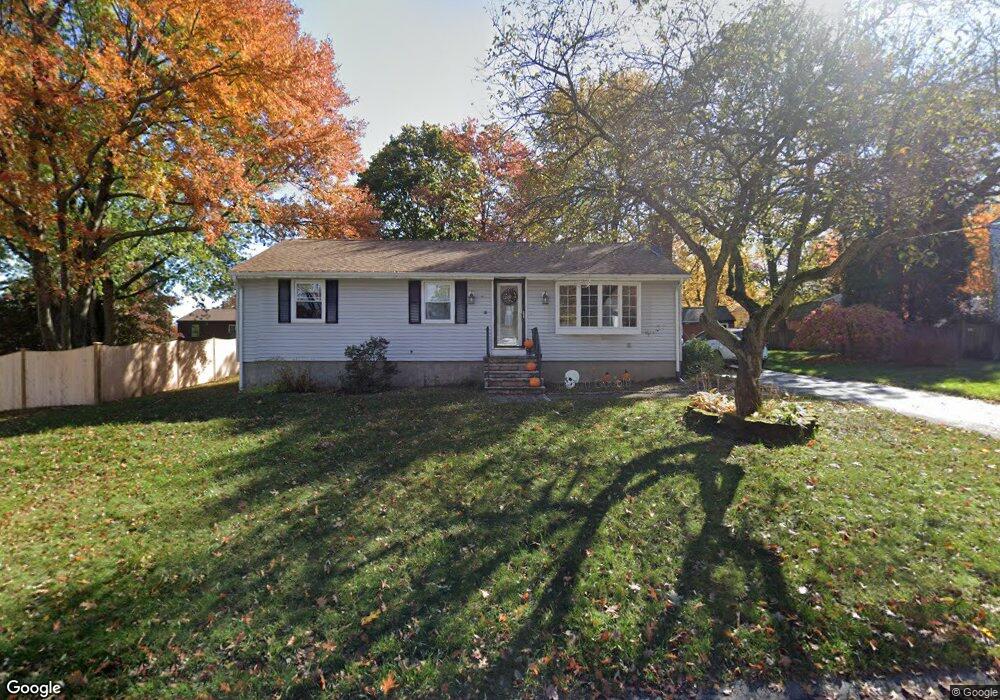
16 Willow Rd Milford, MA 01757
Estimated Value: $446,106 - $554,000
3
Beds
1
Bath
1,040
Sq Ft
$476/Sq Ft
Est. Value
About This Home
This home is located at 16 Willow Rd, Milford, MA 01757 and is currently estimated at $494,527, approximately $475 per square foot. 16 Willow Rd is a home located in Worcester County with nearby schools including Milford High School.
Ownership History
Date
Name
Owned For
Owner Type
Purchase Details
Closed on
Oct 1, 2002
Sold by
Foster Sharon G
Bought by
Long William and Long Maryellen
Current Estimated Value
Home Financials for this Owner
Home Financials are based on the most recent Mortgage that was taken out on this home.
Original Mortgage
$196,000
Outstanding Balance
$77,194
Interest Rate
6.25%
Mortgage Type
Purchase Money Mortgage
Estimated Equity
$417,333
Purchase Details
Closed on
Jun 21, 1996
Sold by
Shane David D and Shane Deborah
Bought by
Foster Sharon G
Purchase Details
Closed on
May 4, 1992
Sold by
Richardson Mary A
Bought by
Shane David D and Shane Deborah
Purchase Details
Closed on
Feb 13, 1992
Sold by
Risio Mark W
Bought by
Fdic
Purchase Details
Closed on
Jan 12, 1989
Sold by
Risio Brenda L
Bought by
Risio Mark W
Create a Home Valuation Report for This Property
The Home Valuation Report is an in-depth analysis detailing your home's value as well as a comparison with similar homes in the area
Home Values in the Area
Average Home Value in this Area
Purchase History
We collect this data history from publicly available records. To have your information removed, we recommend requesting removal directly through your county’s website.
| Date | Buyer | Sale Price | Title Company |
|---|---|---|---|
| Long William | $245,000 | -- | |
| Foster Sharon G | $124,000 | -- | |
| Shane David D | $85,000 | -- | |
| Fdic | $97,300 | -- | |
| Risio Mark W | $75,000 | -- |
Source: Public Records
Mortgage History
We collect this data history from publicly available records. To have your information removed, we recommend requesting removal directly through your county’s website.
| Date | Status | Borrower | Loan Amount |
|---|---|---|---|
| Open | Risio Mark W | $196,000 | |
| Closed | Risio Mark W | $36,750 |
Source: Public Records
Tax History
| Year | Tax Paid | Tax Assessment Tax Assessment Total Assessment is a certain percentage of the fair market value that is determined by local assessors to be the total taxable value of land and additions on the property. | Land | Improvement |
|---|---|---|---|---|
| 2025 | $4,797 | $374,800 | $179,200 | $195,600 |
| 2024 | $4,725 | $355,500 | $172,000 | $183,500 |
| 2023 | $4,559 | $315,500 | $148,700 | $166,800 |
| 2022 | $4,469 | $290,400 | $136,200 | $154,200 |
| 2021 | $4,387 | $274,500 | $136,200 | $138,300 |
| 2020 | $4,099 | $256,800 | $136,200 | $120,600 |
| 2019 | $4,066 | $245,800 | $136,200 | $109,600 |
| 2018 | $3,892 | $235,000 | $132,600 | $102,400 |
| 2017 | $3,791 | $225,800 | $132,600 | $93,200 |
| 2016 | $3,817 | $222,200 | $132,600 | $89,600 |
| 2015 | $3,800 | $216,500 | $125,400 | $91,100 |
Source: Public Records
Map
Nearby Homes
- 17 Robin Rd
- 34 Muriel Ln
- 6 Dennis Rd
- 4 Clearview Dr
- 23 Shadowbrook Ln Unit 18
- 21 Woodridge Rd
- 8 Shadowbrook Ln Unit 41
- 6 Larson Rd
- 15 Shadowbrook Ln Unit 28
- 3 Shadowbrook Ln Unit 3
- 14 Whitewood Rd
- 20 Larson Rd
- 85 Purchase St
- 287 Purchase St
- 2 Esther Dr
- 46 W Fountain St
- 9 Packard Rd
- 18 Field Pond Rd
- 12 Dartmouth Dr
- 309 Purchase St
Your Personal Tour Guide
Ask me questions while you tour the home.