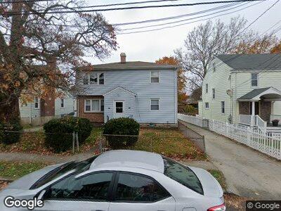
160-162 Broadway Bridge Port, CT 06606
North End NeighborhoodEstimated Value: $306,000 - $865,000
4
Beds
2
Baths
2,545
Sq Ft
$211/Sq Ft
Est. Value
About This Home
This home is located at 160-162 Broadway, Bridge Port, CT 06606 and is currently estimated at $537,050, approximately $211 per square foot. 160-162 Broadway is a home located in Fairfield County with nearby schools including Wilbur L. Cross Elementary School, Central High School, and St Andrew School.
Ownership History
Date
Name
Owned For
Owner Type
Purchase Details
Closed on
Oct 20, 2017
Sold by
Fnma
Bought by
Rua Adam
Current Estimated Value
Purchase Details
Closed on
Oct 21, 2016
Sold by
Cit Bank Na
Bought by
Federal National Mortgage Association
Purchase Details
Closed on
Aug 16, 1982
Bought by
Desalle Vincent
Create a Home Valuation Report for This Property
The Home Valuation Report is an in-depth analysis detailing your home's value as well as a comparison with similar homes in the area
Home Values in the Area
Average Home Value in this Area
Purchase History
| Date | Buyer | Sale Price | Title Company |
|---|---|---|---|
| Rua Adam | $179,900 | -- | |
| Rua Adam | $179,900 | -- | |
| Federal National Mortgage Association | -- | -- | |
| Federal National Mortgage Association | -- | -- | |
| Desalle Vincent | -- | -- |
Source: Public Records
Mortgage History
| Date | Status | Borrower | Loan Amount |
|---|---|---|---|
| Previous Owner | Desalle Vincent | $40,000 |
Source: Public Records
Tax History Compared to Growth
Tax History
| Year | Tax Paid | Tax Assessment Tax Assessment Total Assessment is a certain percentage of the fair market value that is determined by local assessors to be the total taxable value of land and additions on the property. | Land | Improvement |
|---|---|---|---|---|
| 2024 | $9,177 | $211,210 | $70,120 | $141,090 |
| 2023 | $9,177 | $211,210 | $70,120 | $141,090 |
| 2022 | $9,177 | $211,210 | $70,120 | $141,090 |
| 2021 | $9,177 | $211,210 | $70,120 | $141,090 |
| 2020 | $8,172 | $151,360 | $42,490 | $108,870 |
| 2019 | $8,172 | $151,360 | $42,490 | $108,870 |
| 2018 | $8,229 | $151,360 | $42,490 | $108,870 |
| 2017 | $8,229 | $151,360 | $42,490 | $108,870 |
| 2016 | $8,229 | $151,360 | $42,490 | $108,870 |
| 2015 | $8,146 | $193,030 | $42,840 | $150,190 |
| 2014 | $8,146 | $193,030 | $42,840 | $150,190 |
Source: Public Records
Map
Nearby Homes
- 888 Platt St
- 25 Broadway
- 31 Elm Ct
- 247 Tesiny Ave
- 26 Stoehrs Place
- 64 E Thorme St
- 143 Valley Ave
- 219 Exeter St
- 213 Exeter St
- 738 Platt St
- 160 Norland Ave
- 18 Victory St
- 4942,49 Main St
- 1095 Wayne St
- 184 Merritt St
- 1075 Chopsey Hill Rd
- 187 Jewett Ave
- 499 Woodlawn Avenue Extension
- 44 Wentworth St
- 84 Glendale Ave
- 160-162 Broadway
- 160 Broadway Unit 162
- 190 Broadway
- 170 Broadway
- 138 Broadway
- 367 Valley Ave
- 556 Broadway
- 44 Wing St
- 359 Valley Ave
- 179 Broadway
- 136 Broadway
- 34 Wing St
- 464 Beechmont Ave Unit 468
- 169 Broadway
- 484 Beechmont Ave
- 496 Beechmont Ave Unit 1
- 496 Beechmont Ave Unit 3
- 159 Broadway
- 347 Valley Ave
- 24 Wing St