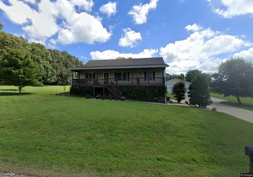
Estimated Value: $232,000 - $289,000
3
Beds
2
Baths
1,580
Sq Ft
$164/Sq Ft
Est. Value
About This Home
This home is located at 160 Cody Dr, Almo, KY 42020 and is currently estimated at $259,018, approximately $163 per square foot. 160 Cody Dr is a home located in Calloway County with nearby schools including North Calloway Elementary School, Calloway County Middle School, and Calloway County High School.
Ownership History
Date
Name
Owned For
Owner Type
Purchase Details
Closed on
Sep 27, 2022
Sold by
Mason Janfa Marie
Bought by
Mason Michael Adolph
Current Estimated Value
Home Financials for this Owner
Home Financials are based on the most recent Mortgage that was taken out on this home.
Original Mortgage
$15,300
Interest Rate
5.5%
Purchase Details
Closed on
Nov 10, 2006
Sold by
Steward Brian and Steward Regina
Bought by
Mason Michael A and Mason Jana M
Home Financials for this Owner
Home Financials are based on the most recent Mortgage that was taken out on this home.
Original Mortgage
$26,900
Interest Rate
6.27%
Mortgage Type
Stand Alone Second
Create a Home Valuation Report for This Property
The Home Valuation Report is an in-depth analysis detailing your home's value as well as a comparison with similar homes in the area
Purchase History
| Date | Buyer | Sale Price | Title Company |
|---|---|---|---|
| Mason Michael Adolph | -- | None Listed On Document | |
| Mason Michael Adolph | -- | None Listed On Document | |
| Mason Michael A | $134,500 | None Available |
Source: Public Records
Mortgage History
| Date | Status | Borrower | Loan Amount |
|---|---|---|---|
| Closed | Mason Michael Adolph | $15,300 | |
| Open | Mason Michael Adolph | $179,600 | |
| Closed | Mason Michael Adolph | $179,600 | |
| Previous Owner | Mason Michael A | $26,900 |
Source: Public Records
Tax History Compared to Growth
Tax History
| Year | Tax Paid | Tax Assessment Tax Assessment Total Assessment is a certain percentage of the fair market value that is determined by local assessors to be the total taxable value of land and additions on the property. | Land | Improvement |
|---|---|---|---|---|
| 2025 | $1,529 | $170,000 | $0 | $0 |
| 2024 | $1,510 | $170,000 | $0 | $0 |
| 2023 | $1,375 | $150,000 | $0 | $0 |
| 2022 | $1,403 | $150,000 | $0 | $0 |
| 2021 | $1,430 | $150,000 | $0 | $0 |
| 2020 | $1,408 | $150,000 | $0 | $0 |
| 2019 | $1,375 | $150,000 | $0 | $0 |
| 2018 | $1,243 | $140,000 | $0 | $0 |
| 2017 | $1,208 | $140,000 | $0 | $0 |
| 2016 | $1,196 | $140,000 | $0 | $0 |
| 2015 | $1,100 | $140,000 | $0 | $0 |
| 2011 | $1,100 | $140,000 | $0 | $0 |
Source: Public Records
Map
Nearby Homes
- 118 Stonecrest Dr
- 206 Metcalf Ln
- 93 North Dr
- Lot 17 Jordyn Bailey Rd
- 0 U S 641 N
- 363 Grant Rd
- 000 Spring Rd
- 0 Brinn Rd
- 1783 Radio Rd
- 4835 Airport Rd
- 445 John Purdom Dr
- 00 N 16th St
- 2690 Bethel Rd
- 000 Southwood Dr
- 1005 Southwood Dr
- 000 Keepers Way Unit Tract A
- 000 Keepers Way
- 1 Logan Trail
- 1417 Longwood Dr
- 74 Astoria Ct
- 142 Cody Dr
- 145 Breezeway Dr
- 105 Breezeway Dr
- 918 Walston Rd
- 110 Breezeway Dr
- 158 Breezeway Dr
- 66 Breezeway Dr
- 194 Breezeway Dr
- 231 Breezeway Dr
- 231 Breezeway Dr Unit corner of StoneCrest
- 972 Walston Rd
- 941 Walston Rd
- 901 Walston Rd
- 56 Birchtree Dr
- 224 Breezeway Dr
- 81 Stonecrest Dr
- 304 Stonecrest Dr
- 203 Stonecrest Dr
- 157 Stonecrest Dr
- 190 Stonecrest Dr
