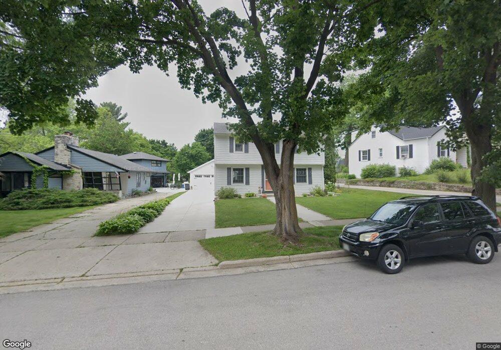
160 S Porter Ave Waukesha, WI 53186
Estimated Value: $326,000 - $380,000
3
Beds
2
Baths
1,712
Sq Ft
$207/Sq Ft
Est. Value
About This Home
This home is located at 160 S Porter Ave, Waukesha, WI 53186 and is currently estimated at $354,580, approximately $207 per square foot. 160 S Porter Ave is a home located in Waukesha County with nearby schools including Hadfield Elementary School, Horning Middle School, and South High School.
Ownership History
Date
Name
Owned For
Owner Type
Purchase Details
Closed on
Oct 31, 2001
Sold by
Larimer William J and Larimer Angela M
Bought by
Ray Michael T and Schwartz Christine M
Current Estimated Value
Home Financials for this Owner
Home Financials are based on the most recent Mortgage that was taken out on this home.
Original Mortgage
$147,250
Interest Rate
6.92%
Purchase Details
Closed on
Jul 6, 1998
Sold by
Deloye Dennis M and Deloye Anne M
Bought by
Larimer William J and Larimer Angela M
Home Financials for this Owner
Home Financials are based on the most recent Mortgage that was taken out on this home.
Original Mortgage
$148,217
Interest Rate
7.13%
Mortgage Type
VA
Create a Home Valuation Report for This Property
The Home Valuation Report is an in-depth analysis detailing your home's value as well as a comparison with similar homes in the area
Home Values in the Area
Average Home Value in this Area
Purchase History
| Date | Buyer | Sale Price | Title Company |
|---|---|---|---|
| Ray Michael T | $155,000 | -- | |
| Larimer William J | $143,900 | -- |
Source: Public Records
Mortgage History
| Date | Status | Borrower | Loan Amount |
|---|---|---|---|
| Previous Owner | Ray Michael T | $147,250 | |
| Previous Owner | Larimer William J | $148,217 |
Source: Public Records
Tax History Compared to Growth
Tax History
| Year | Tax Paid | Tax Assessment Tax Assessment Total Assessment is a certain percentage of the fair market value that is determined by local assessors to be the total taxable value of land and additions on the property. | Land | Improvement |
|---|---|---|---|---|
| 2024 | $4,525 | $306,100 | $74,500 | $231,600 |
| 2023 | $4,396 | $306,100 | $74,500 | $231,600 |
| 2022 | $4,398 | $230,000 | $55,400 | $174,600 |
| 2021 | $4,501 | $230,000 | $55,400 | $174,600 |
| 2020 | $4,351 | $230,000 | $55,400 | $174,600 |
| 2019 | $4,214 | $230,000 | $55,400 | $174,600 |
| 2018 | $3,641 | $195,600 | $52,400 | $143,200 |
| 2017 | $3,635 | $195,600 | $52,400 | $143,200 |
| 2016 | $3,618 | $182,800 | $52,400 | $130,400 |
| 2015 | $3,598 | $182,800 | $52,400 | $130,400 |
| 2014 | $3,676 | $179,200 | $52,400 | $126,800 |
| 2013 | $3,676 | $179,200 | $52,300 | $126,900 |
Source: Public Records
Map
Nearby Homes
- W230S2425 Morningside Dr
- 1422 E Racine Ave
- 1037 Windsor Dr
- 125 Tenny Ave
- 1343 Hillside Dr
- S21W23079 Hillside Dr
- 403 Midland Ave
- 1535 E Racine Ave
- 715 Cavalier Dr
- 400 Sheffield Rd Unit 5
- 917 E Roberta Ave
- 1164 Downing Dr
- 309 Stonebrook Dr
- 1103 Arcadian Ave
- 1021 Arcadian Ave
- 1825 E Racine Ave Unit 5
- 930 Harding Ave
- 1337 Camden Way Unit 2
- 953 Genesee St
- 131 Wisconsin Ave
- 150 S Porter Ave
- 164 S Porter Ave
- 1301 Lookout Dr
- 170 S Porter Ave
- 171 S Porter Ave
- 174 S Porter Ave
- 1305 Lookout Dr
- 140 S Porter Ave
- 177 S Porter Ave
- 135 S Porter Ave
- 1300 Lookout Dr
- 136 S Porter Ave
- 1309 Lookout Dr
- 1213 Grant St
- 178 S Porter Ave
- 181 S Porter Ave
- 1209 Grant St
- 1112 E Racine Ave
- 1225 Grant St
- 1116 E Racine Ave