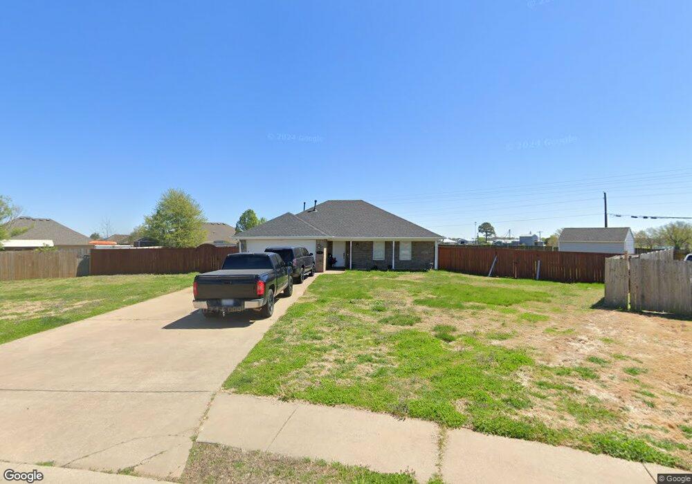
160 Washburn Dr Pea Ridge, AR 72751
Estimated Value: $265,000 - $312,000
--
Bed
2
Baths
1,329
Sq Ft
$215/Sq Ft
Est. Value
About This Home
This home is located at 160 Washburn Dr, Pea Ridge, AR 72751 and is currently estimated at $286,027, approximately $215 per square foot. 160 Washburn Dr is a home located in Benton County with nearby schools including Pea Ridge Intermediate School, Pea Ridge Primary School, and Pea Ridge Middle School.
Ownership History
Date
Name
Owned For
Owner Type
Purchase Details
Closed on
Sep 23, 2005
Sold by
Lazenby William A
Bought by
Garcia Hector
Current Estimated Value
Home Financials for this Owner
Home Financials are based on the most recent Mortgage that was taken out on this home.
Original Mortgage
$117,500
Outstanding Balance
$62,388
Interest Rate
5.73%
Mortgage Type
New Conventional
Estimated Equity
$223,639
Create a Home Valuation Report for This Property
The Home Valuation Report is an in-depth analysis detailing your home's value as well as a comparison with similar homes in the area
Home Values in the Area
Average Home Value in this Area
Purchase History
| Date | Buyer | Sale Price | Title Company |
|---|---|---|---|
| Garcia Hector | $118,000 | Stewart Title Of Arkansas |
Source: Public Records
Mortgage History
| Date | Status | Borrower | Loan Amount |
|---|---|---|---|
| Open | Garcia Hector | $117,500 |
Source: Public Records
Tax History Compared to Growth
Tax History
| Year | Tax Paid | Tax Assessment Tax Assessment Total Assessment is a certain percentage of the fair market value that is determined by local assessors to be the total taxable value of land and additions on the property. | Land | Improvement |
|---|---|---|---|---|
| 2025 | $1,584 | $48,561 | $6,400 | $42,161 |
| 2024 | $1,551 | $48,561 | $6,400 | $42,161 |
| 2023 | $1,477 | $31,960 | $5,600 | $26,360 |
| 2022 | $1,100 | $31,960 | $5,600 | $26,360 |
| 2021 | $1,020 | $31,960 | $5,600 | $26,360 |
| 2020 | $997 | $23,540 | $2,800 | $20,740 |
| 2019 | $943 | $23,540 | $2,800 | $20,740 |
| 2018 | $913 | $23,540 | $2,800 | $20,740 |
| 2017 | $729 | $23,540 | $2,800 | $20,740 |
| 2016 | $729 | $23,540 | $2,800 | $20,740 |
| 2015 | $1,028 | $18,070 | $4,000 | $14,070 |
| 2014 | $678 | $18,070 | $4,000 | $14,070 |
Source: Public Records
Map
Nearby Homes
- 1805 Bugg St
- 1807 Bugg St
- 1806 Bugg St
- 100 Greer St
- 108 Greer St
- 112 Greer St
- 200 Greer St
- 204 Greer St
- 208 Greer St
- 212 Greer St
- 300 Greer St
- 304 Greer St
- 104 Rickett St
- 100 Rickett St
- 109 Ratliff Ave
- WARREN Plan at Rolling Meadows
- 204 Ratliff Ave
- 309 Ratliff Ave
- BELLEVUE Plan at Rolling Meadows
- 209 Ratliff Ave
- 140 Washburn Dr
- 170 Washburn Dr
- 101 Blair Cir
- 0 Lot 76 Washburn Dr Unit 712418
- 0 Lot 78 Washburn Dr Unit 712417
- 103 Blair Cir
- Lot 17 Blair Cir
- Lot 19 Blair Cir
- Lot 23 Blair Cir
- Lot 51 Blair Cir
- Lot 55 Blair Cir
- Lot 13 Blair Cir
- 185 Washburn Dr
- 105 Blair Cir
- 210 Washburn Dr
- 0 Lot 77 Washburn Dr Unit 712413
- 106 Benton Dr
- Lot 28 Blair Cir
- Lot 52 Blair Cir
- Lot 12 Blair Cir