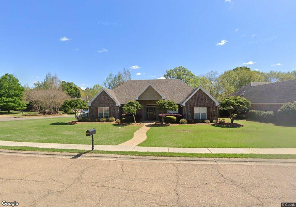
1600 Baywood Dr Madison, MS 39110
Estimated Value: $411,000 - $495,000
--
Bed
--
Bath
3,199
Sq Ft
$139/Sq Ft
Est. Value
About This Home
This home is located at 1600 Baywood Dr, Madison, MS 39110 and is currently estimated at $446,245, approximately $139 per square foot. 1600 Baywood Dr is a home located in Madison County with nearby schools including Madison Avenue Upper Elementary School, Madison Avenue Elementary, and Madison Middle School.
Ownership History
Date
Name
Owned For
Owner Type
Purchase Details
Closed on
Aug 21, 2017
Sold by
Roosmalen Kerry D
Bought by
Bradshaw James E and Bradshaw Dorothy C
Current Estimated Value
Home Financials for this Owner
Home Financials are based on the most recent Mortgage that was taken out on this home.
Original Mortgage
$240,000
Outstanding Balance
$199,782
Interest Rate
3.96%
Mortgage Type
New Conventional
Estimated Equity
$246,463
Purchase Details
Closed on
Feb 3, 2015
Sold by
Roosmalen Michelle T
Bought by
Roosmalen Kerry D
Create a Home Valuation Report for This Property
The Home Valuation Report is an in-depth analysis detailing your home's value as well as a comparison with similar homes in the area
Home Values in the Area
Average Home Value in this Area
Purchase History
| Date | Buyer | Sale Price | Title Company |
|---|---|---|---|
| Bradshaw James E | -- | None Available | |
| Roosmalen Kerry D | -- | None Available |
Source: Public Records
Mortgage History
| Date | Status | Borrower | Loan Amount |
|---|---|---|---|
| Open | Bradshaw James E | $240,000 |
Source: Public Records
Tax History Compared to Growth
Tax History
| Year | Tax Paid | Tax Assessment Tax Assessment Total Assessment is a certain percentage of the fair market value that is determined by local assessors to be the total taxable value of land and additions on the property. | Land | Improvement |
|---|---|---|---|---|
| 2025 | $2,351 | $28,832 | $0 | $0 |
| 2024 | $2,351 | $28,832 | $0 | $0 |
| 2023 | $2,351 | $28,832 | $0 | $0 |
| 2022 | $2,351 | $28,832 | $0 | $0 |
| 2021 | $3,150 | $27,673 | $0 | $0 |
| 2020 | $3,150 | $27,673 | $0 | $0 |
| 2019 | $2,351 | $27,673 | $0 | $0 |
| 2018 | $2,351 | $27,673 | $0 | $0 |
| 2017 | $2,871 | $27,211 | $0 | $0 |
| 2016 | $2,871 | $27,211 | $0 | $0 |
| 2015 | $2,871 | $27,211 | $0 | $0 |
| 2014 | -- | $28,690 | $0 | $0 |
Source: Public Records
Map
Nearby Homes
- 865 Wellington Way
- 113 N Ridge Dr
- 662 Baywood Pointe
- 418 Wildwood Pointe
- 1005 Laramie Ct
- 557 Spring Hill Dr
- 204 Street Charlotte Cove
- 1133 Windrose Cir
- 202 Saint Pierre Cove
- 169 Saint Ives Dr
- 165 Saint Ives Dr
- 265 Woodland Brook Dr
- 129 Victoria Place
- 105 Victoria Place
- Lot 4 Chantilly Dr
- 722 Arlington Ct
- 0 Sundial Rd Unit 4104072
- 207 Geneva Blvd
- 181 Chantilly Dr
- 262 Geneva Blvd
- 1608 Baywood Dr
- 1610 Baywood Dr
- 443 S Place Dr
- 451 S Place Dr
- 1601 Baywood Dr
- 1605 Baywood Dr
- 1612 Baywood Dr
- 885 Wellington Way
- 508 Spring Hill Dr
- 1609 Baywood Dr
- 506 Spring Hill Dr
- 510 Spring Hill Dr
- 504 Spring Hill Dr
- 881 Wellington Way
- 1616 Baywood Dr
- 1615 Baywood Dr
- 512 Spring Hill Dr
- 874 Wellington Way
- 502 Spring Hill Dr
- 514 Spring Hill Dr