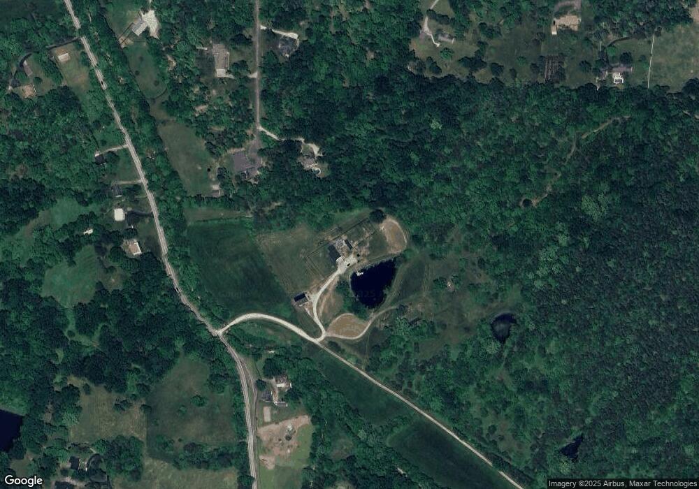
16001 Leeland Farm Ln Louisville, KY 40299
Estimated Value: $418,000 - $776,000
3
Beds
1
Bath
1,421
Sq Ft
$366/Sq Ft
Est. Value
About This Home
This home is located at 16001 Leeland Farm Ln, Louisville, KY 40299 and is currently estimated at $520,351, approximately $366 per square foot. 16001 Leeland Farm Ln is a home located in Jefferson County with nearby schools including Tully Elementary School, Cochrane Elementary School, and Jeffersontown Elementary School.
Ownership History
Date
Name
Owned For
Owner Type
Purchase Details
Closed on
Jul 21, 2025
Sold by
Leeland Farm Holding Dsl Llc and Leeland Farm Holding Clb Llc
Bought by
Alvey David and Alvey Kim
Current Estimated Value
Purchase Details
Closed on
Jan 16, 2025
Sold by
Alvey David and Alvey Kimberly
Bought by
Alvey David and Alvey Kimberly
Home Financials for this Owner
Home Financials are based on the most recent Mortgage that was taken out on this home.
Original Mortgage
$60,000
Interest Rate
6.89%
Mortgage Type
Credit Line Revolving
Purchase Details
Closed on
Jun 25, 2010
Sold by
Alvey Robert J and Alvey Doris
Bought by
Alvey David
Home Financials for this Owner
Home Financials are based on the most recent Mortgage that was taken out on this home.
Original Mortgage
$120,065
Interest Rate
5.5%
Mortgage Type
FHA
Create a Home Valuation Report for This Property
The Home Valuation Report is an in-depth analysis detailing your home's value as well as a comparison with similar homes in the area
Home Values in the Area
Average Home Value in this Area
Purchase History
| Date | Buyer | Sale Price | Title Company |
|---|---|---|---|
| Alvey David | $59,670 | None Listed On Document | |
| Alvey David | $59,670 | None Listed On Document | |
| Alvey David | -- | None Listed On Document | |
| Alvey David | -- | None Listed On Document | |
| Alvey David | $235,000 | Limestone Title |
Source: Public Records
Mortgage History
| Date | Status | Borrower | Loan Amount |
|---|---|---|---|
| Previous Owner | Alvey David | $60,000 | |
| Previous Owner | Alvey David | $120,065 |
Source: Public Records
Tax History Compared to Growth
Tax History
| Year | Tax Paid | Tax Assessment Tax Assessment Total Assessment is a certain percentage of the fair market value that is determined by local assessors to be the total taxable value of land and additions on the property. | Land | Improvement |
|---|---|---|---|---|
| 2024 | $4,068 | $355,290 | $207,880 | $147,410 |
| 2023 | $3,061 | $259,890 | $111,560 | $148,330 |
| 2022 | $3,072 | $259,890 | $111,560 | $148,330 |
| 2021 | $3,254 | $259,890 | $111,560 | $148,330 |
| 2020 | $2,290 | $194,570 | $79,040 | $115,530 |
| 2019 | $2,109 | $194,570 | $79,040 | $115,530 |
| 2018 | $2,083 | $194,570 | $79,040 | $115,530 |
| 2017 | $2,042 | $194,570 | $79,040 | $115,530 |
| 2013 | $2,350 | $235,000 | $135,220 | $99,780 |
Source: Public Records
Map
Nearby Homes
- 6601 Old Heady Rd
- West Tract Old Heady Rd
- Lot 0164 Old Heady Rd
- 7907 Old Heady Rd
- 6400 Old Heady Rd
- 4805 Jolynn Wolf Way
- 5000 Thurman Rd
- 15810 Crystal Valley Way
- 15815 Crystal Valley Way
- 0 Thurman Rd Unit 1691864
- 17603 Three Girls Way
- Tract 3 Old Heady Rd
- 17810 Deertrace Ln
- 6120 Old Heady Rd
- 14010 Echo Hill Trail
- 16715 Dry Ridge Rd
- 16311 Dry Ridge Rd
- 3800 Old Routt Rd
- 7009 Echo Trail
- 795 Schultz Ln
- 6001 Bradbe Farm Ln
- 6000 Bradbe Farm Ln
- 5 Darlington Place
- 6207 Routt Rd
- 6100 Routt Rd
- 5901 Bradbe Farm Ln
- 6008 Routt Rd
- 16220 Bradbe Rd
- 6004 Routt Rd
- 6301 Routt Rd
- 7 Darlington Place
- 10 Darlington Place
- 8 Darlington Place
- 16230 Bradbe Rd
- 16300 Bradbe Rd
- 5900 Routt Rd
- 6312 Routt Rd
- 16218 Bradbe Rd
- 9 Darlington Place
