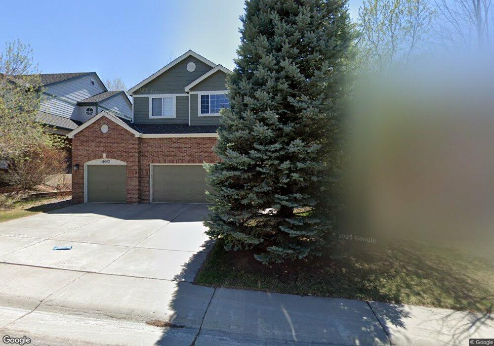
16002 Crestrock Cir Parker, CO 80134
Stonegate NeighborhoodEstimated Value: $678,000 - $750,000
3
Beds
3
Baths
2,580
Sq Ft
$271/Sq Ft
Est. Value
About This Home
This home is located at 16002 Crestrock Cir, Parker, CO 80134 and is currently estimated at $698,482, approximately $270 per square foot. 16002 Crestrock Cir is a home located in Douglas County with nearby schools including Pine Grove Elementary School, Sierra Middle School, and Chaparral High School.
Ownership History
Date
Name
Owned For
Owner Type
Purchase Details
Closed on
Nov 20, 1996
Sold by
Falcon Partnership Ltd
Bought by
Hofland Gregg S and Hofland Sherri E
Current Estimated Value
Home Financials for this Owner
Home Financials are based on the most recent Mortgage that was taken out on this home.
Original Mortgage
$180,950
Outstanding Balance
$13,911
Interest Rate
7.9%
Estimated Equity
$684,571
Purchase Details
Closed on
Feb 9, 1996
Sold by
Stonegate Dev Inc
Bought by
Falcon Partnership
Create a Home Valuation Report for This Property
The Home Valuation Report is an in-depth analysis detailing your home's value as well as a comparison with similar homes in the area
Home Values in the Area
Average Home Value in this Area
Purchase History
| Date | Buyer | Sale Price | Title Company |
|---|---|---|---|
| Hofland Gregg S | $226,243 | Land Title | |
| Falcon Partnership | $347,100 | -- |
Source: Public Records
Mortgage History
| Date | Status | Borrower | Loan Amount |
|---|---|---|---|
| Open | Hofland Gregg S | $180,950 |
Source: Public Records
Tax History
| Year | Tax Paid | Tax Assessment Tax Assessment Total Assessment is a certain percentage of the fair market value that is determined by local assessors to be the total taxable value of land and additions on the property. | Land | Improvement |
|---|---|---|---|---|
| 2025 | $4,946 | $43,550 | $10,510 | $33,040 |
| 2024 | $4,946 | $49,870 | $9,680 | $40,190 |
| 2023 | $4,989 | $49,870 | $9,680 | $40,190 |
| 2022 | $3,879 | $35,140 | $6,580 | $28,560 |
| 2021 | $3,990 | $35,140 | $6,580 | $28,560 |
| 2020 | $3,921 | $35,410 | $7,780 | $27,630 |
| 2019 | $3,826 | $35,410 | $7,780 | $27,630 |
| 2018 | $3,427 | $31,290 | $7,010 | $24,280 |
| 2017 | $3,232 | $31,290 | $7,010 | $24,280 |
| 2016 | $3,176 | $30,270 | $6,410 | $23,860 |
| 2015 | $1,619 | $30,270 | $6,410 | $23,860 |
| 2014 | $1,525 | $25,700 | $6,220 | $19,480 |
Source: Public Records
Map
Nearby Homes
- 16042 Crestrock Cir
- 16230 Martingale Dr
- 16116 Martingale Dr
- 10553 Stonemeadow Dr
- 10857 Tundra Top Dr
- 10866 Tundra Top Dr
- 10874 Tundra Top Dr
- 10873 Tundra Top Dr
- 10626 Oakmoor Ct
- 10890 Tundra Top Dr
- 10912 Snowdon St
- 15733 Mccauley Dr
- 10965 Hayloft St
- 16145 Peregrine Dr
- 10730 Tomboy Dr
- 10734 Tomboy Dr
- 10794 Tomboy Dr
- 15362 Foxglove Ct
- 10619 Winterflower Way
- 10776 Tomboy Dr
- 15992 Crestrock Cir
- 16012 Crestrock Cir
- 16022 Crestrock Cir
- 15982 Crestrock Cir
- 10689 Singleleaf Ct
- 16032 Crestrock Cir
- 15972 Crestrock Cir
- 10679 Singleleaf Ct
- 10668 Stone Creek Ct
- 15962 Crestrock Cir
- 16031 Crestrock Cir
- 10677 Stone Creek Ct
- 10669 Singleleaf Ct
- 10658 Stone Creek Ct
- 15952 Crestrock Cir
- 16052 Crestrock Cir
- 10667 Stone Creek Ct
- 16051 Crestrock Cir
- 10670 Singleleaf Ct
- 10659 Singleleaf Ct
Your Personal Tour Guide
Ask me questions while you tour the home.