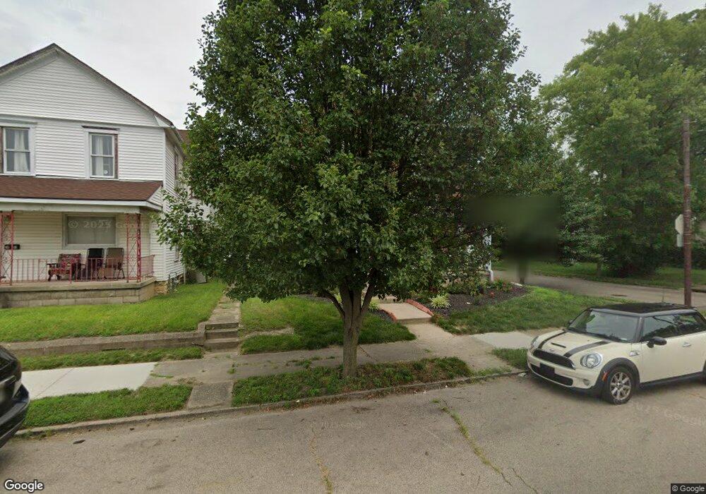
1601 W 2nd St Dayton, OH 45402
Wolf Creek NeighborhoodEstimated Value: $76,000 - $284,000
4
Beds
3
Baths
2,168
Sq Ft
$71/Sq Ft
Est. Value
About This Home
This home is located at 1601 W 2nd St, Dayton, OH 45402 and is currently estimated at $153,034, approximately $70 per square foot. 1601 W 2nd St is a home located in Montgomery County with nearby schools including International School at Residence Park, Louise Troy Elementary, and Westwood Elementary.
Ownership History
Date
Name
Owned For
Owner Type
Purchase Details
Closed on
Oct 4, 2016
Sold by
Mapp Karen
Bought by
Sliver Scott Edward and Sliver Bonnie F
Current Estimated Value
Home Financials for this Owner
Home Financials are based on the most recent Mortgage that was taken out on this home.
Original Mortgage
$69,877
Outstanding Balance
$55,966
Interest Rate
3.43%
Mortgage Type
New Conventional
Estimated Equity
$97,068
Purchase Details
Closed on
Feb 18, 2016
Sold by
Mapp John R
Bought by
Mapp Karen
Home Financials for this Owner
Home Financials are based on the most recent Mortgage that was taken out on this home.
Interest Rate
3.65%
Purchase Details
Closed on
May 13, 2005
Sold by
Rescomm Holdings #2 Llc
Bought by
Mapp John R
Purchase Details
Closed on
Nov 22, 2004
Sold by
Greenwich Investors Xi Llc
Bought by
Rescomm Holdings #2 Llc
Purchase Details
Closed on
Feb 18, 2003
Sold by
Bell James O
Bought by
Greenwich Investors Xi Llc
Create a Home Valuation Report for This Property
The Home Valuation Report is an in-depth analysis detailing your home's value as well as a comparison with similar homes in the area
Home Values in the Area
Average Home Value in this Area
Purchase History
| Date | Buyer | Sale Price | Title Company |
|---|---|---|---|
| Sliver Scott Edward | $32,500 | Home Services Title Llc | |
| Mapp Karen | -- | -- | |
| Mapp John R | $16,000 | -- | |
| Rescomm Holdings #2 Llc | $16,000 | -- | |
| Greenwich Investors Xi Llc | $27,500 | -- |
Source: Public Records
Mortgage History
| Date | Status | Borrower | Loan Amount |
|---|---|---|---|
| Open | Sliver Scott Edward | $69,877 | |
| Previous Owner | Mapp Karen | -- |
Source: Public Records
Tax History Compared to Growth
Tax History
| Year | Tax Paid | Tax Assessment Tax Assessment Total Assessment is a certain percentage of the fair market value that is determined by local assessors to be the total taxable value of land and additions on the property. | Land | Improvement |
|---|---|---|---|---|
| 2024 | $1,175 | $20,770 | $1,970 | $18,800 |
| 2023 | $1,175 | $20,770 | $1,970 | $18,800 |
| 2022 | $1,513 | $20,770 | $1,970 | $18,800 |
| 2021 | $1,505 | $20,770 | $1,970 | $18,800 |
| 2020 | $1,502 | $20,770 | $1,970 | $18,800 |
| 2019 | $1,933 | $24,340 | $1,970 | $22,370 |
| 2018 | $1,936 | $24,340 | $1,970 | $22,370 |
| 2017 | $1,921 | $24,340 | $1,970 | $22,370 |
| 2016 | $2,075 | $24,360 | $1,970 | $22,390 |
| 2015 | $1,409 | $24,360 | $1,970 | $22,390 |
| 2014 | $1,238 | $24,360 | $1,970 | $22,390 |
| 2012 | -- | $13,890 | $2,210 | $11,680 |
Source: Public Records
Map
Nearby Homes
- 1568 W 2nd St
- 1540 W 2nd St
- 1527 W 1st St
- 235 Mercer Ave
- 149 Edison St
- 408 N Conover St
- 401 S Euclid Ave Unit 403
- 403 S Euclid Ave
- 40 S Mathison St
- 42 S Mathison St
- 369 N Mathison St
- 200 N Orchard Ave
- 66 Barnett St Unit 64
- 721 Kumler Ave
- 121 Gordon Ave
- 1515 Ingomar Ave
- 508 S Paul Laurence Dunbar St
- 436 N Orchard Ave
- 1412 Oakridge Dr
- 40 Gordon Ave