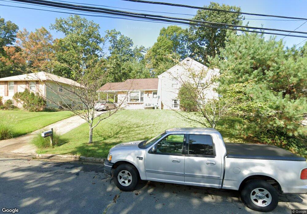
16010 Kent Rd Laurel, MD 20707
West Laurel NeighborhoodEstimated Value: $485,950 - $600,000
Studio
3
Baths
2,388
Sq Ft
$232/Sq Ft
Est. Value
About This Home
This home is located at 16010 Kent Rd, Laurel, MD 20707 and is currently estimated at $553,238, approximately $231 per square foot. 16010 Kent Rd is a home located in Prince George's County with nearby schools including Bond Mill Elementary, Martin Luther King Jr. Middle School, and Laurel High School.
Ownership History
Date
Name
Owned For
Owner Type
Purchase Details
Closed on
Jan 29, 2009
Sold by
Hamilton David C
Bought by
Hamilton Kama Lynn B
Current Estimated Value
Home Financials for this Owner
Home Financials are based on the most recent Mortgage that was taken out on this home.
Original Mortgage
$193,000
Outstanding Balance
$122,642
Interest Rate
5.28%
Mortgage Type
New Conventional
Estimated Equity
$430,596
Purchase Details
Closed on
Aug 7, 1990
Sold by
Pittman Kenneth O
Bought by
Hamilton David C and Hamilton Kama-Lynn B
Create a Home Valuation Report for This Property
The Home Valuation Report is an in-depth analysis detailing your home's value as well as a comparison with similar homes in the area
Home Values in the Area
Average Home Value in this Area
Purchase History
| Date | Buyer | Sale Price | Title Company |
|---|---|---|---|
| Hamilton Kama Lynn B | -- | -- | |
| Hamilton David C | $184,000 | -- |
Source: Public Records
Mortgage History
| Date | Status | Borrower | Loan Amount |
|---|---|---|---|
| Open | Hamilton Kama Lynn B | $193,000 |
Source: Public Records
Tax History
| Year | Tax Paid | Tax Assessment Tax Assessment Total Assessment is a certain percentage of the fair market value that is determined by local assessors to be the total taxable value of land and additions on the property. | Land | Improvement |
|---|---|---|---|---|
| 2025 | $5,308 | $440,400 | $126,700 | $313,700 |
| 2024 | $5,308 | $413,667 | -- | -- |
| 2023 | $5,093 | $386,933 | $0 | $0 |
| 2022 | $4,005 | $360,200 | $101,700 | $258,500 |
| 2021 | $9,508 | $355,500 | $0 | $0 |
| 2020 | $9,261 | $350,800 | $0 | $0 |
| 2019 | $4,956 | $346,100 | $100,800 | $245,300 |
| 2018 | $4,377 | $334,467 | $0 | $0 |
| 2017 | $6,397 | $322,833 | $0 | $0 |
| 2016 | -- | $311,200 | $0 | $0 |
| 2015 | $3,689 | $300,233 | $0 | $0 |
| 2014 | $3,689 | $289,267 | $0 | $0 |
Source: Public Records
Map
Nearby Homes
- 6003 Windham Rd
- 15611 Riding Stable Rd
- 6201 Goodman Rd
- 14005 Barkham Ct
- 7004 Fitzpatrick Dr
- 6918 Scotch Dr
- 7019 Fitzpatrick Dr
- 7002 Scotch Dr
- 7106 Donston Dr
- 16140 Kenny Rd
- 4402 Regalwood Terrace
- 7209 Brooklyn Bridge Rd
- 4302 Regalwood Terrace
- 14706 Saddle Creek Dr
- 15712 Dorset Rd Unit 104
- 16001 Amina Dr
- 15708 Dorset Rd Unit 202
- 15706 Dorset Rd Unit 102
- 14724 Crosswood Terrace
- 14836 Silver Ash Ct
- 16008 Kent Rd
- 16012 Kent Rd
- 15503 Straughn Dr
- 15501 Straughn Dr
- 15505 Straughn Dr
- 16006 Kent Rd
- 15411 Straughn Dr
- 16011 Kent Rd
- 16009 Kent Rd
- 16004 Kent Rd
- 15409 Straughn Dr
- 16100 Kent Rd
- 16007 Kent Rd
- 16007 Jerald Rd
- 15511 Straughn Dr
- 15500 Straughn Dr
- 15504 Straughn Dr
- 16101 Kent Rd
- 15407 Straughn Dr
- 16005 Kent Rd
Your Personal Tour Guide
Ask me questions while you tour the home.