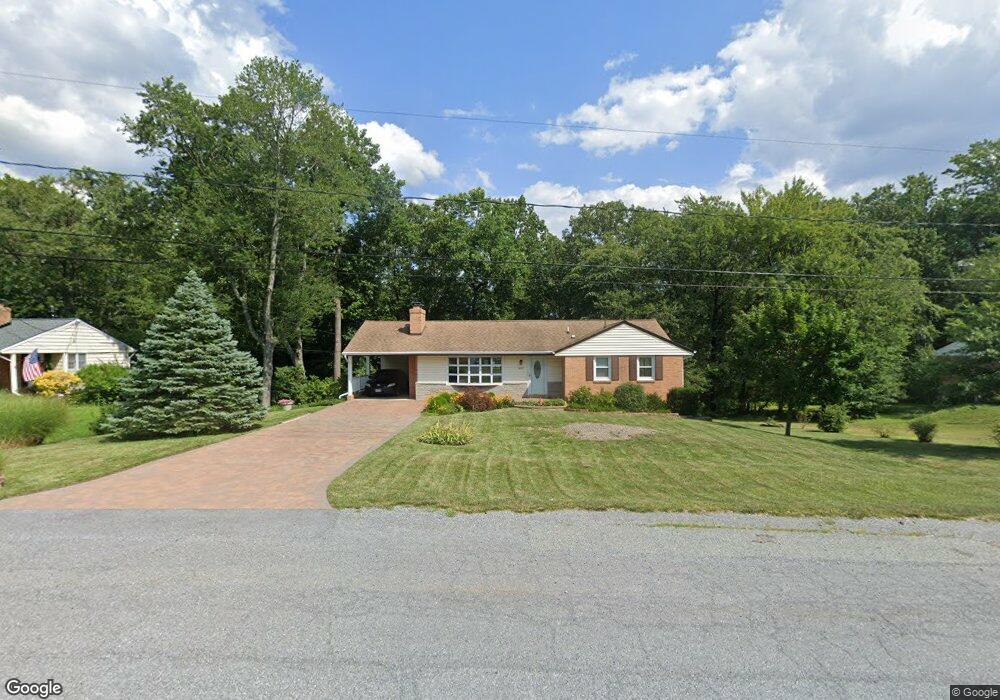
16017 Kenny Rd Laurel, MD 20707
West Laurel NeighborhoodEstimated Value: $448,422 - $545,000
Studio
2
Baths
1,687
Sq Ft
$303/Sq Ft
Est. Value
About This Home
This home is located at 16017 Kenny Rd, Laurel, MD 20707 and is currently estimated at $511,856, approximately $303 per square foot. 16017 Kenny Rd is a home located in Prince George's County with nearby schools including Bond Mill Elementary, Martin Luther King Jr. Middle School, and Laurel High School.
Ownership History
Date
Name
Owned For
Owner Type
Purchase Details
Closed on
Oct 24, 2001
Sold by
Muzzy David F and Muzzy Theresa A
Bought by
Muzzy Living Trust
Current Estimated Value
Purchase Details
Closed on
Aug 20, 1976
Sold by
Dickey George And
Bought by
Muzzy David F and Muzzy Theresa A
Create a Home Valuation Report for This Property
The Home Valuation Report is an in-depth analysis detailing your home's value as well as a comparison with similar homes in the area
Home Values in the Area
Average Home Value in this Area
Purchase History
We collect this data history from publicly available records. To have your information removed, we recommend requesting removal directly through your county’s website.
| Date | Buyer | Sale Price | Title Company |
|---|---|---|---|
| Muzzy Living Trust | -- | -- | |
| Muzzy David F | $56,500 | -- |
Source: Public Records
Tax History
| Year | Tax Paid | Tax Assessment Tax Assessment Total Assessment is a certain percentage of the fair market value that is determined by local assessors to be the total taxable value of land and additions on the property. | Land | Improvement |
|---|---|---|---|---|
| 2025 | $4,348 | $449,200 | $124,100 | $325,100 |
| 2024 | $4,348 | $420,100 | -- | -- |
| 2023 | $4,348 | $391,000 | $0 | $0 |
| 2022 | $4,024 | $361,900 | $104,100 | $257,800 |
| 2021 | $5,030 | $348,467 | $0 | $0 |
| 2020 | $4,283 | $335,033 | $0 | $0 |
| 2019 | $4,605 | $321,600 | $102,000 | $219,600 |
| 2018 | $4,700 | $320,267 | $0 | $0 |
| 2017 | $4,563 | $318,933 | $0 | $0 |
| 2016 | -- | $317,600 | $0 | $0 |
| 2015 | $3,624 | $315,300 | $0 | $0 |
| 2014 | $3,624 | $313,000 | $0 | $0 |
Source: Public Records
Map
Nearby Homes
- 7012 Redmiles Rd
- 15800 Kerr Rd
- 7106 Donston Dr
- 7209 Brooklyn Bridge Rd
- 15708 Dorset Rd Unit 203
- 15708 Dorset Rd Unit 202
- 6920 Scotch Dr
- 6918 Scotch Dr
- 7600 Lord Snowden Cir
- 15706 Dorset Rd Unit 102
- 6915 Scotch Dr
- 15518 Casulas Way
- 15700 Dorset Rd
- 6707 Sandy View Ct
- 15925 Dorset Rd
- 15601 Dorset Rd Unit 102
- 15732 Millbrook Ln
- 15734 Millbrook Ln
- 16302 Gales St
- 15837 Millbrook Ln
- 16013 Kenny Rd
- 16101 Kenny Rd
- 7014 Redmiles Rd
- 7016 Redmiles Rd
- 16009 Kenny Rd
- 16105 Kenny Rd
- 6807 Orem Dr
- 6806 Orem Dr
- 7010 Redmiles Rd
- 16012 Malcolm Dr
- 6805 Orem Dr
- 16109 Kenny Rd
- 7008 Redmiles Rd
- 16005 Kenny Rd
- 16006 Malcolm Dr
- 6804 Orem Dr
- 16004 Kenny Rd
- 7013 Redmiles Rd
- 7006 Redmiles Rd
- 6803 Orem Dr
Your Personal Tour Guide
Ask me questions while you tour the home.