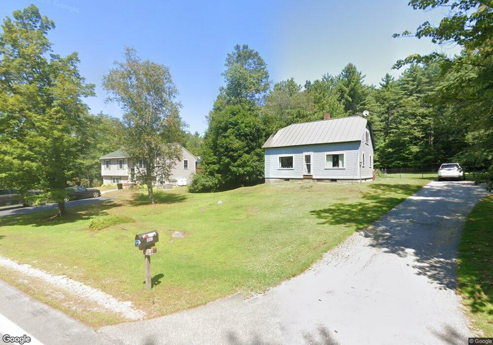
1602 Battle St Webster, NH 03303
Estimated Value: $339,551 - $457,000
2
Beds
1
Bath
1,233
Sq Ft
$317/Sq Ft
Est. Value
About This Home
This home is located at 1602 Battle St, Webster, NH 03303 and is currently estimated at $391,138, approximately $317 per square foot. 1602 Battle St is a home located in Merrimack County with nearby schools including Webster Elementary School, Merrimack Valley Middle School, and Merrimack Valley High School.
Create a Home Valuation Report for This Property
The Home Valuation Report is an in-depth analysis detailing your home's value as well as a comparison with similar homes in the area
Home Values in the Area
Average Home Value in this Area
Tax History Compared to Growth
Tax History
| Year | Tax Paid | Tax Assessment Tax Assessment Total Assessment is a certain percentage of the fair market value that is determined by local assessors to be the total taxable value of land and additions on the property. | Land | Improvement |
|---|---|---|---|---|
| 2024 | $3,614 | $232,733 | $106,833 | $125,900 |
| 2023 | $3,463 | $232,713 | $106,813 | $125,900 |
| 2022 | $3,144 | $137,573 | $66,573 | $71,000 |
| 2021 | $3,067 | $137,576 | $66,576 | $71,000 |
| 2020 | $8,361 | $137,654 | $66,654 | $71,000 |
| 2019 | $3,024 | $137,713 | $66,713 | $71,000 |
Source: Public Records
Map
Nearby Homes
- 231 Mutton Rd
- 233 Hensmith Rd
- 54 Franklin Rd
- 110 Pearson Hill Rd
- 437 High St
- 10 Call Rd
- 7 Cashell Ln
- 375 Franklin Rd
- Map 6, Lot 38 Chadwick Hill Rd
- 220 Couchtown Rd
- 516 W Salisbury Rd
- 526 Salisbury Rd
- 122 Centennial Dr
- 19 Bailey Dr
- 222 Daniel Webster Hwy
- 428 North Rd
- 428 N Rd
- 71 Old Pumpkin Hill Rd
- 29 Centennial Dr
- 17 Centennial Dr