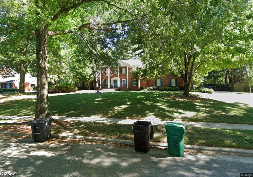
1602 Heathgate Point High Point, NC 27262
Greater High Point NeighborhoodEstimated Value: $554,000 - $685,000
4
Beds
4
Baths
3,258
Sq Ft
$193/Sq Ft
Est. Value
About This Home
This home is located at 1602 Heathgate Point, High Point, NC 27262 and is currently estimated at $627,591, approximately $192 per square foot. 1602 Heathgate Point is a home located in Guilford County with nearby schools including Northwood Elementary School, Ferndale Middle School, and High Point Central High School.
Ownership History
Date
Name
Owned For
Owner Type
Purchase Details
Closed on
Nov 30, 2001
Sold by
Safrit June W
Bought by
Freeman Ii Thomas C and Freeman Elizabethe A
Current Estimated Value
Home Financials for this Owner
Home Financials are based on the most recent Mortgage that was taken out on this home.
Original Mortgage
$233,000
Outstanding Balance
$91,181
Interest Rate
6.59%
Estimated Equity
$536,410
Create a Home Valuation Report for This Property
The Home Valuation Report is an in-depth analysis detailing your home's value as well as a comparison with similar homes in the area
Home Values in the Area
Average Home Value in this Area
Purchase History
| Date | Buyer | Sale Price | Title Company |
|---|---|---|---|
| Freeman Ii Thomas C | $350,000 | -- |
Source: Public Records
Mortgage History
| Date | Status | Borrower | Loan Amount |
|---|---|---|---|
| Open | Freeman Ii Thomas C | $233,000 |
Source: Public Records
Tax History
| Year | Tax Paid | Tax Assessment Tax Assessment Total Assessment is a certain percentage of the fair market value that is determined by local assessors to be the total taxable value of land and additions on the property. | Land | Improvement |
|---|---|---|---|---|
| 2025 | $5,411 | $392,700 | $66,000 | $326,700 |
| 2024 | $5,411 | $392,700 | $66,000 | $326,700 |
| 2023 | $5,411 | $392,700 | $66,000 | $326,700 |
| 2022 | $5,005 | $371,300 | $66,000 | $305,300 |
| 2021 | $4,642 | $336,900 | $55,000 | $281,900 |
| 2020 | $4,642 | $336,900 | $55,000 | $281,900 |
| 2019 | $4,642 | $336,900 | $0 | $0 |
| 2018 | $4,619 | $336,900 | $0 | $0 |
| 2017 | $4,619 | $336,900 | $0 | $0 |
| 2016 | $4,439 | $316,500 | $0 | $0 |
| 2015 | $4,463 | $316,500 | $0 | $0 |
| 2014 | $4,539 | $316,500 | $0 | $0 |
Source: Public Records
Map
Nearby Homes
- 900 W Lexington Ave
- 1204 Ascot Ct
- 1616 Heathcliff Rd
- 1266 Dovershire Place
- 1101 Robin Hood Rd
- 708 Rockspring Rd
- 1352 Trafalgar Dr
- 1312 Gilbrook Ct
- 1307 Gilbrook Ct
- 1001 Nuthatch Ct
- 4106 Stallion St Unit Lot 78
- 4094 Stallion St Unit lot 75
- 4090 Stallion St Unit Lot 74
- 914 Flicker Ln
- 4244 Canter Creek Ln
- 4244 Canter Creek Ln Unit 96
- 607 Rockspring Rd
- 1200 Devlin Ct
- 504 W Lexington Ave
- 1625 Appaloosa Place Unit Lot 12
- 1604 Heathgate Point
- 904 W Lexington Ave
- 1500 Heathcliff Rd
- 902 W Lexington Ave
- 1603 Heathgate Point
- 1606 Heathgate Point
- 1601 Heathgate Point
- 1605 Heathgate Point
- 1602 Heathcliff Rd
- 1505 Heathcliff Rd
- 1507 Heathcliff Rd
- 1608 Heathgate Point
- 1501 Heathcliff Rd
- 1607 Heathgate Point
- 1424 Heathcliff Rd
- 1325 Robin Hood Rd
- 1604 Heathcliff Rd
- 1307 Swanner Ct
- 1203 Ascot Ct
- 1323 Robin Hood Rd
Your Personal Tour Guide
Ask me questions while you tour the home.