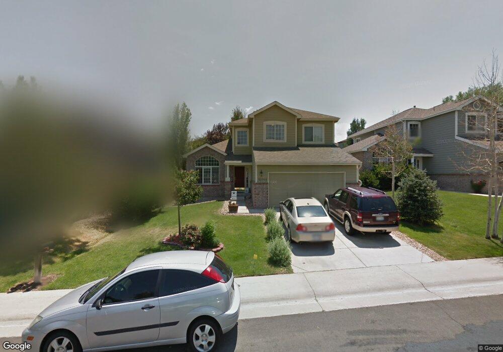
16044 Rock Crystal Dr Parker, CO 80134
Stonegate NeighborhoodEstimated Value: $655,686 - $710,000
4
Beds
4
Baths
2,986
Sq Ft
$228/Sq Ft
Est. Value
About This Home
This home is located at 16044 Rock Crystal Dr, Parker, CO 80134 and is currently estimated at $681,172, approximately $228 per square foot. 16044 Rock Crystal Dr is a home located in Douglas County with nearby schools including Mammoth Heights Elementary School, Sierra Middle School, and Chaparral High School.
Ownership History
Date
Name
Owned For
Owner Type
Purchase Details
Closed on
Jun 8, 2011
Sold by
Henderson Timothy M and Henderson Tracy A
Bought by
Wong Chun
Current Estimated Value
Home Financials for this Owner
Home Financials are based on the most recent Mortgage that was taken out on this home.
Original Mortgage
$222,000
Outstanding Balance
$154,329
Interest Rate
4.81%
Mortgage Type
Unknown
Estimated Equity
$526,843
Purchase Details
Closed on
May 25, 2004
Sold by
Pennington David M
Bought by
Henderson Timothy M and Henderson Tracy A
Home Financials for this Owner
Home Financials are based on the most recent Mortgage that was taken out on this home.
Original Mortgage
$274,000
Interest Rate
5.93%
Mortgage Type
Unknown
Purchase Details
Closed on
May 1, 2002
Sold by
Pennington David Michael
Bought by
Pennington David M
Home Financials for this Owner
Home Financials are based on the most recent Mortgage that was taken out on this home.
Original Mortgage
$197,050
Interest Rate
6.96%
Mortgage Type
Stand Alone First
Purchase Details
Closed on
Oct 29, 1999
Sold by
Townsend Ben M and Townsend Janet Townsend
Bought by
Pennington David Michael
Home Financials for this Owner
Home Financials are based on the most recent Mortgage that was taken out on this home.
Original Mortgage
$207,000
Interest Rate
6.87%
Purchase Details
Closed on
Oct 26, 1999
Sold by
Townsend Janet
Bought by
Townsend Ben N
Home Financials for this Owner
Home Financials are based on the most recent Mortgage that was taken out on this home.
Original Mortgage
$207,000
Interest Rate
6.87%
Purchase Details
Closed on
Jan 23, 1998
Sold by
Cascade Homes Colorado Llc
Bought by
Townsend Ben M and Townsend Janet
Home Financials for this Owner
Home Financials are based on the most recent Mortgage that was taken out on this home.
Original Mortgage
$146,508
Interest Rate
7.16%
Purchase Details
Closed on
Nov 26, 1996
Sold by
Stonegate Developments Inc
Bought by
Westerra Stonegate Llc
Purchase Details
Closed on
Mar 5, 1996
Sold by
Stonegate Westerra
Bought by
Cascade Homes Colo
Create a Home Valuation Report for This Property
The Home Valuation Report is an in-depth analysis detailing your home's value as well as a comparison with similar homes in the area
Home Values in the Area
Average Home Value in this Area
Purchase History
| Date | Buyer | Sale Price | Title Company |
|---|---|---|---|
| Wong Chun | $312,000 | Heritage Title | |
| Henderson Timothy M | $274,000 | Land Title | |
| Pennington David M | -- | Guardian Title Agency Llc | |
| Pennington David Michael | $230,000 | Land Title | |
| Townsend Ben N | -- | -- | |
| Townsend Ben M | $183,135 | -- | |
| Westerra Stonegate Llc | $12,700,000 | -- | |
| Cascade Homes Colo | $237,000 | -- |
Source: Public Records
Mortgage History
| Date | Status | Borrower | Loan Amount |
|---|---|---|---|
| Open | Wong Chun | $222,000 | |
| Previous Owner | Henderson Timothy M | $274,000 | |
| Previous Owner | Pennington David M | $197,050 | |
| Previous Owner | Pennington David Michael | $207,000 | |
| Previous Owner | Townsend Ben M | $146,508 |
Source: Public Records
Tax History Compared to Growth
Tax History
| Year | Tax Paid | Tax Assessment Tax Assessment Total Assessment is a certain percentage of the fair market value that is determined by local assessors to be the total taxable value of land and additions on the property. | Land | Improvement |
|---|---|---|---|---|
| 2024 | $4,615 | $46,780 | $8,970 | $37,810 |
| 2023 | $4,655 | $46,780 | $8,970 | $37,810 |
| 2022 | $3,606 | $32,670 | $6,110 | $26,560 |
| 2021 | $3,709 | $32,670 | $6,110 | $26,560 |
| 2020 | $3,546 | $32,030 | $6,720 | $25,310 |
| 2019 | $3,460 | $32,030 | $6,720 | $25,310 |
| 2018 | $3,145 | $28,720 | $6,060 | $22,660 |
| 2017 | $2,966 | $28,720 | $6,060 | $22,660 |
| 2016 | $2,853 | $27,190 | $5,570 | $21,620 |
| 2015 | $1,454 | $27,190 | $5,570 | $21,620 |
| 2014 | $2,752 | $23,200 | $5,410 | $17,790 |
Source: Public Records
Map
Nearby Homes
- 9865 Centre Cir
- 15904 Stonebriar Dr
- 16136 Sequoia Dr
- 15626 Greenstone Cir
- 9792 Clandan Ct
- 10056 Carnelian Place
- 10050 Granite Hill Dr
- 15432 Greenstone Cir
- 9551 Longford Way
- 16056 Quarry Hill Dr
- 9585 Pearl Cir Unit 203
- 16341 Maple Rock Ct
- 9416 Ashbury Cir Unit 102
- 9551 Pearl Cir Unit 202
- 10158 Stoneridge Terrace
- 9531 Pearl Cir Unit 203
- 9397 Las Ramblas Ct Unit C
- 9350 Amison Cir Unit 103
- 9555 Deerhorn Ct Unit 1
- 9335 Amison Cir Unit 101
- 16032 Rock Crystal Dr
- 16060 Rock Crystal Dr
- 16020 Rock Crystal Dr
- 16078 Rock Crystal Dr
- 16097 Amber Rock Ct
- 16107 Amber Rock Ct
- 9794 Ironstone Place
- 16008 Rock Crystal Dr
- 16096 Rock Crystal Dr
- 16088 Amber Rock Ct
- 16063 Rock Crystal Dr
- 9818 Hedgeway Ct
- 15996 Rock Crystal Dr
- 9784 Ironstone Place
- 16117 Amber Rock Ct
- 9828 Hedgeway Ct
- 16079 Rock Crystal Dr
- 16114 Rock Crystal Dr
- 16093 Rock Crystal Dr
- 9793 Ironstone Place