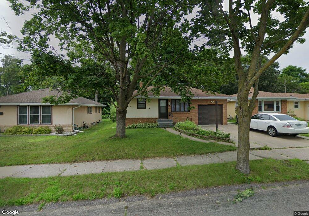
1605 1605 McAfee-street- St. Paul, MN 55106
Estimated Value: $279,000 - $319,000
3
Beds
2
Baths
864
Sq Ft
$347/Sq Ft
Est. Value
About This Home
This home is located at 1605 1605 McAfee-street-, St. Paul, MN 55106 and is currently estimated at $299,877, approximately $347 per square foot. 1605 1605 McAfee-street- is a home located in Ramsey County with nearby schools including Frost Lake Elementary School, Txuj Ci HMong Language and Culture Upper Campus, and Johnson Senior High School.
Ownership History
Date
Name
Owned For
Owner Type
Purchase Details
Closed on
Nov 22, 2023
Sold by
Stein Brea A and Stein Kee S
Bought by
Win Nai Soe and Myint Mi Win
Current Estimated Value
Home Financials for this Owner
Home Financials are based on the most recent Mortgage that was taken out on this home.
Original Mortgage
$249,750
Outstanding Balance
$245,629
Interest Rate
7.79%
Mortgage Type
New Conventional
Estimated Equity
$54,248
Purchase Details
Closed on
Nov 25, 2015
Sold by
Lang Amber and Lang Matt
Bought by
Stein Brea A and Davis Stein Kee S
Home Financials for this Owner
Home Financials are based on the most recent Mortgage that was taken out on this home.
Original Mortgage
$120,000
Interest Rate
3.78%
Mortgage Type
New Conventional
Purchase Details
Closed on
Oct 10, 2008
Sold by
Federal National Mortgage Association
Bought by
Thomas Amber
Create a Home Valuation Report for This Property
The Home Valuation Report is an in-depth analysis detailing your home's value as well as a comparison with similar homes in the area
Home Values in the Area
Average Home Value in this Area
Purchase History
| Date | Buyer | Sale Price | Title Company |
|---|---|---|---|
| Win Nai Soe | $270,000 | Titlesmart | |
| Stein Brea A | $150,000 | Burnet Title | |
| Thomas Amber | $112,900 | -- |
Source: Public Records
Mortgage History
| Date | Status | Borrower | Loan Amount |
|---|---|---|---|
| Open | Win Nai Soe | $249,750 | |
| Previous Owner | Stein Brea A | $120,000 |
Source: Public Records
Tax History Compared to Growth
Tax History
| Year | Tax Paid | Tax Assessment Tax Assessment Total Assessment is a certain percentage of the fair market value that is determined by local assessors to be the total taxable value of land and additions on the property. | Land | Improvement |
|---|---|---|---|---|
| 2025 | $3,668 | $270,300 | $30,000 | $240,300 |
| 2023 | $3,668 | $246,000 | $25,000 | $221,000 |
| 2022 | $3,272 | $271,200 | $25,000 | $246,200 |
| 2021 | $2,928 | $215,000 | $25,000 | $190,000 |
| 2020 | $2,864 | $201,100 | $13,600 | $187,500 |
| 2019 | $2,570 | $185,600 | $13,600 | $172,000 |
| 2018 | $2,384 | $166,800 | $13,600 | $153,200 |
| 2017 | $1,956 | $160,900 | $13,600 | $147,300 |
| 2016 | $1,950 | $0 | $0 | $0 |
| 2015 | $2,032 | $121,000 | $13,600 | $107,400 |
| 2014 | $1,454 | $0 | $0 | $0 |
Source: Public Records
Map
Nearby Homes
- 1639 Clarence St
- 1567 Atlantic St
- 1672 Manton St
- 1730 Atlantic St
- 1751 Clarence St
- 1714 Duluth St
- 1435 Price Ave
- 1450 Arlington Ave E
- 1532 Larpenteur Ave E
- 1377 Clarence St
- 1357 Birmingham St
- 1870 Clarence St
- 1869 Birmingham St
- 1583 Nevada Ave E
- 1607 Hoyt Ave E
- 1854 Barclay St
- 1627 Christie Place
- 1637 Iowa Ave E
- 866 Clear Ave E
- 1844 E Shore Dr
- 1605 Mcafee St
- 1609 Mcafee St
- 1599 Mcafee St
- 1615 Mcafee St
- 1595 Mcafee St
- 1619 Mcafee St
- 1589 Mcafee St
- 1606 Mcafee St
- 1598 Mcafee St
- 1598 1598 McAfee-street-
- 1614 Mcafee St
- 1616 Mcafee St
- 1592 Mcafee St
- 1585 Mcafee St
- 1602 English St
- 1614 English St
- 1588 Mcafee St
- 1620 Mcafee St
- 1594 N English St Unit 1S
- 1594 N English St