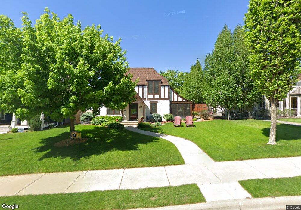
1605 Beechwood Ave Saint Paul, MN 55116
Highland Park NeighborhoodEstimated Value: $917,979 - $1,005,000
4
Beds
4
Baths
2,524
Sq Ft
$383/Sq Ft
Est. Value
About This Home
This home is located at 1605 Beechwood Ave, Saint Paul, MN 55116 and is currently estimated at $965,995, approximately $382 per square foot. 1605 Beechwood Ave is a home located in Ramsey County with nearby schools including Expo for Excellence Elementary School, Highland Park Middle School, and Highland Park Senior High.
Ownership History
Date
Name
Owned For
Owner Type
Purchase Details
Closed on
Jun 29, 2018
Sold by
Broadhead Dean L and Broadhead Cheri L
Bought by
Sherwood Michelle and Sherwood Andrew
Current Estimated Value
Home Financials for this Owner
Home Financials are based on the most recent Mortgage that was taken out on this home.
Original Mortgage
$600,000
Outstanding Balance
$519,990
Interest Rate
4.5%
Mortgage Type
New Conventional
Estimated Equity
$446,005
Purchase Details
Closed on
Apr 30, 2003
Sold by
Olson Daniel and Olson Jill
Bought by
Broadhead Dean and Broadhead Cheri L
Purchase Details
Closed on
Aug 15, 1997
Sold by
Ubel Frank Andrew and Ubel Margaret L
Bought by
Olson Daniel and Olson Jill
Create a Home Valuation Report for This Property
The Home Valuation Report is an in-depth analysis detailing your home's value as well as a comparison with similar homes in the area
Home Values in the Area
Average Home Value in this Area
Purchase History
| Date | Buyer | Sale Price | Title Company |
|---|---|---|---|
| Sherwood Michelle | $750,000 | Burnet Title | |
| Broadhead Dean | $349,900 | -- | |
| Olson Daniel | $189,000 | -- |
Source: Public Records
Mortgage History
| Date | Status | Borrower | Loan Amount |
|---|---|---|---|
| Open | Sherwood Michelle | $600,000 |
Source: Public Records
Tax History Compared to Growth
Tax History
| Year | Tax Paid | Tax Assessment Tax Assessment Total Assessment is a certain percentage of the fair market value that is determined by local assessors to be the total taxable value of land and additions on the property. | Land | Improvement |
|---|---|---|---|---|
| 2025 | $14,000 | $893,900 | $152,300 | $741,600 |
| 2023 | $14,000 | $842,400 | $152,300 | $690,100 |
| 2022 | $11,906 | $739,500 | $152,300 | $587,200 |
| 2021 | $11,724 | $696,500 | $152,300 | $544,200 |
| 2020 | $11,508 | $709,600 | $152,300 | $557,300 |
| 2019 | $10,026 | $654,000 | $152,300 | $501,700 |
| 2018 | $9,638 | $575,100 | $152,300 | $422,800 |
| 2017 | $9,314 | $553,600 | $152,300 | $401,300 |
| 2016 | $9,080 | $0 | $0 | $0 |
| 2015 | $9,740 | $510,900 | $131,300 | $379,600 |
| 2014 | $8,934 | $0 | $0 | $0 |
Source: Public Records
Map
Nearby Homes
- 1647 Montreal Ave
- 1705 Ford Pkwy
- 1759 Montreal Ave
- 1712 Highland Pkwy
- 1776 Ford Pkwy
- 1778 Ford Pkwy
- 2040 Edgcumbe Rd
- 1841 W Saunders Ave
- 1022 Fairview Ave S
- 1846 Saunders Ave
- 1501 Eleanor Ave
- 1625 Scheffer Ave
- 1756 Eleanor Ave
- 2135 Lower Saint Dennis Rd
- 633 Saratoga St S
- 1631 Bayard Ave
- 1857 Ford Pkwy
- 1886 Rome Ave
- 1856 Highland Pkwy
- 1368 Eleanor Ave
- 1601 Beechwood Ave
- 1611 Beechwood Ave
- 1595 Beechwood Ave
- 1615 Beechwood Ave
- 1600 Bohland Ave
- 1608 Bohland Ave
- 1587 Beechwood Ave
- 1594 Bohland Ave
- 1614 Bohland Ave
- 1604 Beechwood Ave
- 1610 Beechwood Ave
- 1596 Beechwood Ave
- 1625 Beechwood Ave
- 1588 Bohland Ave
- 1622 Bohland Ave
- 1581 Beechwood Ave
- 1616 Beechwood Ave
- 1590 Beechwood Ave
- 1631 Beechwood Ave
- 1622 Beechwood Ave