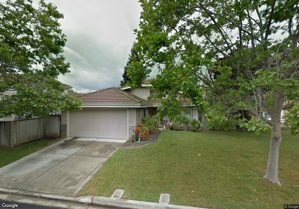
1605 Lindbergh Dr Concord, CA 94521
Crestwood NeighborhoodEstimated Value: $795,941 - $851,000
3
Beds
2
Baths
1,320
Sq Ft
$630/Sq Ft
Est. Value
About This Home
This home is located at 1605 Lindbergh Dr, Concord, CA 94521 and is currently estimated at $831,235, approximately $629 per square foot. 1605 Lindbergh Dr is a home located in Contra Costa County with nearby schools including Westwood Elementary School, El Dorado Middle School, and Concord High School.
Ownership History
Date
Name
Owned For
Owner Type
Purchase Details
Closed on
Nov 6, 2019
Sold by
Mitchell Natalie A
Bought by
Tello Maria
Current Estimated Value
Home Financials for this Owner
Home Financials are based on the most recent Mortgage that was taken out on this home.
Original Mortgage
$589,950
Interest Rate
3.6%
Mortgage Type
New Conventional
Purchase Details
Closed on
Mar 29, 2017
Sold by
Mitchell Michael W
Bought by
Mitchell Natalie A
Purchase Details
Closed on
Mar 7, 2016
Sold by
Benson Susan L
Bought by
Mitchell Michael W and Mitchell Natalie A
Home Financials for this Owner
Home Financials are based on the most recent Mortgage that was taken out on this home.
Original Mortgage
$250,500
Interest Rate
3.79%
Mortgage Type
New Conventional
Purchase Details
Closed on
Jan 21, 2015
Sold by
Benson Susan L
Bought by
Benson Susan L
Purchase Details
Closed on
May 28, 2004
Sold by
Benson Lawrence F and Benson Susan L
Bought by
Benson Lawrence F and Benson Susan L
Home Financials for this Owner
Home Financials are based on the most recent Mortgage that was taken out on this home.
Original Mortgage
$242,000
Interest Rate
4.87%
Mortgage Type
Unknown
Purchase Details
Closed on
Mar 30, 2004
Sold by
Benson Lawrence F and Benson Susan L
Bought by
Benson Lawrence F and Benson Susan L
Home Financials for this Owner
Home Financials are based on the most recent Mortgage that was taken out on this home.
Original Mortgage
$242,000
Interest Rate
4.87%
Mortgage Type
Unknown
Purchase Details
Closed on
Jan 14, 2003
Sold by
Benson Lawrence F and Benson Susan L
Bought by
Benson Lawrence F and Benson Susan L
Home Financials for this Owner
Home Financials are based on the most recent Mortgage that was taken out on this home.
Original Mortgage
$242,000
Interest Rate
6.28%
Mortgage Type
Unknown
Purchase Details
Closed on
Dec 16, 1998
Sold by
Benson Larry F and Benson Susan L
Bought by
Benson Lawrence F and Benson Susan L
Create a Home Valuation Report for This Property
The Home Valuation Report is an in-depth analysis detailing your home's value as well as a comparison with similar homes in the area
Home Values in the Area
Average Home Value in this Area
Purchase History
| Date | Buyer | Sale Price | Title Company |
|---|---|---|---|
| Tello Maria | $621,000 | Old Republic Title Company | |
| Mitchell Natalie A | -- | None Available | |
| Mitchell Michael W | $525,000 | Old Republic Title Company | |
| Benson Susan L | -- | None Available | |
| Benson Lawrence F | -- | -- | |
| Benson Lawrence F | -- | -- | |
| Benson Lawrence F | -- | Old Republic Title | |
| Benson Lawrence F | -- | -- |
Source: Public Records
Mortgage History
| Date | Status | Borrower | Loan Amount |
|---|---|---|---|
| Open | Tello Maria | $585,000 | |
| Closed | Tello Maria | $589,950 | |
| Previous Owner | Mitchell Michael W | $200,000 | |
| Previous Owner | Mitchell Michael W | $250,500 | |
| Previous Owner | Benson Lawrence F | $209,100 | |
| Previous Owner | Benson Lawrence F | $242,000 | |
| Previous Owner | Benson Lawrence F | $242,000 |
Source: Public Records
Tax History Compared to Growth
Tax History
| Year | Tax Paid | Tax Assessment Tax Assessment Total Assessment is a certain percentage of the fair market value that is determined by local assessors to be the total taxable value of land and additions on the property. | Land | Improvement |
|---|---|---|---|---|
| 2025 | $8,285 | $679,150 | $382,774 | $296,376 |
| 2024 | $8,132 | $665,834 | $375,269 | $290,565 |
| 2023 | $8,132 | $652,779 | $367,911 | $284,868 |
| 2022 | $8,026 | $639,981 | $360,698 | $279,283 |
| 2021 | $7,831 | $627,433 | $353,626 | $273,807 |
| 2019 | $7,099 | $557,133 | $318,362 | $238,771 |
| 2018 | $6,831 | $546,210 | $312,120 | $234,090 |
| 2017 | $6,604 | $535,500 | $306,000 | $229,500 |
| 2016 | $3,424 | $252,529 | $128,985 | $123,544 |
| 2015 | $3,365 | $248,737 | $127,048 | $121,689 |
| 2014 | $3,287 | $243,866 | $124,560 | $119,306 |
Source: Public Records
Map
Nearby Homes
- 4048 Chestnut Ave
- 4044 Chestnut Ave
- 4020 Salem St
- 4022 Wilson Ln
- 1579 West St
- 1693 Greentree Dr
- 4067 Lillian Dr
- 1685 Westchester Place
- 4081 Clayton Rd Unit 117
- 4081 Clayton Rd Unit 328
- 4023 Roland Dr
- 1712 Pepperwood Ct
- 4260 Clayton Rd Unit 65
- 1540 Farm Bureau Rd
- 3901 Clayton Rd Unit 57
- 1604 Chestnut Ct
- 4161 Huckleberry Dr
- 3745 Clayton Rd
- 1739 Sapling Ct Unit A
- 1561 Farm Bureau Rd
- 1609 Lindbergh Dr
- 4015 Denver St
- 4009 Denver St
- 1604 West St
- 1604 Lindbergh Dr
- 1613 Lindbergh Dr
- 1608 West St
- 1608 Lindbergh Dr
- 1600 Lindbergh Dr
- 1612 West St
- 1612 Lindbergh Dr
- 1617 Lindbergh Dr
- 4027 Salem St
- 4033 Salem St
- 4008 Denver St
- 4014 Denver St
- 4002 Denver St
- 4020 Denver St
- 4014 Earhart Dr
- 4008 Earhart Dr