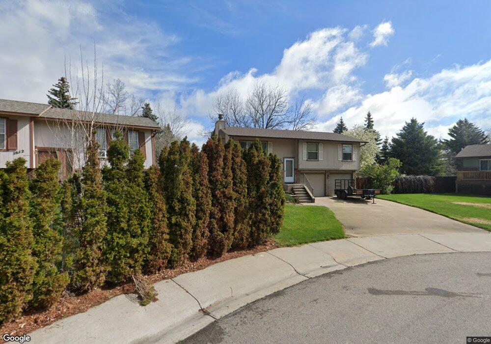
1606 Hanover Ct Fort Collins, CO 80526
Estimated Value: $529,307 - $572,000
3
Beds
3
Baths
1,718
Sq Ft
$320/Sq Ft
Est. Value
About This Home
This home is located at 1606 Hanover Ct, Fort Collins, CO 80526 and is currently estimated at $549,827, approximately $320 per square foot. 1606 Hanover Ct is a home located in Larimer County with nearby schools including Bennett Elementary School, Blevins Middle School, and Rocky Mountain High School.
Ownership History
Date
Name
Owned For
Owner Type
Purchase Details
Closed on
Feb 15, 2022
Sold by
Coleman Jeanne M
Bought by
Dj Coleman Trust
Current Estimated Value
Purchase Details
Closed on
Dec 3, 2007
Sold by
Mitchell David L and Testamentary Trust U/W/O Betty
Bought by
Coleman Jeanne M
Purchase Details
Closed on
Feb 22, 2006
Sold by
Coleman Douglas E and Estate Of Betty J Asmus
Bought by
Testamentary Trust Of Betty J Asmus
Purchase Details
Closed on
Jun 1, 1994
Sold by
Coleman Jeanne M Asmus
Bought by
Asmus Betty J
Create a Home Valuation Report for This Property
The Home Valuation Report is an in-depth analysis detailing your home's value as well as a comparison with similar homes in the area
Home Values in the Area
Average Home Value in this Area
Purchase History
| Date | Buyer | Sale Price | Title Company |
|---|---|---|---|
| Dj Coleman Trust | -- | None Listed On Document | |
| Coleman Jeanne M | -- | None Available | |
| Testamentary Trust Of Betty J Asmus | -- | None Available | |
| Asmus Betty J | -- | -- |
Source: Public Records
Tax History Compared to Growth
Tax History
| Year | Tax Paid | Tax Assessment Tax Assessment Total Assessment is a certain percentage of the fair market value that is determined by local assessors to be the total taxable value of land and additions on the property. | Land | Improvement |
|---|---|---|---|---|
| 2025 | $3,059 | $35,564 | $2,680 | $32,884 |
| 2024 | $2,910 | $35,564 | $2,680 | $32,884 |
| 2022 | $2,371 | $25,110 | $2,780 | $22,330 |
| 2021 | $2,396 | $25,833 | $2,860 | $22,973 |
| 2020 | $2,397 | $25,618 | $2,860 | $22,758 |
| 2019 | $2,407 | $25,618 | $2,860 | $22,758 |
| 2018 | $1,920 | $21,067 | $2,880 | $18,187 |
| 2017 | $1,913 | $21,067 | $2,880 | $18,187 |
| 2016 | $1,657 | $18,149 | $3,184 | $14,965 |
| 2015 | $1,645 | $18,140 | $3,180 | $14,960 |
| 2014 | $1,449 | $15,880 | $3,180 | $12,700 |
Source: Public Records
Map
Nearby Homes
- 2613 Hanover Dr
- 2109 W Drake Rd
- 2706 Dunbar Ave
- 2718 Dunbar Ave
- 1757 Concord Dr
- 1419 Glen Haven Dr
- 2738 Bradford Square
- 1905 Yorktown Ave
- 2420 Sheffield Cir E
- 2855 Trenton Way
- 2828 Silverplume Dr
- 2828 Silverplume Dr Unit R3
- 2404 Sheffield Cir E
- 2918 Silverplume Dr Unit C1
- 1601 W Swallow Rd Unit 1
- 1601 W Swallow Rd Unit 9
- 1601 W Swallow Rd
- 2800 S Taft Hill Rd
- 1531 W Swallow Rd Unit 25
- 1531 W Swallow Rd Unit 28
- 1600 Hanover Ct
- 2606 Hanover Dr
- 1612 Hanover Ct
- 1601 Hanover Ct
- 2600 Hanover Dr
- 1607 Hanover Ct
- 1613 Hanover Ct
- 2607 Hanover Dr
- 1619 Hanover Ct
- 2619 Hanover Dr
- 1642 Hastings Dr
- 1648 Hastings Dr
- 1654 Hastings Dr
- 1636 Hastings Dr
- 2625 Hanover Dr
- 1660 Hastings Dr
- 1630 Hastings Dr
- 2631 Hanover Dr
- 1624 Hastings Dr
- 1618 Hastings Dr