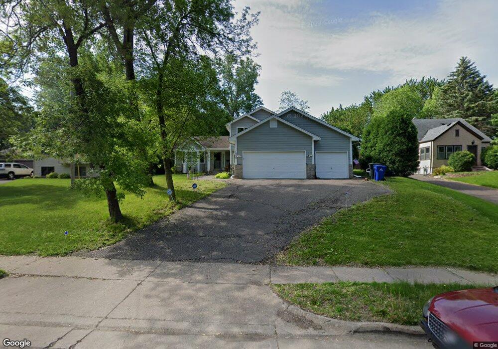
1608 Burns Ave Saint Paul, MN 55106
Battle Creek NeighborhoodEstimated Value: $316,000 - $368,304
3
Beds
3
Baths
1,212
Sq Ft
$286/Sq Ft
Est. Value
About This Home
This home is located at 1608 Burns Ave, Saint Paul, MN 55106 and is currently estimated at $346,576, approximately $285 per square foot. 1608 Burns Ave is a home located in Ramsey County with nearby schools including Highwood Hills Elementary School, Battle Creek Middle School, and Harding Senior High School.
Ownership History
Date
Name
Owned For
Owner Type
Purchase Details
Closed on
Oct 3, 2017
Sold by
Randolph Marvin
Bought by
Sevilla Martinez Miguel A and Rojas Maria Elizabeth
Current Estimated Value
Home Financials for this Owner
Home Financials are based on the most recent Mortgage that was taken out on this home.
Original Mortgage
$214,829
Outstanding Balance
$179,250
Interest Rate
3.78%
Mortgage Type
FHA
Estimated Equity
$167,326
Purchase Details
Closed on
Feb 24, 2014
Sold by
Randolph Toni and Neeley Percy Quintin
Bought by
Randolph Toni and Neely Percy Quintin
Purchase Details
Closed on
May 29, 1998
Sold by
Anderson Shane and Anderson Lori
Bought by
Thembi Tillman N and Jamal Tillman D
Create a Home Valuation Report for This Property
The Home Valuation Report is an in-depth analysis detailing your home's value as well as a comparison with similar homes in the area
Home Values in the Area
Average Home Value in this Area
Purchase History
| Date | Buyer | Sale Price | Title Company |
|---|---|---|---|
| Sevilla Martinez Miguel A | $219,000 | None Available | |
| Martinez Miguel A Sevilla | $219,000 | None Available | |
| Randolph Toni | $515 | Bankers Title | |
| Thembi Tillman N | $134,000 | -- | |
| Thembi Tillman N | $134,000 | -- |
Source: Public Records
Mortgage History
| Date | Status | Borrower | Loan Amount |
|---|---|---|---|
| Open | Martinez Miguel A Sevilla | $214,829 | |
| Closed | Sevilla Martinez Miguel A | $214,829 |
Source: Public Records
Tax History Compared to Growth
Tax History
| Year | Tax Paid | Tax Assessment Tax Assessment Total Assessment is a certain percentage of the fair market value that is determined by local assessors to be the total taxable value of land and additions on the property. | Land | Improvement |
|---|---|---|---|---|
| 2025 | $5,022 | $357,200 | $65,800 | $291,400 |
| 2023 | $5,022 | $329,300 | $40,900 | $288,400 |
| 2022 | $4,648 | $325,800 | $40,900 | $284,900 |
| 2021 | $4,014 | $280,900 | $40,900 | $240,000 |
| 2020 | $3,720 | $258,100 | $40,900 | $217,200 |
| 2019 | $3,556 | $233,300 | $40,900 | $192,400 |
| 2018 | $3,142 | $220,900 | $40,900 | $180,000 |
| 2017 | $3,330 | $203,500 | $40,900 | $162,600 |
| 2016 | $3,166 | $0 | $0 | $0 |
| 2015 | $3,180 | $204,000 | $40,900 | $163,100 |
| 2014 | $2,976 | $0 | $0 | $0 |
Source: Public Records
Map
Nearby Homes
- 237 Sigurd St
- 267 Hazelwood St
- 201 Dora Ct W
- 1747 Louise Ave
- 1600 Old Hudson Rd
- 1538 Wilson Ave
- 125 Battle Creek Place
- 136 White Bear Ave N
- 49 Battle Creek Place
- 244 Point Douglas Rd N
- 1333 Pacific St
- 1821 Wilson Ave
- 271 English St
- 1935 Warbler Ln
- 500 Etna St Unit 104
- 1685 Fremont Ave
- 1320 Wilson Ave
- 1450 Fremont Ave
- 1257 Wilson Ave
- 1989 N Park Dr
- 1604 Burns Ave
- 1610 Burns Ave
- 1586 Burns Ave
- 1614 Burns Ave
- 1580 Burns Ave
- 1561 Leone Ave
- 1618 Burns Ave
- 1579 Leone Ave
- 1555 Leone Ave
- 1555 1555 Leone Ave
- 1583 Leone Ave
- 1597 Burns Ave
- 1607 Burns Ave
- 1589 Leone Ave
- 1591 Burns Ave
- 1551 Leone Ave
- 1572 Burns Ave
- 1622 Burns Ave
- 1615 Burns Ave
- 1583 Burns Ave