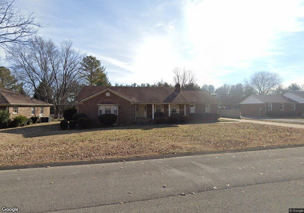
1609 Redbud Dr Murfreesboro, TN 37128
Estimated Value: $370,000 - $448,000
Studio
2
Baths
1,790
Sq Ft
$230/Sq Ft
Est. Value
About This Home
This home is located at 1609 Redbud Dr, Murfreesboro, TN 37128 and is currently estimated at $412,211, approximately $230 per square foot. 1609 Redbud Dr is a home located in Rutherford County with nearby schools including Barfield Elementary School, Cason Lane Academy, and Rockvale Middle School.
Ownership History
Date
Name
Owned For
Owner Type
Purchase Details
Closed on
Aug 30, 2001
Sold by
Lasalle National Bank
Bought by
Lovejoy Jae T
Current Estimated Value
Home Financials for this Owner
Home Financials are based on the most recent Mortgage that was taken out on this home.
Original Mortgage
$57,000
Interest Rate
6.98%
Purchase Details
Closed on
Dec 5, 2000
Sold by
Eta Bennett and Eta Dora
Bought by
Salomon Brothers Mortgage
Purchase Details
Closed on
May 18, 1995
Sold by
Frierson Kevrek M
Bought by
Deloris Frierson Wanda
Create a Home Valuation Report for This Property
The Home Valuation Report is an in-depth analysis detailing your home's value as well as a comparison with similar homes in the area
Home Values in the Area
Average Home Value in this Area
Purchase History
| Date | Buyer | Sale Price | Title Company |
|---|---|---|---|
| Lovejoy Jae T | $102,000 | -- | |
| Salomon Brothers Mortgage | $72,000 | -- | |
| Deloris Frierson Wanda | -- | -- |
Source: Public Records
Mortgage History
| Date | Status | Borrower | Loan Amount |
|---|---|---|---|
| Closed | Deloris Frierson Wanda | $57,000 |
Source: Public Records
Tax History
| Year | Tax Paid | Tax Assessment Tax Assessment Total Assessment is a certain percentage of the fair market value that is determined by local assessors to be the total taxable value of land and additions on the property. | Land | Improvement |
|---|---|---|---|---|
| 2025 | $2,316 | $81,875 | $13,750 | $68,125 |
| 2024 | $2,316 | $81,875 | $13,750 | $68,125 |
| 2023 | $1,536 | $81,875 | $13,750 | $68,125 |
| 2022 | $1,323 | $81,875 | $13,750 | $68,125 |
| 2021 | $1,230 | $55,425 | $10,625 | $44,800 |
| 2020 | $1,230 | $55,425 | $10,625 | $44,800 |
| 2019 | $1,230 | $55,425 | $10,625 | $44,800 |
| 2018 | $1,690 | $55,425 | $0 | $0 |
| 2017 | $1,556 | $40,050 | $0 | $0 |
| 2016 | $1,556 | $40,050 | $0 | $0 |
| 2015 | $1,556 | $40,050 | $0 | $0 |
| 2014 | $996 | $40,050 | $0 | $0 |
| 2013 | -- | $36,800 | $0 | $0 |
Source: Public Records
Map
Nearby Homes
- 510 Iris Ave
- 711 Warrior Dr
- 465 Warrior Dr Unit 2
- 953 Warrior Dr
- 2417 New Holland Cir
- 2413 New Holland Cir
- 2354 New Holland Cir
- 416 Kubota Dr
- 411 Kubota Dr
- 2323 New Holland Cir
- 2638 Merchants Walk
- 306 Arapaho Dr
- 304 Arapaho Dr
- 260 Arapaho Dr
- 210 Seminole St
- 622 Driftstone Ln
- 2511 Havenstone Ln
- 618 Driftstone Ln
- 2507 Havenstone Ln
- 245 Shoshone Place
Your Personal Tour Guide
Ask me questions while you tour the home.