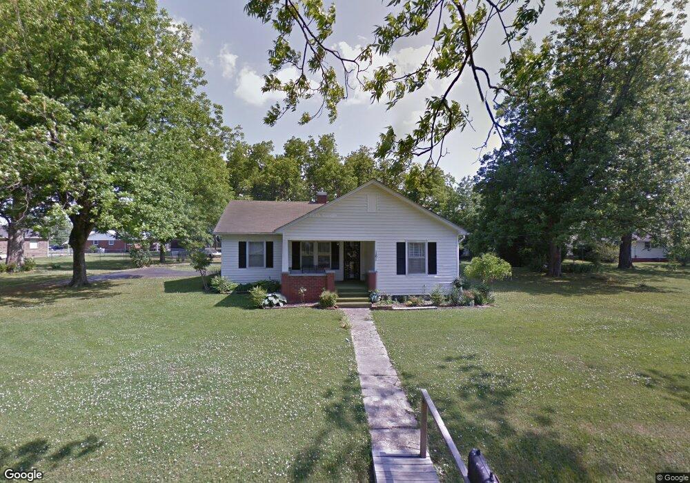
161 Prather Ln Union City, TN 38261
Estimated Value: $101,000 - $148,000
--
Bed
1
Bath
1,154
Sq Ft
$101/Sq Ft
Est. Value
About This Home
This home is located at 161 Prather Ln, Union City, TN 38261 and is currently estimated at $116,023, approximately $100 per square foot. 161 Prather Ln is a home located in Obion County.
Ownership History
Date
Name
Owned For
Owner Type
Purchase Details
Closed on
Jul 25, 2024
Sold by
Prather Jessica
Bought by
Prather Jessica and Wirgau Ashlee
Current Estimated Value
Purchase Details
Closed on
Jun 19, 2019
Sold by
Prather Carolyn
Bought by
Prather Jessica
Home Financials for this Owner
Home Financials are based on the most recent Mortgage that was taken out on this home.
Original Mortgage
$84,490
Interest Rate
4%
Mortgage Type
Commercial
Purchase Details
Closed on
Jun 10, 2004
Bought by
Prather Carolyn
Purchase Details
Closed on
Nov 13, 2003
Bought by
Prather Carolyn
Purchase Details
Closed on
Aug 28, 1956
Bought by
Prather James W and Prather Carolyn
Purchase Details
Closed on
Jan 1, 1956
Create a Home Valuation Report for This Property
The Home Valuation Report is an in-depth analysis detailing your home's value as well as a comparison with similar homes in the area
Home Values in the Area
Average Home Value in this Area
Purchase History
| Date | Buyer | Sale Price | Title Company |
|---|---|---|---|
| Prather Jessica | -- | None Listed On Document | |
| Prather Jessica | $50,000 | -- | |
| Prather Carolyn | -- | -- | |
| Prather Carolyn | -- | -- | |
| Prather James W | -- | -- | |
| -- | -- | -- |
Source: Public Records
Mortgage History
| Date | Status | Borrower | Loan Amount |
|---|---|---|---|
| Previous Owner | Prather Jessica | $84,490 |
Source: Public Records
Tax History Compared to Growth
Tax History
| Year | Tax Paid | Tax Assessment Tax Assessment Total Assessment is a certain percentage of the fair market value that is determined by local assessors to be the total taxable value of land and additions on the property. | Land | Improvement |
|---|---|---|---|---|
| 2025 | -- | $22,025 | $0 | $0 |
| 2024 | -- | $22,025 | $2,200 | $19,825 |
| 2023 | $432 | $22,025 | $2,200 | $19,825 |
| 2022 | $327 | $11,700 | $2,200 | $9,500 |
| 2021 | $310 | $11,700 | $2,200 | $9,500 |
| 2020 | $306 | $11,550 | $2,200 | $9,350 |
| 2019 | $291 | $11,550 | $2,200 | $9,350 |
| 2018 | $292 | $11,550 | $2,200 | $9,350 |
| 2017 | $299 | $11,300 | $2,200 | $9,100 |
| 2016 | $299 | $11,300 | $2,200 | $9,100 |
| 2015 | $300 | $11,300 | $2,200 | $9,100 |
| 2014 | $300 | $11,300 | $2,200 | $9,100 |
Source: Public Records
Map
Nearby Homes
- 370 S Thompson St
- 1535 Lattus Ln
- 874 Gum St
- 915 Gum St
- 560 Todd Thomas Rd
- 3611 W Main St
- 0 Burrus Rd
- 3412 Lakeview Dr
- 3305 Cottonwood Dr
- 5680 Floyd Shuck Rd
- 3694 Pete Gray Rd
- 4478 Crystal Rd
- Tract 1 Walter Whipple Rd
- 604 Denver Dr
- 2703 Salem Dr
- 210 Graham St
- 72 W Highway 22
- 2235 Bel Air Cir
- 317 W Highway 22
- 1433 E County Home Rd
- 212 W Jones St
- 223 S Thompson St
- 236 W Jones St
- 237 S Thompson St
- 235 S Thompson St
- 120 Prather Ln
- 176 W Jones St
- 158 Hudson St
- 186 Hudson St
- 259 S Thompson St
- 260 W Jones St
- 161 S Thompson St
- 160 W Jones St
- 160 W Jones St
- 208 S Thompson St
- 194 S Thompson St
- 243 W Jones St
- 276 S Thompson St
- 151 S Thompson St
- 176 S Thompson St