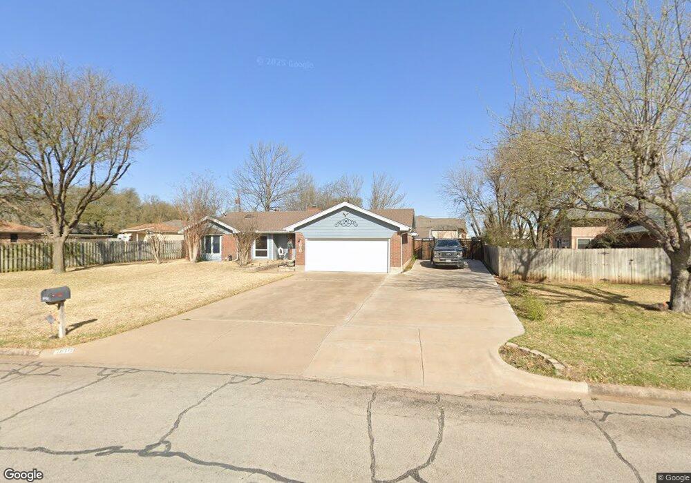
1610 Danny Ray Dr Cleburne, TX 76033
Estimated Value: $302,000 - $375,000
3
Beds
2
Baths
1,936
Sq Ft
$181/Sq Ft
Est. Value
About This Home
This home is located at 1610 Danny Ray Dr, Cleburne, TX 76033 and is currently estimated at $350,872, approximately $181 per square foot. 1610 Danny Ray Dr is a home located in Johnson County with nearby schools including Gerard Elementary School, Lowell Smith Jr. Middle School, and Cleburne High School.
Ownership History
Date
Name
Owned For
Owner Type
Purchase Details
Closed on
Aug 28, 2015
Sold by
Redding James C and Redding Patricia
Bought by
Oswalt William Lee and Oswalt Gwyn Dawn
Current Estimated Value
Purchase Details
Closed on
Sep 18, 2007
Sold by
Bass David R and Bass Jessica
Bought by
Redding James C and Redding Patricia
Home Financials for this Owner
Home Financials are based on the most recent Mortgage that was taken out on this home.
Original Mortgage
$110,400
Interest Rate
6.63%
Mortgage Type
New Conventional
Purchase Details
Closed on
Dec 6, 2005
Sold by
Sandles Henry and Sandles Karen F
Bought by
Bass David R and Bass Jessica
Home Financials for this Owner
Home Financials are based on the most recent Mortgage that was taken out on this home.
Original Mortgage
$125,352
Interest Rate
6.29%
Mortgage Type
FHA
Create a Home Valuation Report for This Property
The Home Valuation Report is an in-depth analysis detailing your home's value as well as a comparison with similar homes in the area
Home Values in the Area
Average Home Value in this Area
Purchase History
| Date | Buyer | Sale Price | Title Company |
|---|---|---|---|
| Oswalt William Lee | -- | Capital Title | |
| Redding James C | -- | Fatco | |
| Bass David R | -- | Fatco |
Source: Public Records
Mortgage History
| Date | Status | Borrower | Loan Amount |
|---|---|---|---|
| Previous Owner | Redding James C | $110,400 | |
| Previous Owner | Bass David R | $125,352 |
Source: Public Records
Tax History
| Year | Tax Paid | Tax Assessment Tax Assessment Total Assessment is a certain percentage of the fair market value that is determined by local assessors to be the total taxable value of land and additions on the property. | Land | Improvement |
|---|---|---|---|---|
| 2025 | $3,894 | $387,651 | $59,000 | $328,651 |
| 2024 | $6,136 | $275,187 | $0 | $0 |
| 2023 | $4,177 | $387,651 | $59,000 | $328,651 |
| 2022 | $5,692 | $243,163 | $40,750 | $202,413 |
| 2021 | $5,394 | $243,163 | $40,750 | $202,413 |
| 2020 | $5,208 | $211,105 | $30,000 | $181,105 |
| 2019 | $5,049 | $172,139 | $30,000 | $142,139 |
| 2018 | $4,592 | $168,416 | $32,000 | $136,416 |
| 2017 | $4,157 | $168,416 | $32,000 | $136,416 |
| 2016 | $3,779 | $128,376 | $22,000 | $106,376 |
Source: Public Records
Map
Nearby Homes
- 1608 Quail Hollow
- 703 Brandon Dr
- 400 Meadow View Dr
- 1607 W Westhill Dr
- 703 Dripping Springs Ln
- 1907 Heritage Ct
- 810 Chestnut Grove Dr
- 1605 Heather Ct
- 812 Sugar Hill Ave
- 1503 W Westhill Dr
- 101 Goodnight Ct
- 1900 W Westhill Dr
- 1905 Cherokee Ln
- 1902 W Westhill Dr
- 1911 Cherokee Ln
- 1906 Cherokee Ln
- 904 Meadow View Dr
- 906 Chestnut Grove Dr
- 1908 Cherokee Ln
- 1910 Cherokee Ln
- 1608 Danny Ray Dr
- 409 Rolling Hill Dr
- 411 Rolling Hill Dr
- 407 Rolling Hill Dr
- 1606 Danny Ray Dr
- 1611 Danny Ray Dr
- 1609 Danny Ray Dr
- 1613 Danny Ray Dr
- 405 Rolling Hill Dr
- 410 Rolling Hill Dr
- 408 Rolling Hill Dr
- 1607 Danny Ray Dr
- 412 Rolling Hill Dr
- 1604 Danny Ray Dr
- 1701 Danny Ray Dr
- 406 Rolling Hill Dr
- 1605 Danny Ray Dr
- 403 Rolling Hill Dr
- 1700 Quail Hollow
- 706 Misty Ln
Your Personal Tour Guide
Ask me questions while you tour the home.