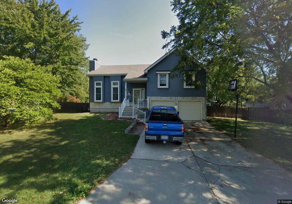
1610 NE Baron Dr Lees Summit, MO 64086
Estimated Value: $284,000 - $357,000
3
Beds
3
Baths
1,500
Sq Ft
$215/Sq Ft
Est. Value
About This Home
This home is located at 1610 NE Baron Dr, Lees Summit, MO 64086 and is currently estimated at $322,067, approximately $214 per square foot. 1610 NE Baron Dr is a home located in Jackson County with nearby schools including Bernard C. Campbell Middle School and Lee's Summit North High School.
Ownership History
Date
Name
Owned For
Owner Type
Purchase Details
Closed on
Feb 25, 2008
Sold by
Murray Michael J and Murray Vikki L
Bought by
Bovee Joshua N and Bovee Erin E
Current Estimated Value
Home Financials for this Owner
Home Financials are based on the most recent Mortgage that was taken out on this home.
Original Mortgage
$149,600
Outstanding Balance
$92,471
Interest Rate
5.68%
Mortgage Type
Purchase Money Mortgage
Estimated Equity
$229,596
Purchase Details
Closed on
Aug 20, 2001
Sold by
Mcnally Marc W and Mcnally Lisa A
Bought by
Murray Michael J and Acklie Vikki L
Home Financials for this Owner
Home Financials are based on the most recent Mortgage that was taken out on this home.
Original Mortgage
$126,129
Interest Rate
7.16%
Mortgage Type
Purchase Money Mortgage
Purchase Details
Closed on
Jul 18, 1996
Sold by
Myers James E and Myers Kathryn E
Bought by
Mcnally Marc W
Home Financials for this Owner
Home Financials are based on the most recent Mortgage that was taken out on this home.
Original Mortgage
$93,100
Interest Rate
8.33%
Mortgage Type
FHA
Create a Home Valuation Report for This Property
The Home Valuation Report is an in-depth analysis detailing your home's value as well as a comparison with similar homes in the area
Home Values in the Area
Average Home Value in this Area
Purchase History
| Date | Buyer | Sale Price | Title Company |
|---|---|---|---|
| Bovee Joshua N | -- | Kansas City Title | |
| Murray Michael J | -- | Stewart Title | |
| Mcnally Marc W | -- | Stewart Title |
Source: Public Records
Mortgage History
| Date | Status | Borrower | Loan Amount |
|---|---|---|---|
| Open | Bovee Joshua N | $149,600 | |
| Previous Owner | Murray Michael J | $126,129 | |
| Previous Owner | Mcnally Marc W | $93,100 |
Source: Public Records
Tax History
| Year | Tax Paid | Tax Assessment Tax Assessment Total Assessment is a certain percentage of the fair market value that is determined by local assessors to be the total taxable value of land and additions on the property. | Land | Improvement |
|---|---|---|---|---|
| 2025 | $2,968 | $46,987 | $9,449 | $37,538 |
| 2024 | $2,947 | $41,107 | $7,971 | $33,136 |
| 2023 | $2,947 | $41,106 | $6,874 | $34,232 |
| 2022 | $2,868 | $35,530 | $7,182 | $28,348 |
| 2021 | $2,928 | $35,530 | $7,182 | $28,348 |
| 2020 | $2,762 | $33,196 | $7,182 | $26,014 |
| 2019 | $2,687 | $33,196 | $7,182 | $26,014 |
| 2018 | $2,430 | $27,861 | $3,156 | $24,705 |
| 2016 | $2,317 | $26,296 | $3,914 | $22,382 |
Source: Public Records
Map
Nearby Homes
- 1707 NE Duchess Dr
- 1611 NE Duchess Dr
- 1613 NE Misty Ln
- 1625 NE Debonair Dr
- 616 NE Michael Dr
- 408 NE Deerfield Ct
- 617 NE Birchwood Dr
- 1941 NE Patterson Dr
- 116 NE Greystone Dr
- 1325 NE Foxwood Dr
- 1833 NE Ravenwood Dr
- 1000 NE Brookfield Dr
- 1345 NE Foxwood Dr
- 905 NE Country Ln
- 100 NE Keystone Dr
- 405 NE Dogwood Ln
- 1700 NE Bluff St
- 1708 NE Bluff St
- 1704 NE Bluff St
- 1029 NE Brookfield Dr
- 31301 Pollard Place
- 31212 Pollard Place
- 31106 Pollard Place
- 603 NE Bordner Dr
- 1614 NE Baron Dr
- 511 NE Bordner Dr
- 600 NE Bordner Dr
- 602 NE Bordner Dr
- 1702 NE Duchess Dr
- 528 NE Bordner Dr
- 509 NE Bordner Dr
- 1610 NE Duchess Dr
- 604 NE Bordner Dr
- 607 NE Bordner Dr
- 526 NE Bordner Dr
- 1706 NE Duchess Dr
- 524 NE Bordner Dr
- 1620 NE Baron Dr
- 611 NE Bordner Dr
- 507 NE Bordner Dr
Your Personal Tour Guide
Ask me questions while you tour the home.