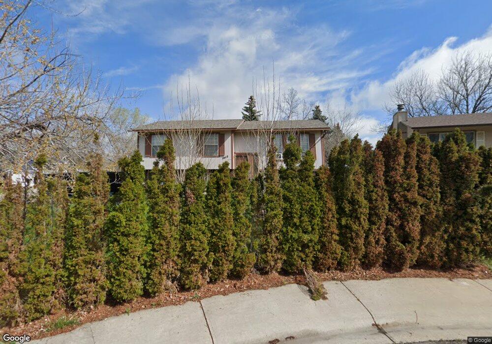
1612 Hanover Ct Fort Collins, CO 80526
Estimated Value: $404,000 - $502,336
3
Beds
2
Baths
1,532
Sq Ft
$303/Sq Ft
Est. Value
About This Home
This home is located at 1612 Hanover Ct, Fort Collins, CO 80526 and is currently estimated at $463,834, approximately $302 per square foot. 1612 Hanover Ct is a home located in Larimer County with nearby schools including Bennett Elementary School, Blevins Middle School, and Rocky Mountain High School.
Ownership History
Date
Name
Owned For
Owner Type
Purchase Details
Closed on
Feb 12, 2025
Sold by
Westin Diane E
Bought by
Williams Matthew Alan and Williams Krista Lee
Current Estimated Value
Home Financials for this Owner
Home Financials are based on the most recent Mortgage that was taken out on this home.
Original Mortgage
$319,200
Outstanding Balance
$317,311
Interest Rate
6.93%
Mortgage Type
New Conventional
Estimated Equity
$146,523
Purchase Details
Closed on
Feb 19, 1999
Sold by
Weston Earl J and Weston Pamela L
Bought by
Westin David C and Westin Diane E
Home Financials for this Owner
Home Financials are based on the most recent Mortgage that was taken out on this home.
Original Mortgage
$106,400
Interest Rate
6.83%
Purchase Details
Closed on
Feb 1, 1994
Sold by
Dewitt Jack Allen
Bought by
Weston Pamela L
Create a Home Valuation Report for This Property
The Home Valuation Report is an in-depth analysis detailing your home's value as well as a comparison with similar homes in the area
Home Values in the Area
Average Home Value in this Area
Purchase History
| Date | Buyer | Sale Price | Title Company |
|---|---|---|---|
| Williams Matthew Alan | $399,000 | Land Title Guarantee | |
| Westin David C | $133,000 | -- | |
| Weston Pamela L | $116,000 | -- |
Source: Public Records
Mortgage History
| Date | Status | Borrower | Loan Amount |
|---|---|---|---|
| Open | Williams Matthew Alan | $319,200 | |
| Previous Owner | Westin David C | $106,400 |
Source: Public Records
Tax History Compared to Growth
Tax History
| Year | Tax Paid | Tax Assessment Tax Assessment Total Assessment is a certain percentage of the fair market value that is determined by local assessors to be the total taxable value of land and additions on the property. | Land | Improvement |
|---|---|---|---|---|
| 2025 | $2,282 | $34,163 | $2,680 | $31,483 |
| 2024 | $2,171 | $34,163 | $2,680 | $31,483 |
| 2022 | $1,642 | $24,339 | $2,780 | $21,559 |
| 2021 | $1,659 | $25,039 | $2,860 | $22,179 |
| 2020 | $1,540 | $23,609 | $2,860 | $20,749 |
| 2019 | $1,547 | $23,609 | $2,860 | $20,749 |
| 2018 | $1,121 | $19,498 | $2,880 | $16,618 |
| 2017 | $1,117 | $19,498 | $2,880 | $16,618 |
| 2016 | $809 | $16,819 | $3,184 | $13,635 |
| 2015 | $803 | $16,820 | $3,180 | $13,640 |
| 2014 | $1,357 | $14,880 | $3,180 | $11,700 |
Source: Public Records
Map
Nearby Homes
- 2613 Hanover Dr
- 2109 W Drake Rd
- 1757 Concord Dr
- 2706 Dunbar Ave
- 2718 Dunbar Ave
- 1905 Yorktown Ave
- 2420 Sheffield Cir E
- 1419 Glen Haven Dr
- 2738 Bradford Square
- 2855 Trenton Way
- 2404 Sheffield Cir E
- 2828 Silverplume Dr
- 2828 Silverplume Dr Unit R3
- 2918 Silverplume Dr Unit C1
- 2800 S Taft Hill Rd
- 1601 W Swallow Rd Unit 1
- 1601 W Swallow Rd Unit 9
- 1601 W Swallow Rd
- 2607 S Taft Hill Rd
- 1531 W Swallow Rd Unit 25
- 1606 Hanover Ct
- 2606 Hanover Dr
- 1600 Hanover Ct
- 2607 Hanover Dr
- 1613 Hanover Ct
- 1619 Hanover Ct
- 1601 Hanover Ct
- 2619 Hanover Dr
- 1607 Hanover Ct
- 2600 Hanover Dr
- 2625 Hanover Dr
- 1654 Hastings Dr
- 2631 Hanover Dr
- 1660 Hastings Dr
- 1648 Hastings Dr
- 1642 Hastings Dr
- 1700 Hastings Dr
- 1636 Hastings Dr
- 1630 Hastings Dr
- 1706 Hastings Dr