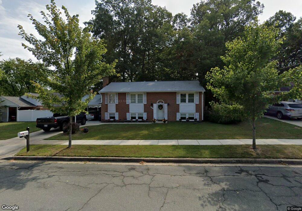
16121 Kent Rd Laurel, MD 20707
West Laurel NeighborhoodEstimated Value: $412,604 - $529,000
Studio
3
Baths
1,244
Sq Ft
$396/Sq Ft
Est. Value
About This Home
This home is located at 16121 Kent Rd, Laurel, MD 20707 and is currently estimated at $492,151, approximately $395 per square foot. 16121 Kent Rd is a home located in Prince George's County with nearby schools including Bond Mill Elementary, Martin Luther King Jr. Middle School, and Laurel High School.
Ownership History
Date
Name
Owned For
Owner Type
Purchase Details
Closed on
Feb 18, 2025
Sold by
Washam Carole Anne
Bought by
Thomas And Carole Washam Living Trust and Washam
Current Estimated Value
Purchase Details
Closed on
Jun 10, 2024
Sold by
Washam Thomas W and Washam Carole Anne
Bought by
Thomas And Carole Washam Living Trust and Washam
Create a Home Valuation Report for This Property
The Home Valuation Report is an in-depth analysis detailing your home's value as well as a comparison with similar homes in the area
Home Values in the Area
Average Home Value in this Area
Purchase History
| Date | Buyer | Sale Price | Title Company |
|---|---|---|---|
| Thomas And Carole Washam Living Trust | -- | None Listed On Document | |
| Washam Carole Anne | -- | None Listed On Document | |
| Washam Carole Anne | -- | None Listed On Document | |
| Thomas And Carole Washam Living Trust | -- | None Listed On Document |
Source: Public Records
Tax History
| Year | Tax Paid | Tax Assessment Tax Assessment Total Assessment is a certain percentage of the fair market value that is determined by local assessors to be the total taxable value of land and additions on the property. | Land | Improvement |
|---|---|---|---|---|
| 2025 | $4,982 | $389,200 | $126,300 | $262,900 |
| 2024 | $4,982 | $364,500 | -- | -- |
| 2023 | $3,779 | $339,800 | $0 | $0 |
| 2022 | $4,529 | $315,100 | $101,300 | $213,800 |
| 2021 | $4,405 | $315,100 | $101,300 | $213,800 |
| 2020 | $4,380 | $315,100 | $101,300 | $213,800 |
| 2019 | $4,520 | $353,800 | $100,600 | $253,200 |
| 2018 | $4,375 | $338,333 | $0 | $0 |
| 2017 | $4,254 | $322,867 | $0 | $0 |
| 2016 | -- | $307,400 | $0 | $0 |
| 2015 | $3,586 | $294,733 | $0 | $0 |
| 2014 | $3,586 | $282,067 | $0 | $0 |
Source: Public Records
Map
Nearby Homes
- 6201 Goodman Rd
- 6003 Windham Rd
- 15611 Riding Stable Rd
- 14005 Barkham Ct
- 7004 Fitzpatrick Dr
- 7019 Fitzpatrick Dr
- 6918 Scotch Dr
- 7106 Donston Dr
- 7002 Scotch Dr
- 16140 Kenny Rd
- 7209 Brooklyn Bridge Rd
- 15712 Dorset Rd Unit 104
- 15708 Dorset Rd Unit 202
- 15706 Dorset Rd Unit 102
- 15603 Dorset Rd Unit 101
- 4402 Regalwood Terrace
- 15743 Millbrook Ln
- 16001 Amina Dr
- 4302 Regalwood Terrace
- 14706 Saddle Creek Dr
Your Personal Tour Guide
Ask me questions while you tour the home.